The Slovenska Planinska Pot (the Slovenian High Route)
Stage 3
All content copyright © Ashley Burke 2010. Not to be copied, duplicated or used for any purpose without permission.
The Slovenska Planinska Pot (the Slovenian High Route) Stage 3
All content copyright © Ashley Burke 2010. Not to be copied, duplicated or used for any purpose without permission. |
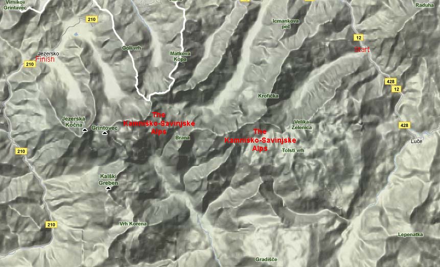
Map of Stage 3
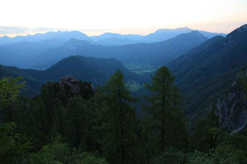
Stage 3 - The Kamniško-Savinjske Alps
27 Jun - 2 Jul 2010
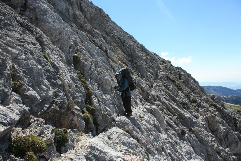
This is a true high mountain stage which, alongside Stage 6, would rank as the most challenging, spectacular and demanding stage of the entire route. On the map above I make no attempt to trace the exact route because it winds back and forth through the mountains in a very convoluted manner in order to reach the summit of every peak possible in the rugged Kamniško-Savinjske range. Over a period of 6 days we climbed 11 peaks in this range and many of these would be completely unclimbable were it not for the steel cables, spikes and rungs (via ferrate) that are provided for protection. It would be highly advisable to carry a harness and via ferrata kit on this stage of the trek although I did not use mine. In the absence of a via ferrata kit, a sling and two carabiners would suffice as a bare minimum.
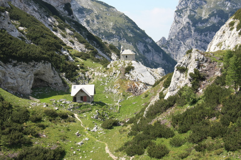
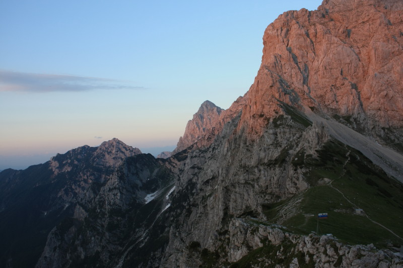
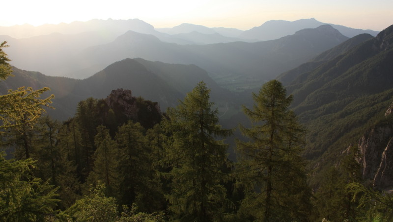
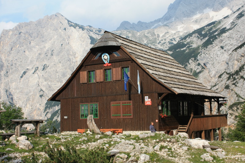
Mountain huts on this stage of the route are situated in spectacular locations on saddles or small level areas high in the mountains.
Water is scarce on many sections of this route and on the long hot sunny days of the warm and stable summer of 2010 I became very thirsty.
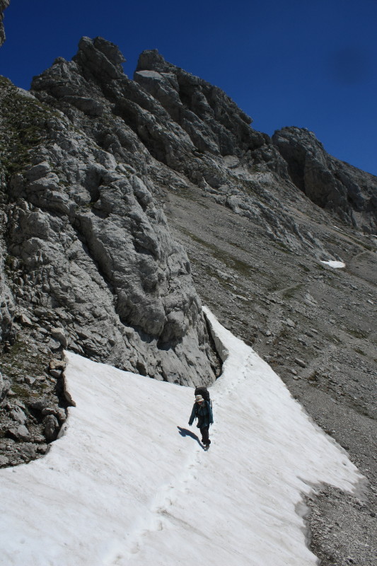
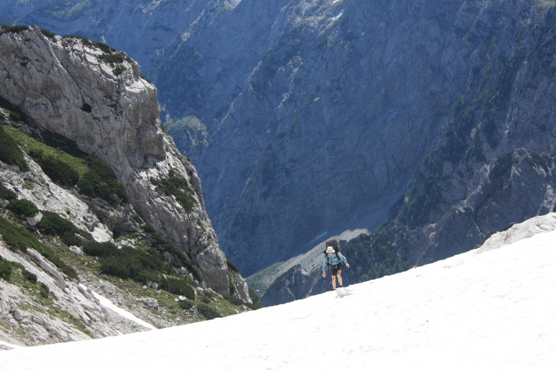
Because it was early in the season, snow still covered large sections of the trail on the high ground, and this presented an additional challenge. In some cases the snow still covered the protected sections of the route. This meant some steep snowdrifts had to be crossed without protection. An ice axe and crampons would have been very welcome at these rather precarious moments, but we were not carrying this equipment. At times it was necesary to deviate from the main route to avoid snow, and this occasionally led over potentially dangerous ground.
So Stage 3 was one of the highlights of the entire trip and something to take seriously. We were fortunate enough to have had fine weather throughout this stage. In poor weather, poor visibility or high wind, parts of this stage could become dangerous. Any sensible trekker should take careful stock of the conditions before venturing into this area.
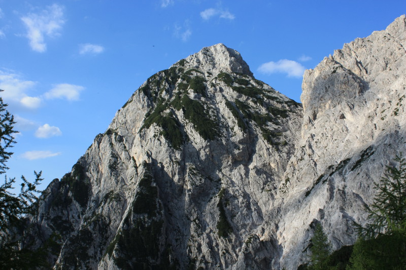
The highest peak in this area is Grintovec, at 2558m.
Here are some photos.
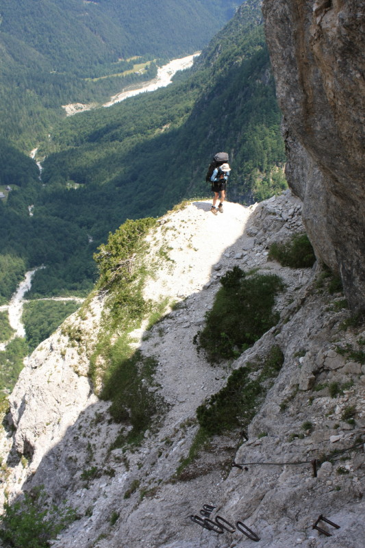 |
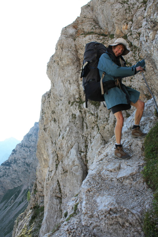
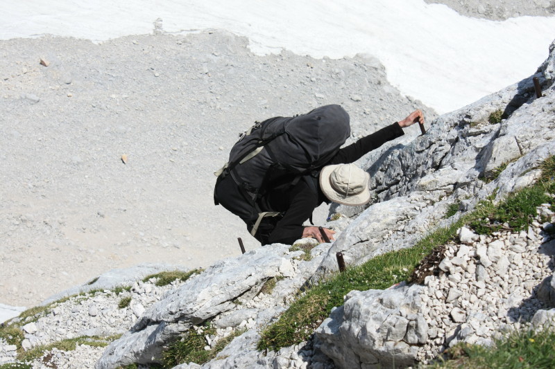
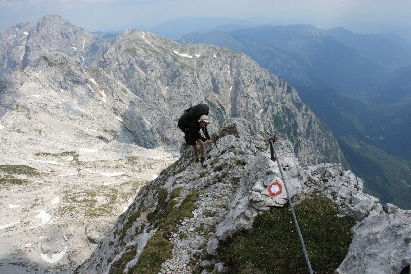
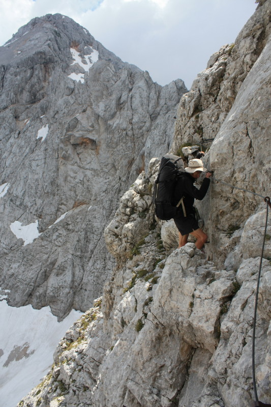
At the very bottom of this photo you can see some steel rungs and a cable which are provided to make it possible for a trekker to scale this near vertical rock face. |
 |
|
 |
|
 |
|
 |
|
 |
|
 |
|
 |
|
 |
|
 |
|
 |
|
 |
This relatively easy section of cable is on the steep descent to Frischaufov dom not long after leaving Kamnika koča. |
 |
|
 |
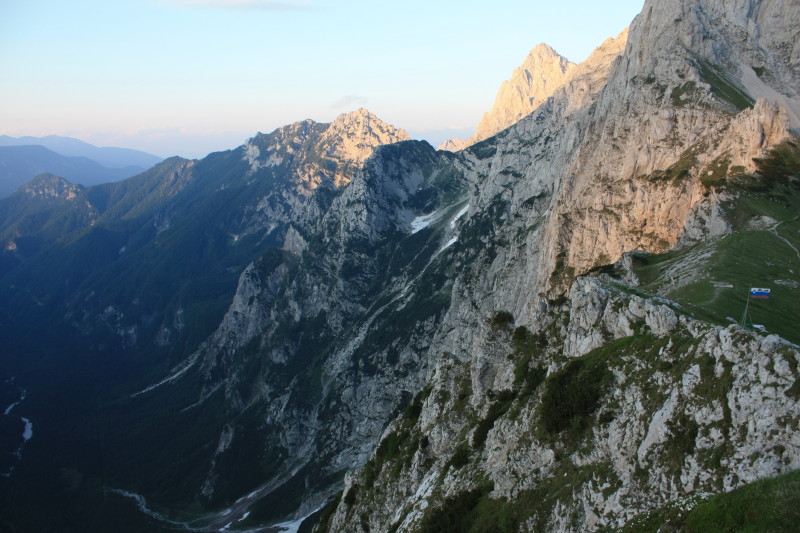
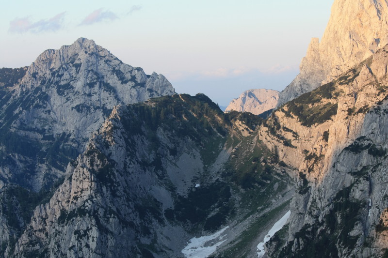
This photo was taken later in the day, from the balcony of Kranjska koča. |
 |
|
 |
|
 |
|
 |
|
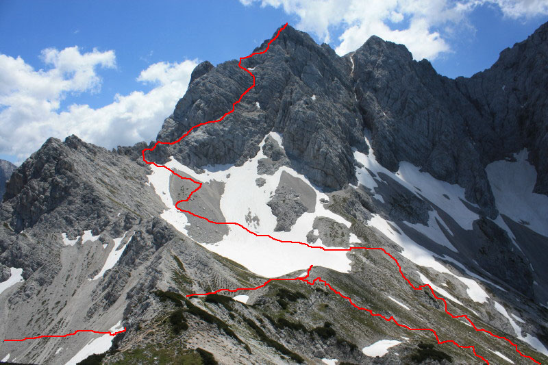 |
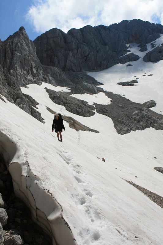
I have marked the route up Križ in this photo. From Kranjska koča we climbed back up to near Jezersko sedlo and then across the snowy bowl in this photo. Then it was up the scree slope to meet the cables, spikes and rungs which led up the exposed rock face to the summit. |
 |
|
 |
|
 |
|
 |
|
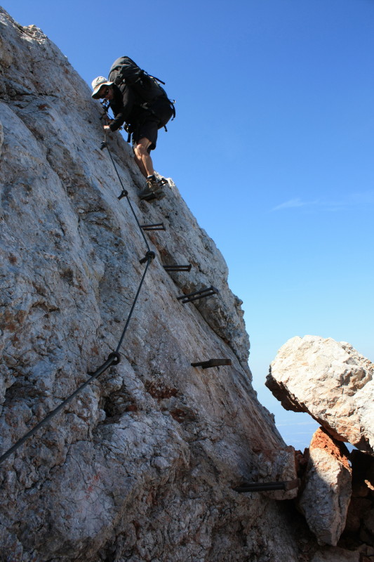 |
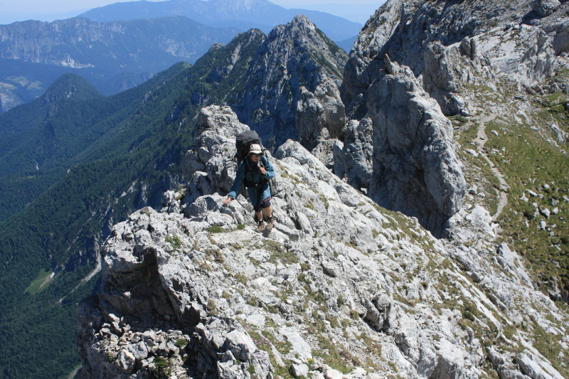
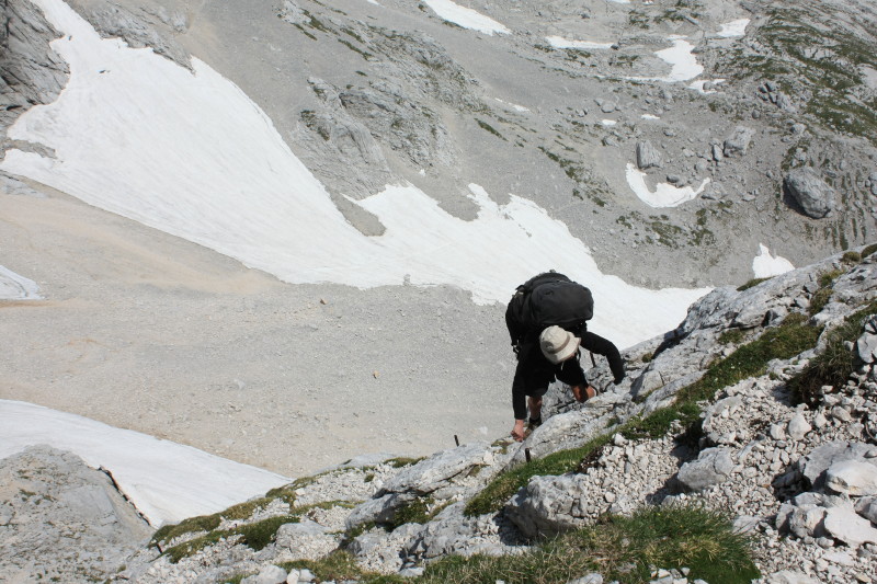
Earlier today we had climbed Grintovec (2558m) from Cojzova koča, a fairly easy uphill plod. The descent from Grintovec to Češka koča was a different story though, with some serious via ferrata sections like the one in this photo. |
 |
|
 |
|
 |
|
 |
|
 |
All content copyright © Ashley Burke 2010. Not to be copied, duplicated or used for any purpose without permission. Page created 25 Sep 2010, last updated 14 Oct 2010. |