Mountaineering in Tierra del Fuego
The Dientes of Navarino - Southernmost Trek in the World
All content copyright © Ashley Burke 2013. Not to be copied, duplicated or used for any purpose without permission.
Mountaineering in Tierra del Fuego The Dientes of Navarino - Southernmost Trek in the World
All content copyright © Ashley Burke 2013. Not to be copied, duplicated or used for any purpose without permission. |
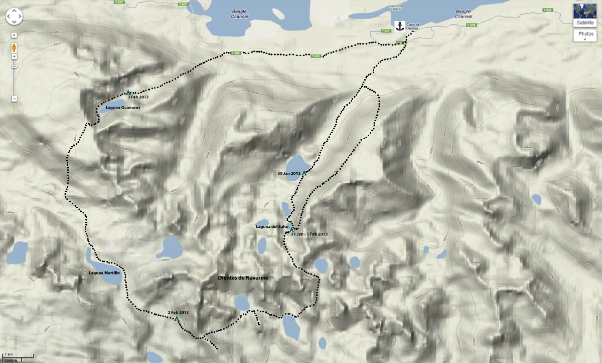
Map showing my route on the Deintes de Navarino trek on 30 Jan - 4 Feb 2013
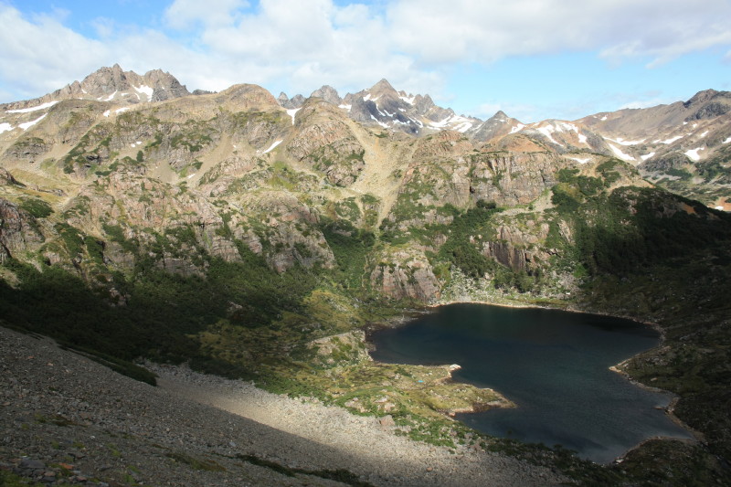
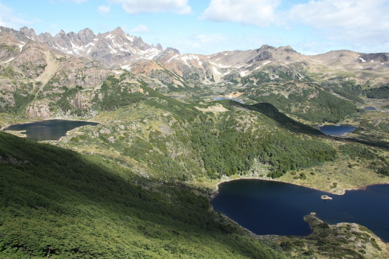
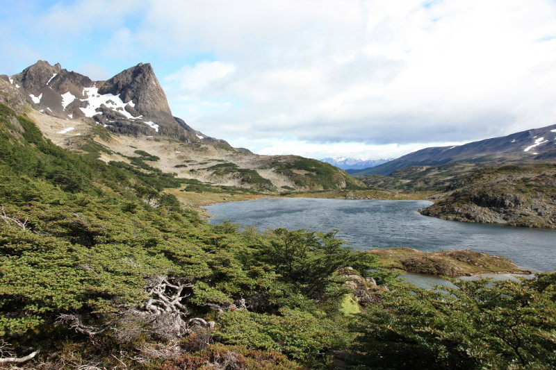
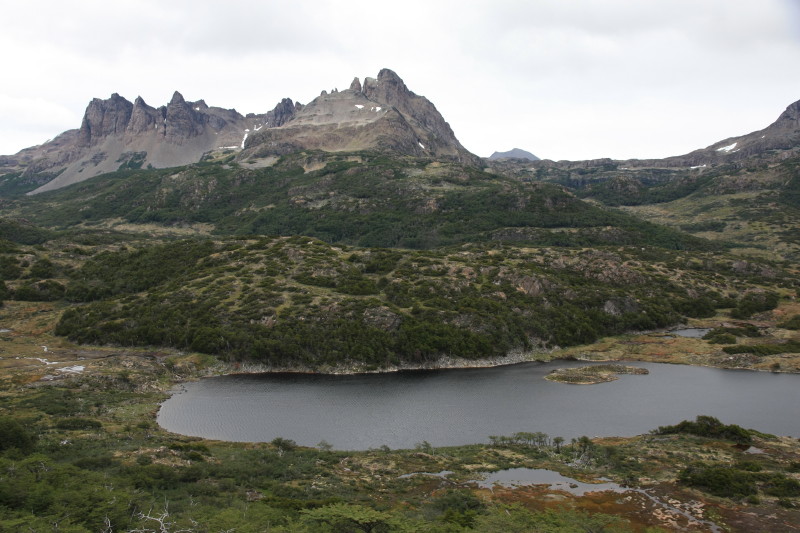
The Dientes de Navarino (teeth of Navarino) is a 4 day trekking circuit on Isla Navarino, a large island on the southern side of the Beagle Channel from Tierra del Fuego. Isla Navarino (or Navarino Island in English) is Chilean territory and the only human settlement of any size is the naval base of Puerto Williams. This naval base also serves as the starting and ending point for the Navarino trek and despite the military purpose of the town, it has a civilian population and serves the needs of trekkers well. There are a few hostels offering budget accommodation for backpackers, and there are a couple of small stores from where food, trekking maps, gas and other trekking supplies can be obtained. I did this trek in Jan-Feb 2013. Here is some information and photos.
Getting There
The Isla Navarino is not far from Ushuaia and in summer there are daily crossings of the Beagle Channel by boat when weather permits. At least two companies operate the passage from Ushuaia to Puerto Williams. Because this involves crossing from Argentina into Chile or vice versa, immigration formalities must be completed at both ends before crossing. The boat crossing is between Ushuaia and the tiny locality of Puerto Navarino on the Chilean side, which is directly opposite Ushuaia. From Puerto Navarino a bus service transfers travellers the 50km along the coast to Puerto Williams.
In my case I was on a chartered boat for my preceding mountaineering expedition to the Darwin Range of western Tierra del Fuego. And we needed to stop on Isla Navarino anyway for immigration and customs before returning to Ushuaia. So my transport to the island was by chartered boat. After the trek I returned to Ushaia using the bus and speedboat option, which is easily arranged in Puerto Williams.
Puerto Williams
Puerto Williams is a naval base but there is an associated township. This is very small, but it has everything you need. There is accommodation, shops, and an ATM.
Maps
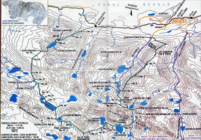
In Puerto Williams, a small map is available for purchase and this shows the trekking route in detail, along with campsites, distances, and other useful trekking information. Here is a small image of the map. Please don't use this one. Buy your own when you get to Puerto Williams:
Time Required
The trek can be done in 3-4 days although 4-5 days should be allowed due to the high probability of bad weather preventing you from continuing.
Time of Year and Weather
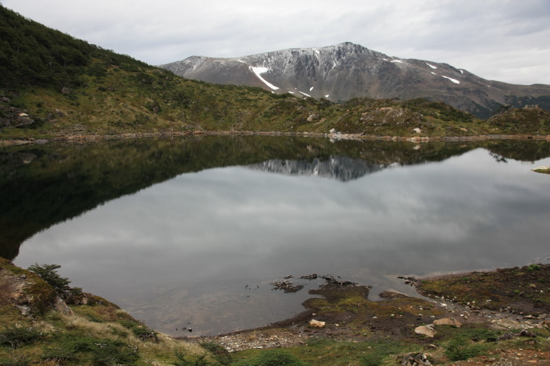
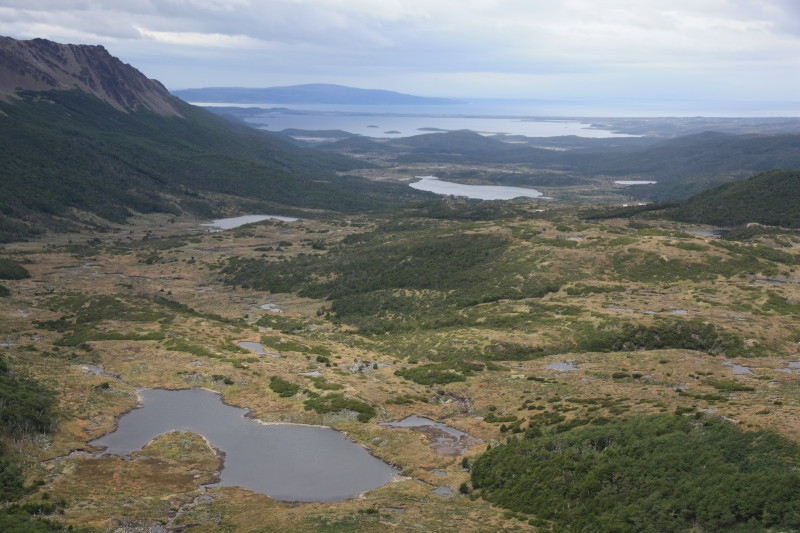
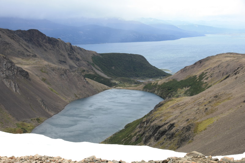
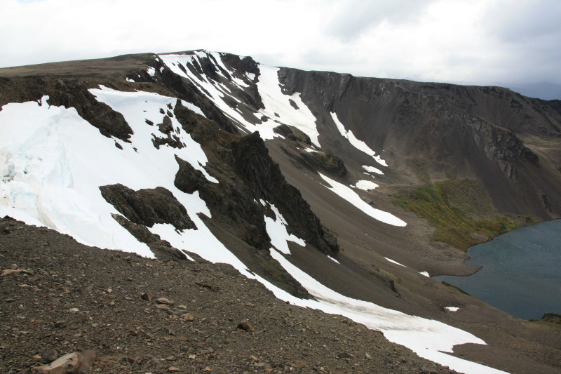
Navarino Island is at sub-antarctic latitude and awful weather can strike even in the height of summer. When I was there at the end of January an almighy storm lasting 2 night and one day struck, bringing snowfalls down to an altitude of 500m and making all trekking impossible. The weather is extremely variable with the full range of weather possible in the space of a couple of hours. High winds are common, as is snow. Rain is frequent. Blue sky is also a frequent occurrence due to the rain shadow effect of the mountains of Isla Hoeste further west.
December to March would seem to be the time of year when the trek is feasible and the passes mostly clear of snow.
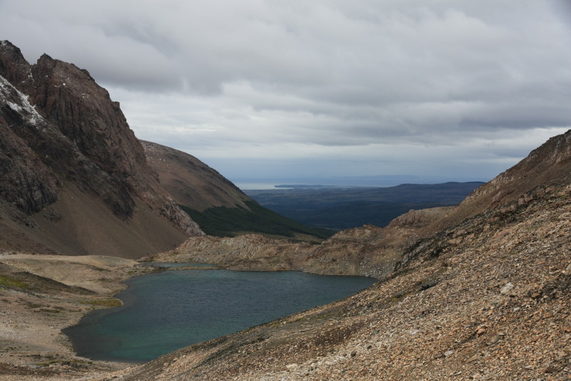
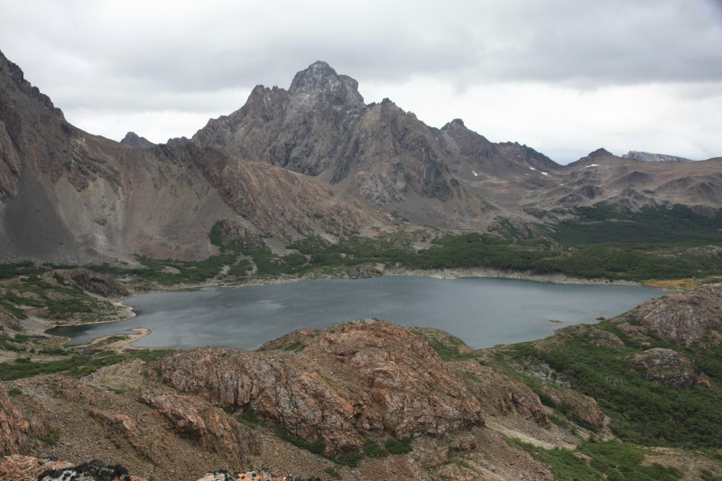
The Route
Whilst the track is indistinct in places or possibly covered in snow, there are numbered posts which mark specific points on the trek and these points are shown on the map along with GPS coordinates, latitude and longitude etc. So the route is actually easy to follow with these marker posts and map. It is easy to lose the route however on the final day of the trek, between Laguna Guanacas and the coastal road.
Equipment
You need a good windproof and weatherproof tent. You need to be completely self sufficient with food. You need a good warm sleeping bag and warm clothes as temperatures can drop below freezing even in summer.
Regarding footwear, light trekking shoes are adequate but your footwear will need to be warm enough for cold and wet conditions. Wellington boots are highly recommended for some of the route that is muddy, although due to rain shadowing, the route is not as muddy as western Tierra del Fuego or the treks in the wild country surrounding Ushuaia.
Verdict
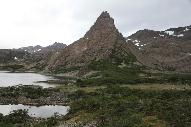
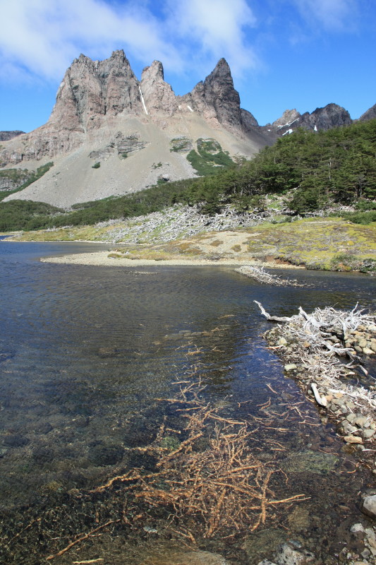
This is a fantastic trek in amazing windswept sub-antarctic landscape. Despite damage to the landscape by beavers, the area has a sense of true wildness and the Dientes of Navarino are spectacular.
My Itinerary
This is my itinerary. I took nearly 6 days to do the trek, mainly because I had the time, but also because of being weatherbound due to a storm for one full day during the trek.
| Date | Comments |
| 29 Jan 2013 | Arrived in Puerto Williams harbour late in the afternoon on the boat Iorana after sailing down the Beagle Channel from Estancia Yendegaia. |
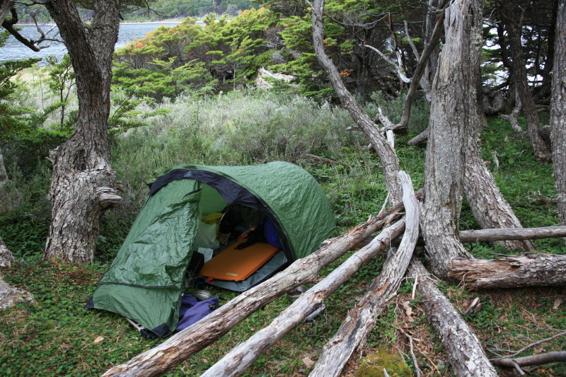
| 30 Jan 2013 | Spent the morning in Puerto Williams preparing for the trek. Set off around lunch time on foot. Arrived at the start of the trek around 3pm. Left some ear and food at Cascada Robalo and then set off for Laguna Robalo - the low route following the river. Nice walk through forest. Camped in fine weather at Laguna Robalo. |
| 31 Jan 2013 | Rain during the night but a fine morning. Hiked up to Laguna del Salto and pitched tent at 11am. Set off with a day pack southwards along the high route to Cerro Bandera and back to the start of the trek again where I retrieved my stashed gear and hiked back along the high route and returned to the tent at Laguna del Salto. A convoluted way to start the trek but at least I completed both the high and low routes to Laguna del Salto and I was now positioned well for the remainder of the Navarino circuit. |
| 1 Feb 2013 | It turned suddenly colder during the night and it snowed or sleeted all day with high winds and lots of driving snow and rain. Remained stuck in tent all day at Laguna del Salto. |
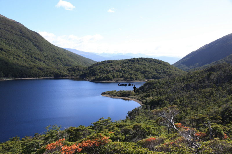
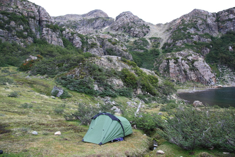
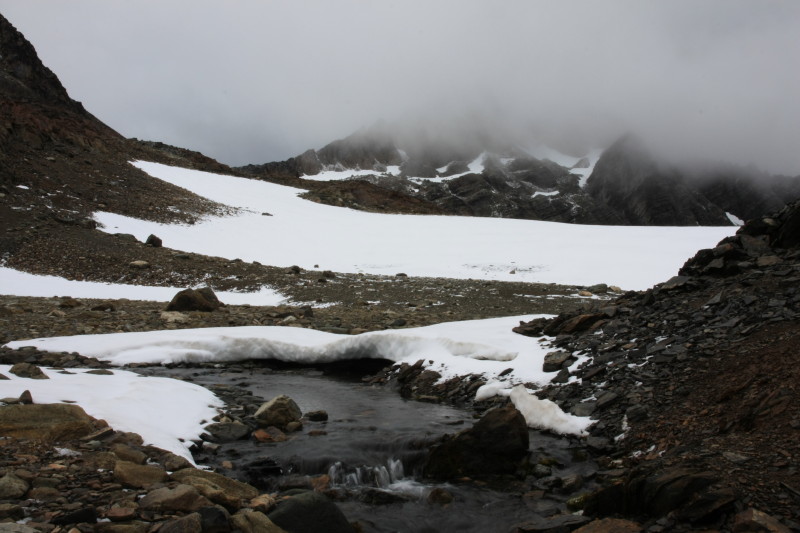
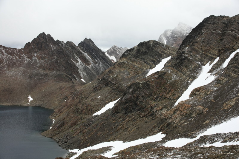
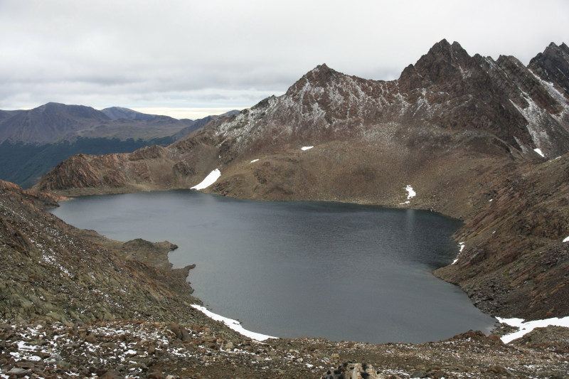
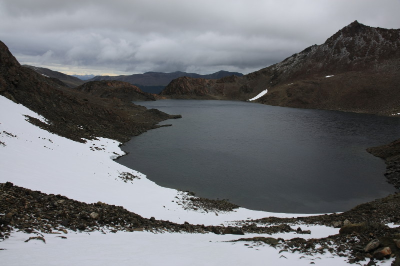
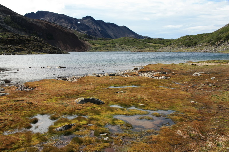
| 2 Feb 2013 | Still cold but it had stopped snowing. Continued the trek over Paso Australia. Some walking on snow and rocky ground past high windswept lakes. Short side trips on ridges heading south. Southernmost point of trek reached, latitude 55 degrees south. Found a nice sheltered spot to camp among trees and near beaver dams. |
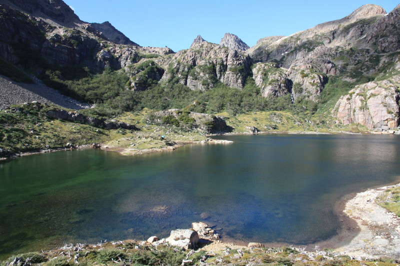
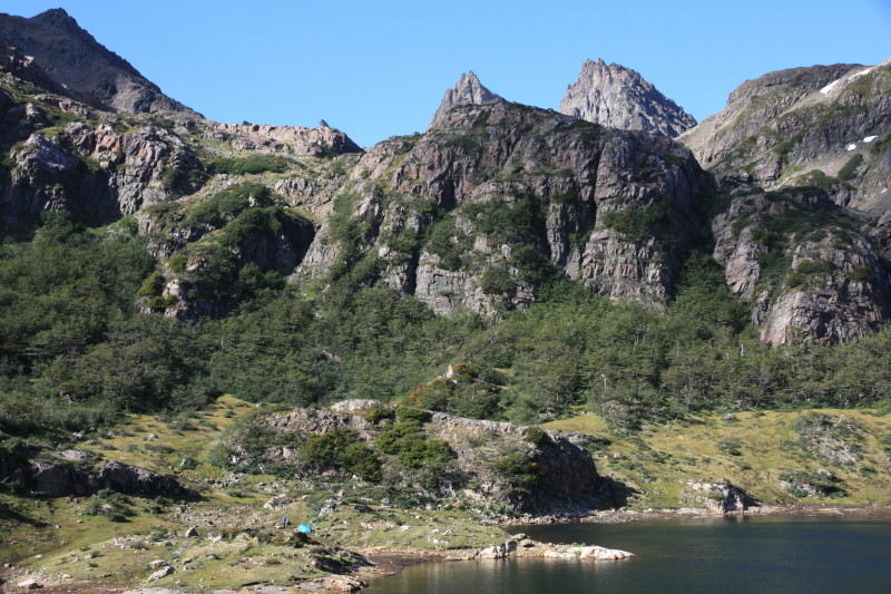
| 3 Feb 2013 | Very variable weather with all extremes. Pleasant walking past lakes and over small hills. Climbed over Paso Virginia, howling wind and amazing views. Nearly got blown off it, descended to Laguna Guanacos but it was still too windy so descended to more sheltered campsites near Laguna Guanacas. |
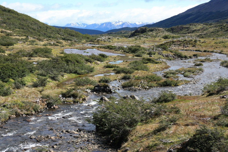
| 4 Feb 2013 | Wind raged throughout the night even though I was sheltered in northofagus forest. Wind abated early morning and it became a fine day. Trekked downward and northwards towards the coastal road, passing through boggy forest and farm country. Hiked the road into Puerto Williams and stayed at Refugio el Padrino in Puerto Williams. |
| 5 Feb 2013 | Bus to Puerto Navarino then inflatable speedboat across the Beagle Channel to Ushuaia. No wind and fine day for easy and fast crossing of the channel. Got a lift to the National Park west of Ushuaia. Camped at Camping Ensenada, a free campsite. |
| 6 Feb 2013 | Pleasant coastal walk in the Parque Nacional Tierra del Fuego. Hiked to Baia Lapataia, got bus back to Ushuaia and stayed in hotel. |
| 7 Feb 2013 | Day in Ushuaia. Went on long run. 6:35pm flight to Buenos Aires and then onward connecting flight to Sydney. |
Photos
Parque Nacional Tierra del Fuego (Argentina)
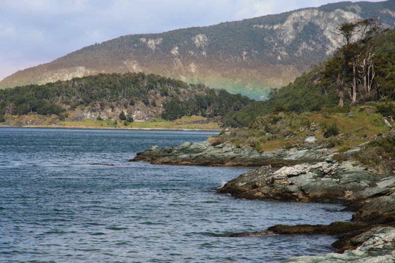 |
Back on Tierra del Fuego after a boat crossing of the Beagle Channel I returned to Ushuaia and then headed to the National Park to the west of Ushuaia. This national park is tame and touristy but featured a very pleasant coastal walk which was a nice way to end the trip. |
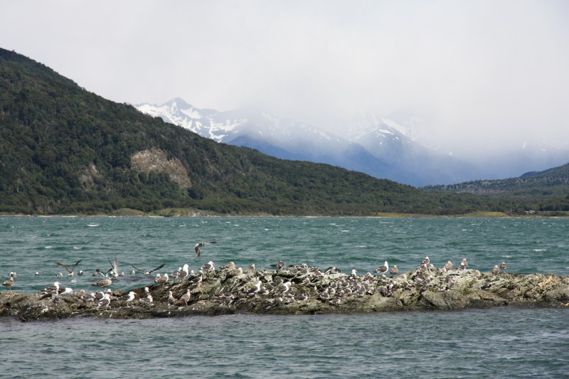 |
Sea birds.
|
The End
All content copyright © Ashley Burke 2013. Not to be copied, duplicated or used for any purpose without permission. Page created 15 May 2013, last updated 15 May 2013. |