Madagascar - The 8th Continent
A 250km run, Mountain Biking, Wildlife and Trekking
All content copyright © Ashley Burke 2015. Not to be copied, duplicated or used for any purpose without permission.
Madagascar - The 8th Continent A 250km run, Mountain Biking, Wildlife and Trekking
All content copyright © Ashley Burke 2015. Not to be copied, duplicated or used for any purpose without permission. |
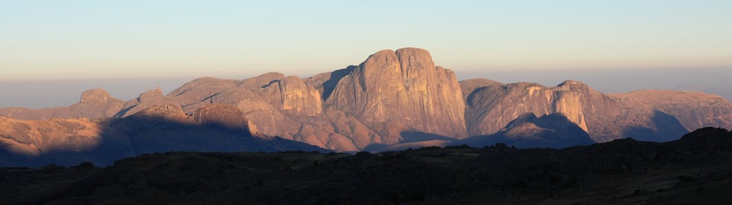
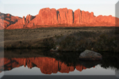
The Tsaranoro Massif at sunrise, central Madagascar
Introduction
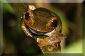
Madagascar is an incredible place. An island so large it is sometimes referred to as the 8th continent. A fragile ecosystem largely given over to human cultivation but where tiny pockets of the most amazing biodiversity are still to be found. Amazing people, poor but friendly and always smiling. A country where the main national highway is a potholed 2 lane bitumen road and virtually every other road in the country is a dusty track. A country with several different climate zones, from the savannah in the north to tropical rainforest in the East, the temperate highlands and the semi arid south and west. A geological marvel with limestone karst, red Tsingy and huge granite mountain ranges. The smallest chameleon in the world. The world's only lemurs. Species of plant, bird, reptile and mammal that are found nowhere else on Earth. Great food (when available), an exotic blend of African, Indian, Indonesian and local. The worlds finest vanilla beans, used in cooking everywhere. I could spend months in Madagascar and barely scratch the surface.
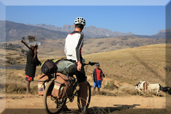
In late August 2014 I went there to participate in Racing The Planet Madagascar 2014, a gruelling 7 day 250km foot race through remote beaches, baobab forests, savannah, rice paddies, tiny villages, a crater lake and a gorge full of fragile red rock stalagmites in the north of the country. After completing this race I rode my mountain bike south from the capital, Antananarivo, mainly following the RN7, the main road through central and southern Madagascar. On the way I detoured to national parks where I saw some of Madagascar's amazing wildlife. After cycling south along the RN7 as far as Ambavalao I rode a rough dusty trail to eventually reach Andringitra National Park where I spent 5 days. This is where some of the best hiking in Madagascar is to be found and where Madagascar's 2nd highest mountain, Pic Boby, can be climbed. It is a land of semi arid highlands and granite domes, and just outside this national park the huge granite wall known as the Tsaranoro Massif can be seen. After exploring Andringitra I returned to Ambavalao and visited a lemur reserve called Anja Community Reserve. Then I rode back along the RN7 as far as Fianarantsoa and from there I took a bus back to Antananarivo.
I have divided the trip into 4 sections for the purposes of this website. On each of the sections below you will find maps and photos.
 |
|
 |
|
 |
|
 |
|
Web page created 10 May 2015, last updated 10 May 2015. All content copyright © Ashley Burke 2015. Not to be copied, duplicated or used for any purpose without permission. |