Madagascar - The 8th Continent
Andringitra National Park - Granite Massifs and Madagascar's Second Highest Peak
All content copyright © Ashley Burke 2015. Not to be copied, duplicated or used for any purpose without permission.
Madagascar - The 8th Continent Andringitra National Park - Granite Massifs and Madagascar's Second Highest Peak
All content copyright © Ashley Burke 2015. Not to be copied, duplicated or used for any purpose without permission. |
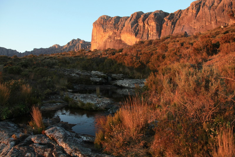
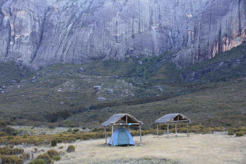
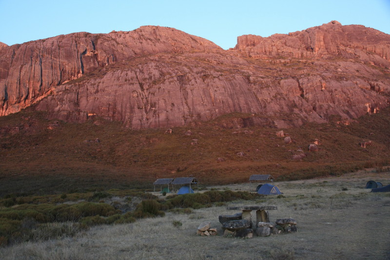
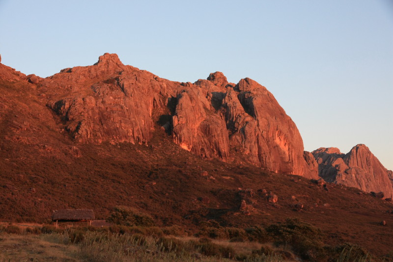
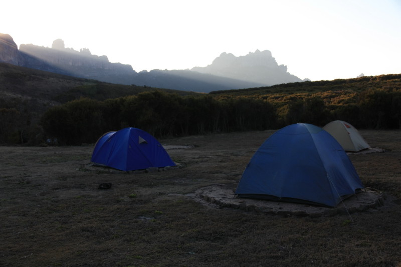
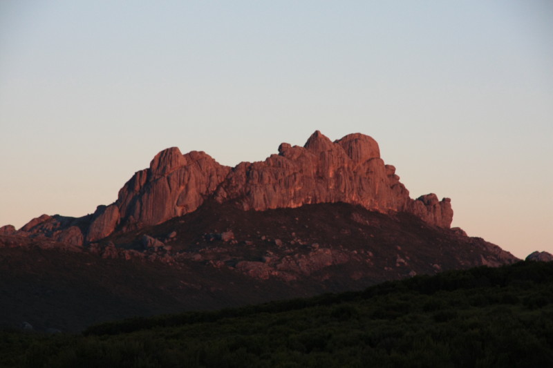
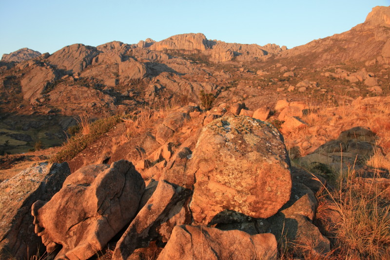
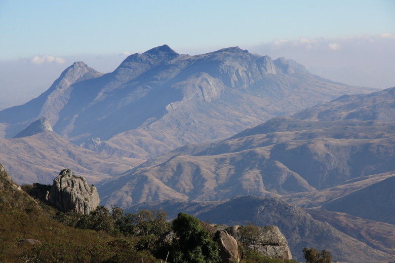
Evening light on the peaks of Andringitra from high camp at 2050m
After a gruelling 250km foot race in northern Madagascar followed by a long mountain bike ride from Fianarantsoa, I was ready for something a bit less intensive and more relaxing. I had at last arrived in Andringitra National Park and by now I had learned that Madagascar isn't so much about the places themselves, but getting to them. Any long distance travel in Madagascar is challenging and rewarding, and Andringitra is a long distance from anywhere. Certainly it seemed that way to me, given that my prime means of travel was my mountain bike.
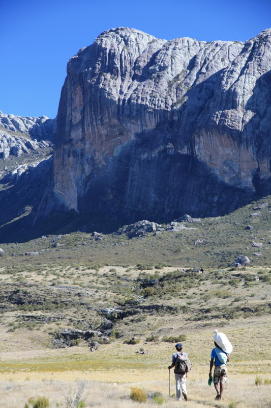
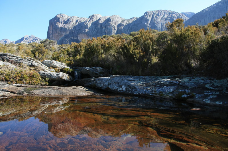
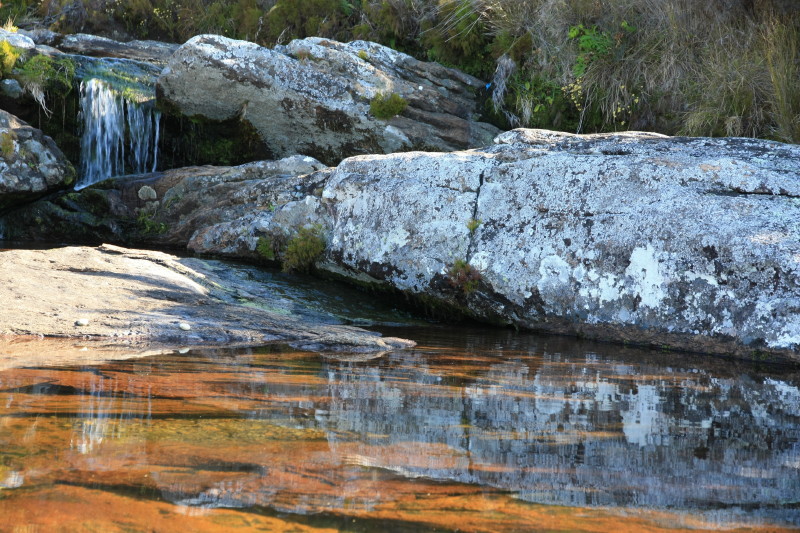
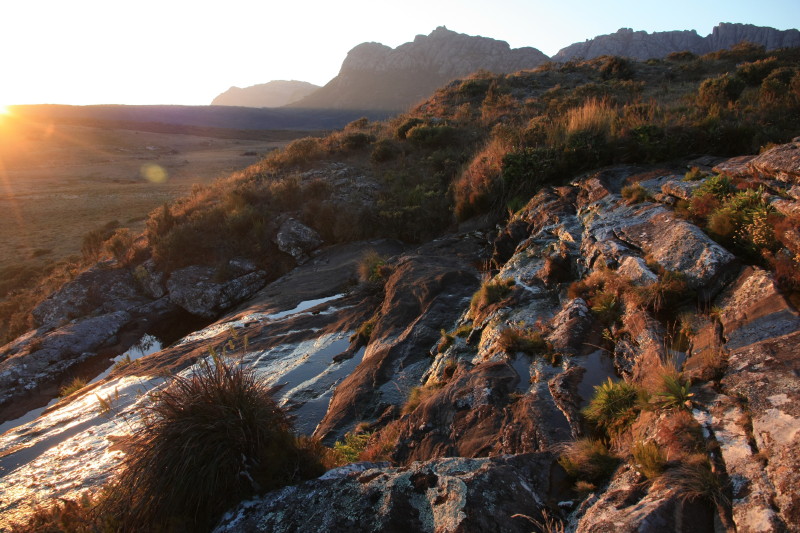
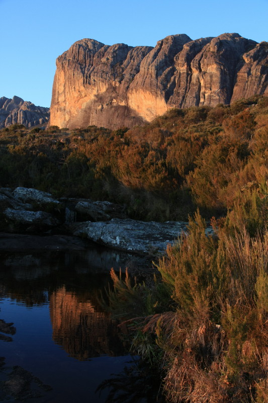
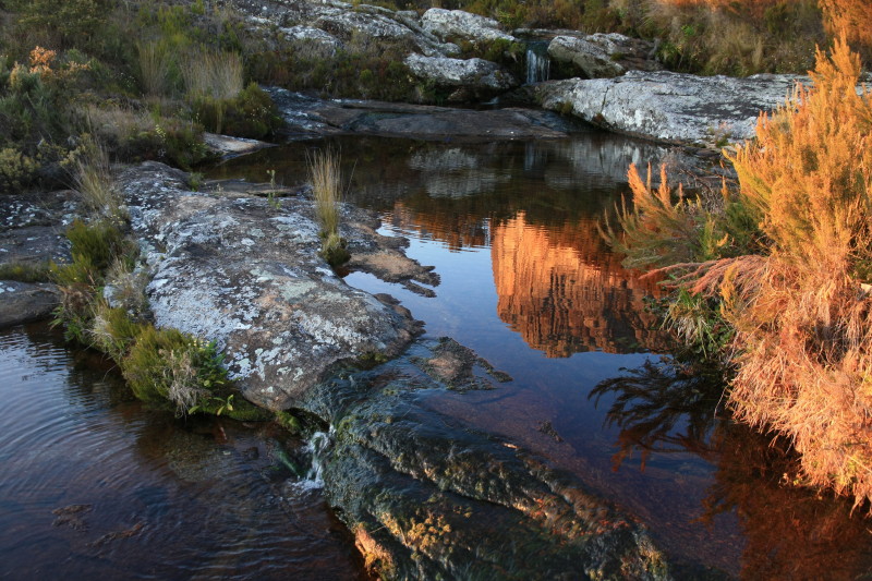
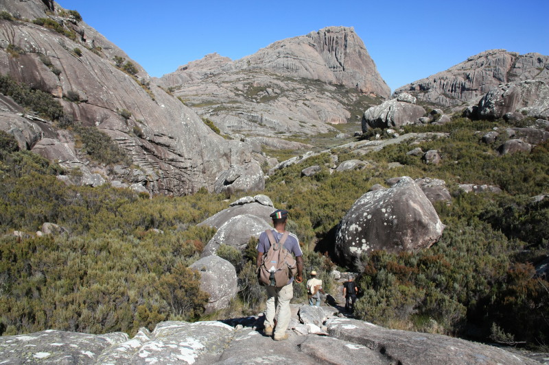
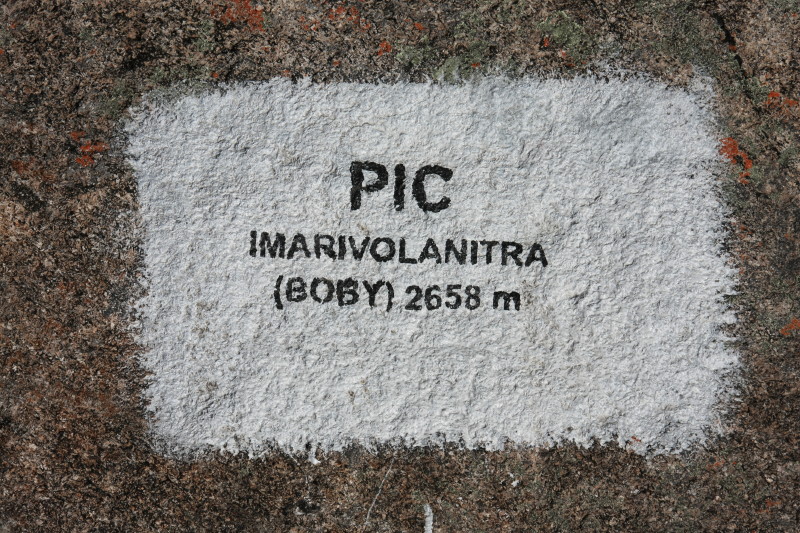
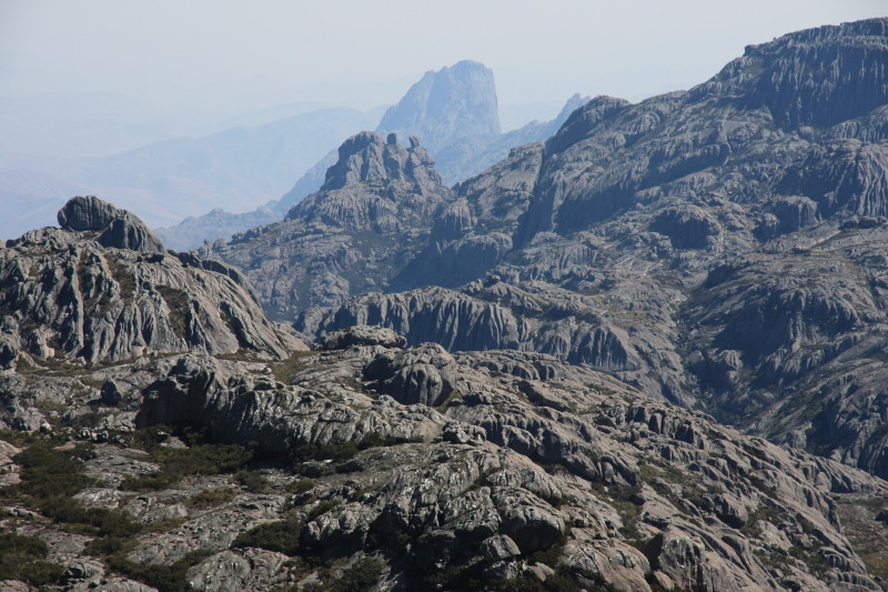
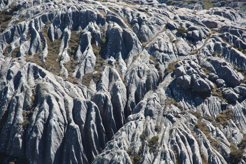
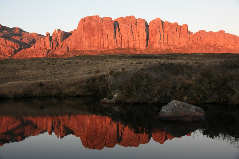
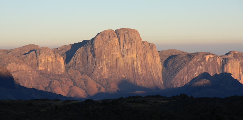
I spent 4 days exploring Andringitra National Park which lies about 50km south of the frontier town of Ambavalao and this was one of the highlights of my 2014 Madagascar adventure. Andringitra National Park is home to Madagascar's second highest mountain, Pic Imarivolanitra (or Pic Boby), at 2658m. The famous Tsaranoro Massif is a huge rock face admired by climbers and photographers. This rock face lies just outside the national park but from many vantage points on the Andringitra range, tremendous views of this great rock face can be seen. Andringitra is home to a rugged granite mountain range, crystal clear streams of water, an alpine plateau and some unique wildlife.
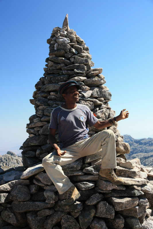
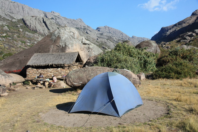
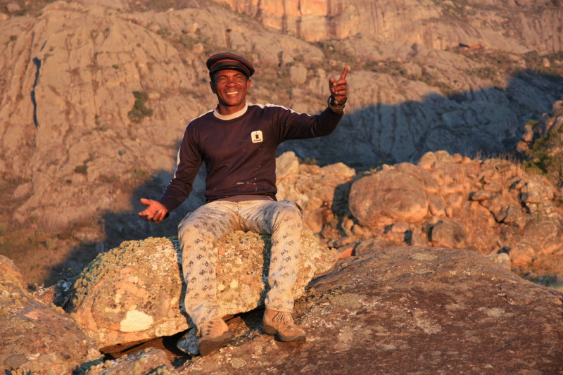
All access to all national parks throughout Madagascar must be in the company of a local guide. Guides do not need to be booked in advance. I arrived at the park entrance to Andringitra hot, thirsty and very tired late one afternoon. There at the parks office I was able to make all the arrangements for the next 4 days of trekking, including the booking of a guide and porter.
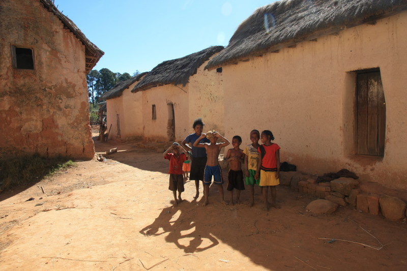
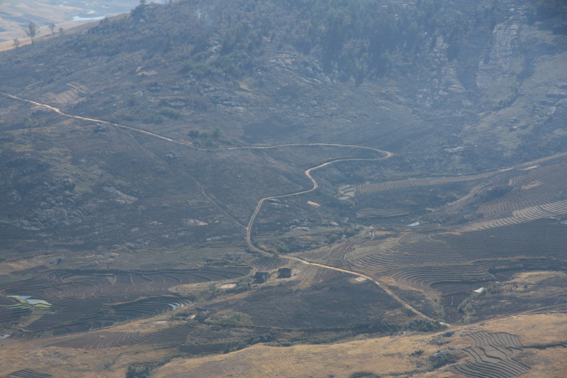
The area surrounding Andringitra is very poor. I had to bring all my food and supplies with me on my bike from Ambavalao or Fianarantsoa and this was challenging as I had limited carrying capacity on my bike, plus I needed to self cater for 4 days of trekking in the national park itself plus an additional 2 days supplies for the journey in and out. I was able to buy small amounts of very basic food locally but essentially you need to carry everything in yourself or else starve. And you don't want to deplete the local people of their own limited supplies. As a result I went very hungry.
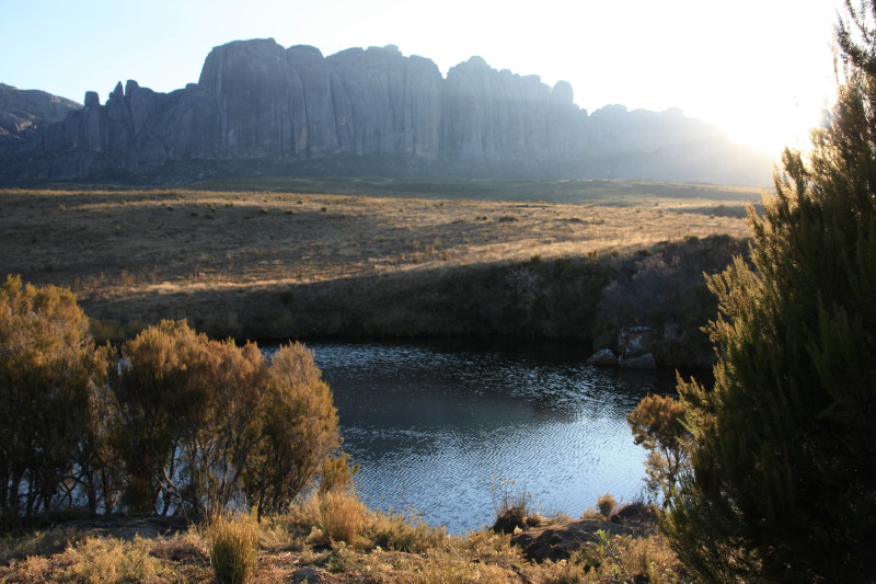
But the trekking was easy, no more than half a day on the move, leaving plenty of time for rest and to enjoy the incredible natual qualities of the area. The streams of crystal clear water were safe to drink from, and there were some lovely natural pools to dive into, and after a long day of hot dusty mountain biking followed by sweaty trekking in heat, lounging around a clear water hole and diving in occasionally was a welcome way to spend an afternoon. Having run 250km earlier in the month and mountain biked for several days to get here, I was well overdue a few days easy trekking.
| Date | Comments | Camp |
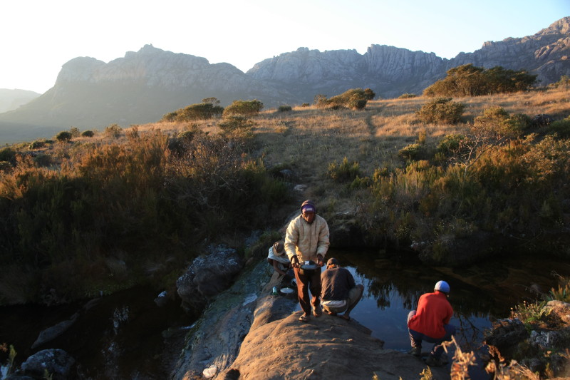
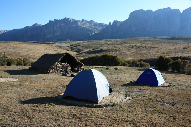
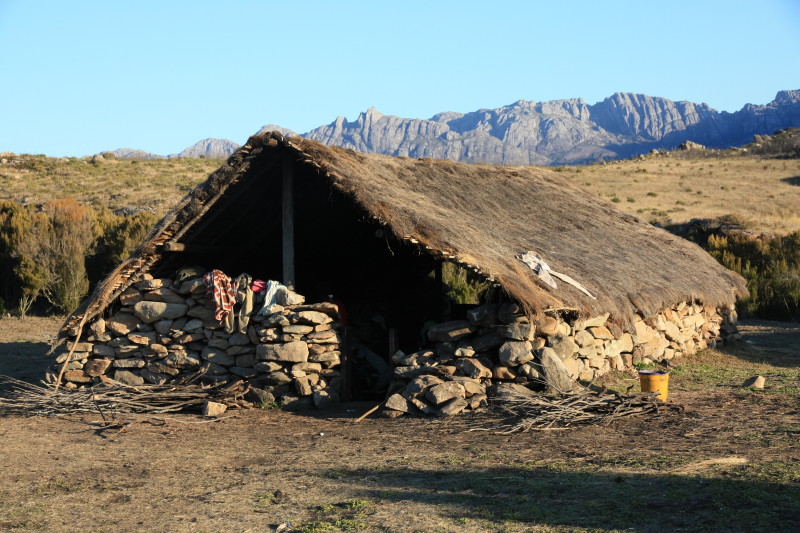
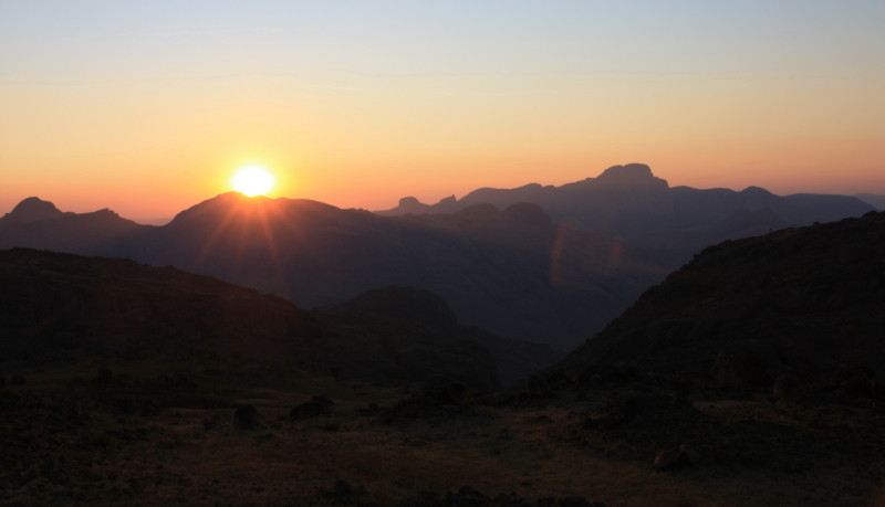
| 15 Sep 2014 | After staying the night at the gîte located 3km from the park entrance I returned to the park entrance to meet my guide (Martin) and a porter. From there we set off, walked through Martin's village and visited his house. We climbed up beside two large waterfalls to reach a plateau at altitude around 2000m. We had lunch by the clear stream and a swim. We then continued along the plateau to the next campsite at altitude 2050m, from where the track led up to Pic Boby. Wonderful sunset and evening light. | Pic Boby base camp at 2050m. |
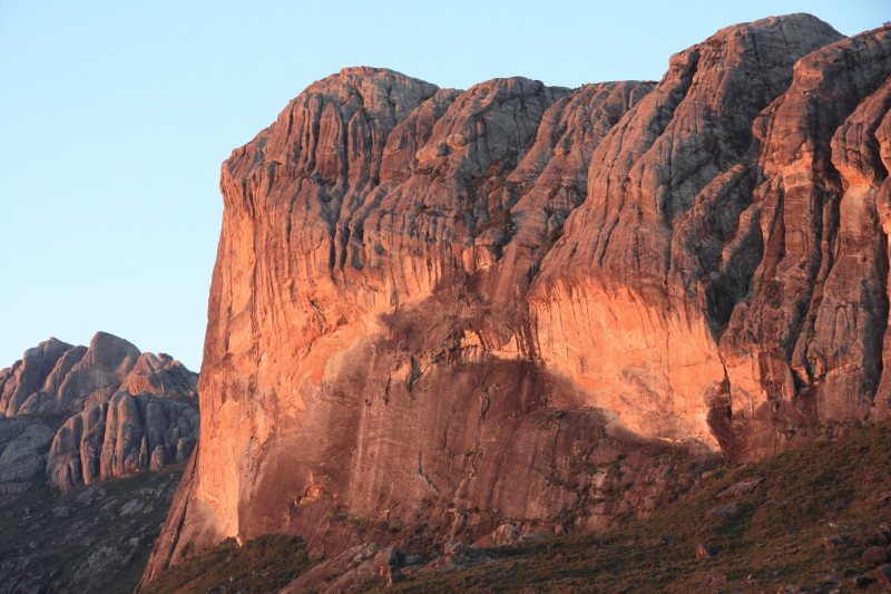
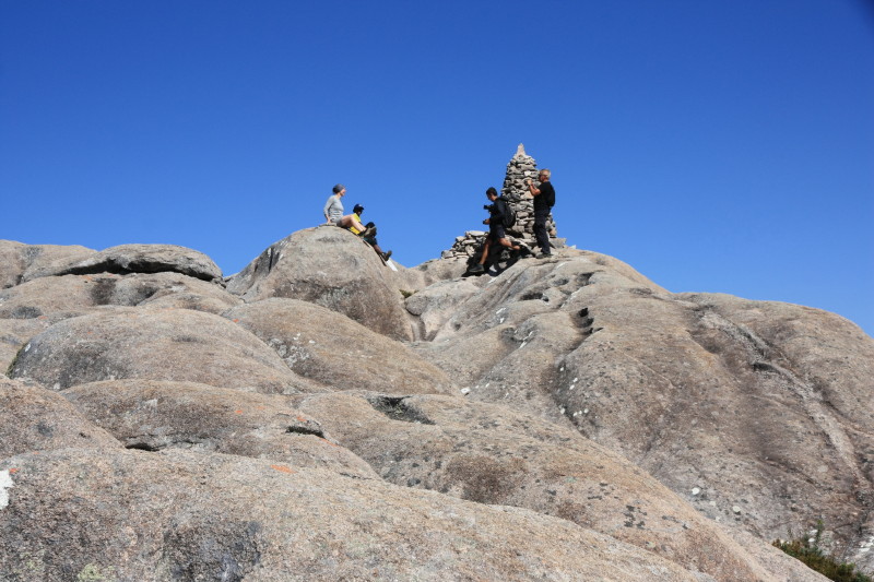
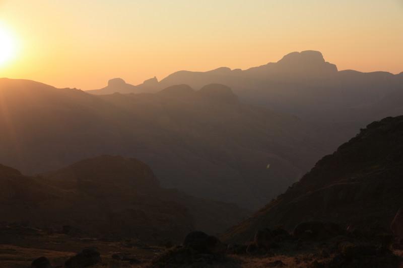
| 16 Sep 2014 | An excellent day. Photographed the sunrise and set off for Pic Boby. Easy climbing on a well marked path. Smooth granite (or gneiss) rock. Some spectacular scenery and spent time on the summit of Pic Boby at 2658m. Headed back to camp and then down to the other camp where we had had lunch the previous day. Went for another swim in the river and relaxed around the camp site. | Plateau camp at 1975m. |
| 17 Sep 2014 | Taking a different path we crossed the main mountain range at a point to the north of Pic Boby. From there the first really great views of the Tsaranoro Massif were seen. Easy walking on a well made path. Saw several lizards and a very colourful grasshopper. Descended the western side of this range to a camp at about 1600m. This was located by a different stream which was still safe to drink from. | Camp on western side of range at 1600m. |
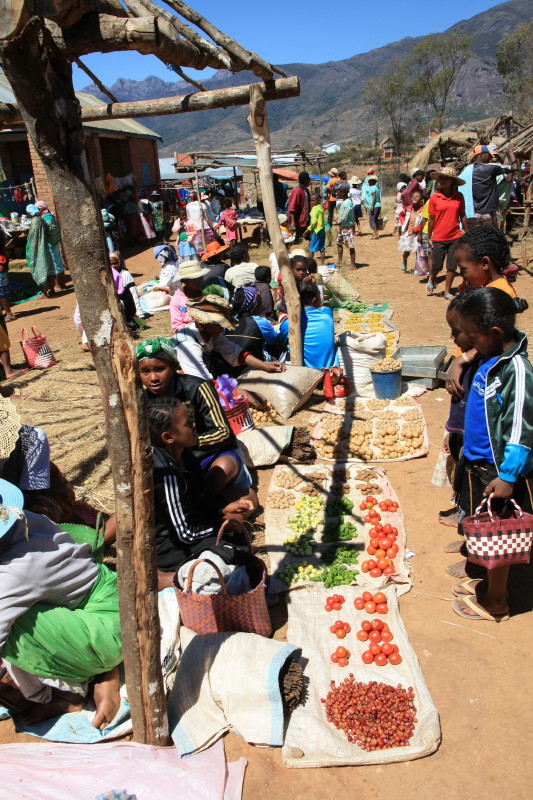
| 18 Sep 2014 | Most groups doing this trek continue west, descending to a road head to exit from. But my bike was back in the Namoly park entrance and so we crossed the range again, on the same path we used yesterday. My guide and porter had run out of food and wanted to get back to their village. I watched the sun hit the Tsaranoro Massif and took some photos. We returned to the Namoly valley, taking a path down a different way to the one we had come up on the 15th. We reached a village near the gîte where my bike was stored and there was a small market going there. I bought a few fresh veges. I had most of the afternoon back at the gîte and was able to rest before my long journey by mountain bike back to Antananarivo. | Gîte near Namoly valley park entrance, 1427m. |
Photos
 |
|
 |
|
 |
|
 |
|
 |
|
 |
|
 |
|
 |
|
 |
|
 |
|
 |
|
 |
|
 |
|
 |
|
 |
|
 |
|
 |
|
 |
|
 |
|
 |
|
 |
|
 |
|
 |
|
 |
|
 |
|
 |
|
 |
|
 |
|
 |
|
 |
|
 |
|
 |
|
 |
|
 |
All content copyright © Ashley Burke 2015. Not to be copied, duplicated or used for any purpose without permission. Page created 10 May 2015, last updated 10 May 2015. |
