Chamonix to Zermatt
The Walker's Haute Route, July 2002
All content copyright © Ashley Burke 2007. Not to be copied, duplicated or used for any purpose without permission.
Chamonix to Zermatt The Walker's Haute Route, July 2002
All content copyright © Ashley Burke 2007. Not to be copied, duplicated or used for any purpose without permission. |
 |
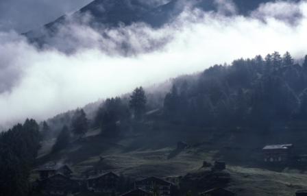
Evening views towards Grand Combin from Cabane du Mont Fort |
Introduction
The Walker's Haute Route from Chamonix to Zermatt is one of the classic treks of Europe. Starting in Chamonix in France and ending in Zermatt in Switzerland, the walk takes in some of the greatest peaks of the European Alps, their beautiful meadows and valleys, and delightful mountain villages. Although the trek starts in France, all but the first day of walking is in Switzerland. Ranging in altitude from about 800m to nearly 3000m the walk involves a great deal of height gain and loss, and crosses some 11 or 12 passes.
In July 2002 Kendy and I did this walk over a period of 12 or 13 days. Highlights of the trek were not limited to the spectacular mountain scenery. It was a delight to walk through the beautiful small villages of the Swiss alps, and to enjoy the rich history and rural charm of the area. It was also a pleasure meeting and walking with other like minded people who were on the trek. Another highlight of the trip is the Europaweg, a spectacular route traversing the high steep sides of the Mattertal into Zermatt. This route winds its way around the sides of the valley, is exposed in some sections, and offers spectacular scenery at every turn. The Weisshorn and its glaciers on the opposite side of the valley provide an incredible backdrop for this spectacular traverse.
Negatives of this walk are the effects of overdevelopment of the Alps, with unsightly ski resorts and dams diminishing what would otherwise be the tranquil beauty of this spectacular part of Europe. The town of Zermatt where the walk concludes is also overrated, being spoilt by excessive tourism and ski resort development, and is nowhere near as picturesque and rich in character as other Swiss villages that we passed through.
As is typical for all trekking in Europe, lodging in fully staffed and catered mountain cabins rather than camping is the norm. Kendy and I prefer the simple pleasures of camping to the crowded, expensive and unnecessary comforts of mountain lodges, so we camped wherever we could. The only downside of this was that our packs were especially heavy compared to what most people would normally carry on this trek owing to the camping gear that we were carrying. Out of a total of 12 nights spent on the trek, we spent only 3 nights in cabins, and on the remaining 9 nights we camped. Camping is allowed only at formal camp grounds, and we used these camp grounds whenever we could. These would typically provide a nice patch of grass on which to pitch our tent, and also an opportunity to take a much needed hot shower after a solid day of trekking.
For maps we used the Swiss 1:50 000 topographic maps, sheets 5003 (Mont Blanc Grand Combin) and 5004 (Matterhorn Mischabel). For a a guide book we used the Cicerone Guide The Walker's Haute Route Chamonix-Zermatt.
After this trek Kendy and I went to Corsica to hike the GR20. And after that I returned to Chamonix to join another group for a climb of Mont Blanc.
Below are some photos from this classic walk. I hope you enjoy them.
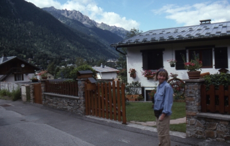 |
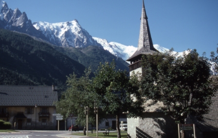
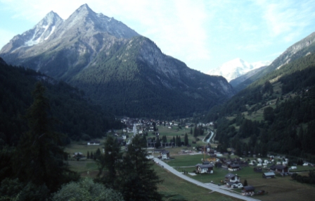
Day 1, 5 Jul 2002. We set off from Chamonix, walking up the valley and passing through the beautiful French village of Argentière. |
|
 |
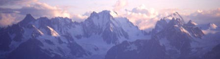
Day 1, 5 Jul 2002. From the village of Argentière we see the high peaks near Mont Blanc. |
|
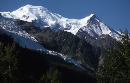 |
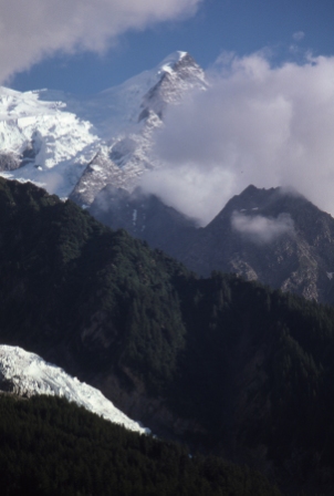
Day 1, 5 Jul 2002. Mont Blanc and the Aigiuille du Midi from the village of Argentière. |
|
 |
Day 1, 5 Jul 2002. Argentière. |
|
 |
Day 1, 5 Jul 2002. Argentière. |
|
 |
Day 1, 5 Jul 2002. Views into Switzerland from the Col de Balme. There is a camp site in the valley floor in this photo where we spent that night. |
|
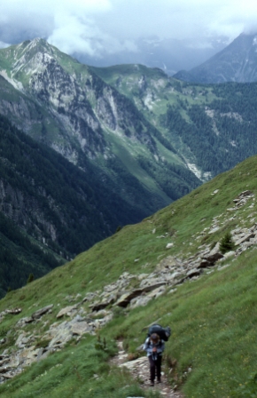 |
Day 2, 6 Jul 2002. Climbing from Le Peuty to Fenetre d'Arpette. This part of the route is the same as the Tour du Mont Blanc. |
|
 |
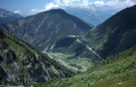
Day 3, 7 Jul 2002. Descending the Val d'Arpette towrads the village of Champex and thence Sembrancher. |
|
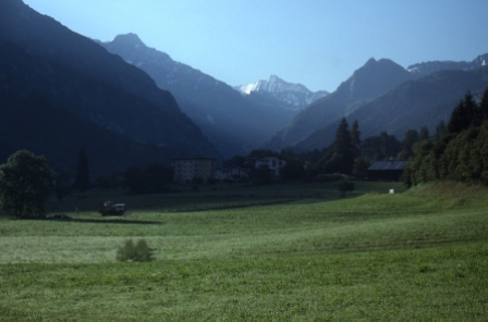 |
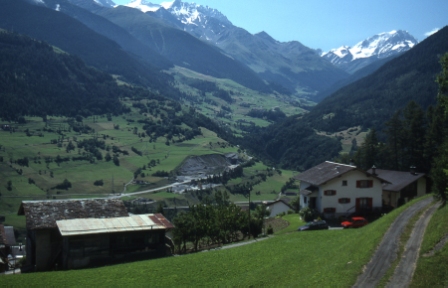
Day 4, 8 Jul 2002. Early morning views as we walk up the valley from Sembrancher towards Le Châble. |
|
 |
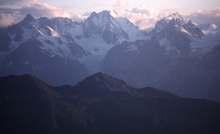
Day 4, 8 Jul 2002. This day is spent climbing above the ski area of Verbier towards Cabane du Mont Fort. The height gain today is 1700m. On the way, these great views are had. |
|
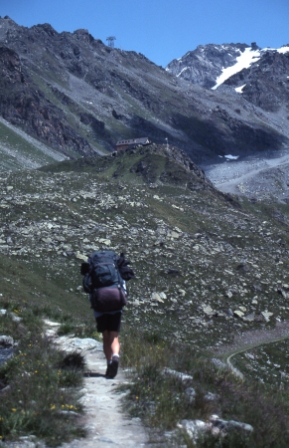 |
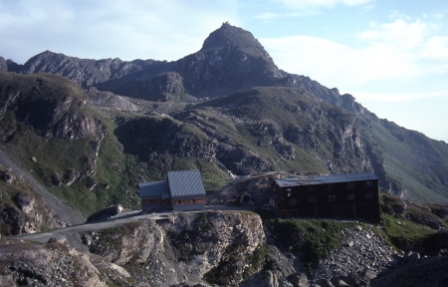
Day 4, 8 Jul 2002. Our first views of Cabane du Mont Fort, perched atop glacial Morraine at 2457m. |
|
 |
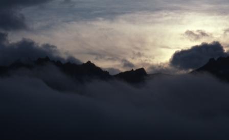
Day 4, 9 Jul 2002. Evening views from the balcony of Cabane du Mont Fort. |
|
 |
Day 4, 9 Jul 2002. Evening views from the balcony of Cabane du Mont Fort. |
|
 |
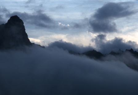
Day 5, 9 Jul 2002. Morning views from the balcony of Cabane du Mont Fort. |
|
 |
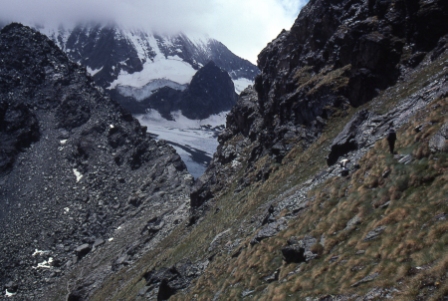
Day 5, 9 Jul 2002. The route from Cabane du Mont Fort traverses to the Col Termin which at around 2600m is very scenic. |
|
 |
Day 5, 9 Jul 2002. A spectacular vantage point near Col Termin. |
|
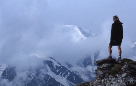 |
Day 5, 9 Jul 2002. Kendy admires the views from a pinnacle near Col Termin. |
|
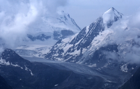 |
Day 5, 9 Jul 2002. Glacier de Corbassiere from Col Termin. |
|
 |
Day 5, 9 Jul 2002. Here is the Cabane de Prafleuri, reached after a day of high passes with snow on then beyond the Col Termin. The altitude here is about 2600m. Today's walking included a crossing of the snowfield known as the Grand Désert. |
|
 |
Day 6, 10 Jul 2002. This photo is taken near the Col de Riedmatten during a welcome break in the weather. We had approached and crossed this pass in terrible weather. But now the weather cleared as we descended towards Arolla. |
|
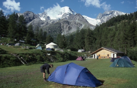 |
Day 6, 10 Jul 2002. The camp ground near the village of Arolla. This was a welcome santuary in which to enjoy an afternoon of fine weather after the bad weather we had experienced earlier in the day. It was also good to be in a tent again after two nights of staying in cabins, where sleep is impossible in crowded dormitories full of restless and snoring trekkers. |
|
 |
Day 7, 11 Jul 2002. Today was a short day in which we climbed high above Arolla and walked among this beautiful mountain scenery to the village of Les Haudères. |
|
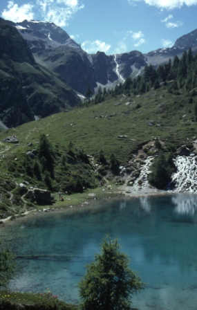 |
Day 7, 11 Jul 2002. On the way to Les Haudères we pass by the popular and aptly named Lac Bleu. |
|
 |
Day 7, 11 Jul 2002. Ahead lies the village of Les Haudères where there is a pleasant camp ground with warm showers. |
|
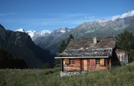 |
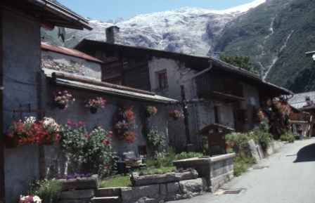
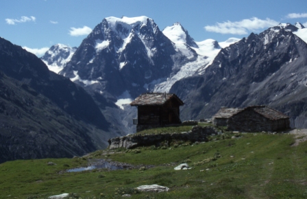
Day 8, 12 Jul 2002. Today we climbed up from Les Haudères through the tiny hamlet of Le Sage and past lovely farmhouses like this one and on towards the Col de Torrent. |
|
 |
Day 8, 12 Jul 2002. As we approache the Col de Torrent we passed this beautiful tarn. |
|
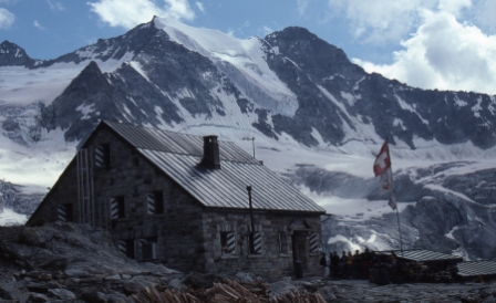 |
Day 8, 12 Jul 2002. After crossing the Col de Torrent (2916m) we descended to the Lac de Moiry and then headed upstream to this cabin, called Cabin de Moiry. This cabin is spectacularly located, perched high above the Glacier de Moiry. |
|
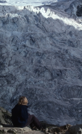 |
Day 8, 12 Jul 2002. These are the amazing views of the Glacier de Moiry that can be seen from just outside the spectacularly located Cabane de Moiry. |
|
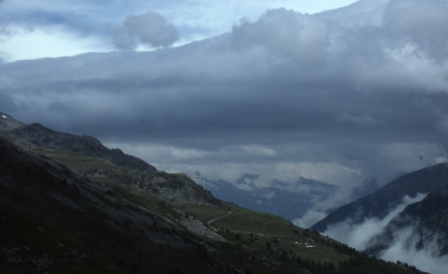 |
Day 9, 13 Jul 2002. From Cabane de Moiry the route sidles high above Lac de Moiry and makes for the Col de Sorebois. As we approached this pass these interesting cloud formations were seen, though they would bring with them more bad weather. We headed on to the village of Zinal today, and stayed at the camp ground about 1 kilometre up the valley from the village. |
|
 |
Day 10, 14 Jul 2002. Today was a very cloudy day but the walking was very pleasant as we crossed the Forcletta Pass (2874m) and then descended to the village of Gruben. There were no camp grounds near Gruben so we climbed up the side of the valley above Gruben and found our own tent site just above the tree line. These views were seen from the tent just as the sun was going down. |
|
 |
Day 10, 14 Jul 2002. Evening views from our tent site above the village of Gruben. |
|
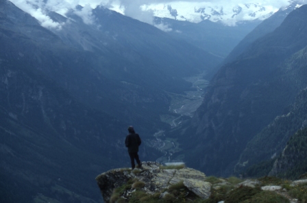 |
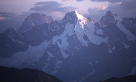
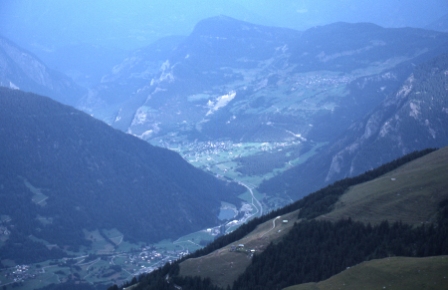
Day 11, 15 Jul 2002. On the following day we continued climbing to the Augstbordpass (2894m) from which our first views of the Mattertal were seen. |
|
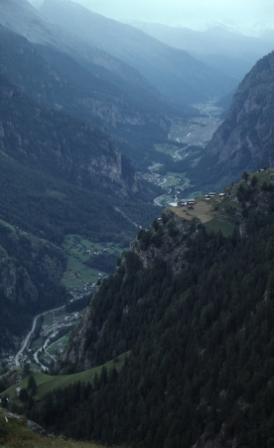 |
Day 11, 15 Jul 2002. Views up the Mattertal from Augstbordpass (2894m). |
|
 |
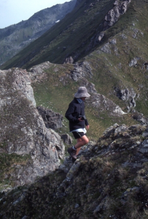
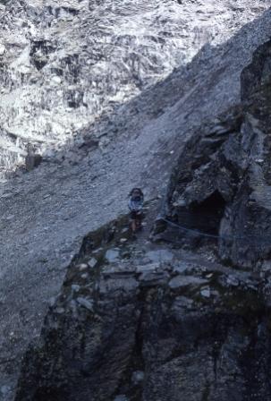
Day 12, 16 Jul 2007. After spending the night at the camp ground near the beautiful town of Grächen we climbed onto the Europaweg, a track hewn into the side of the Mattertal. This traverse high above the Mattertal was undoubtedly one of the most spectacular stages of the walk. |
|
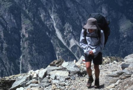 |
Day 12, 16 Jul 2007. Kendy on the Europaweg, traversing high above the Mattertal. |
|
 |
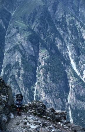
Day 12, 16 Jul 2007. The Europaweg is a track cut into the steep sides of the Mattertal and is spectacular to walk along. |
|
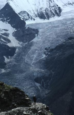 |
Day 12, 16 Jul 2007. Views to glaciers on the opposite side of the Mattertal from the Europaweg. Unfortunately part of the Europaweg was closed due to a landslide and we were forced to descend from this route not far beyond the Europa Hut. We then had to follow the valley floor up to Zermatt where the walk ended. By now the weather was deteriorating again. |
|
 |
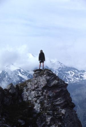
18 Jul 2002. On the morning after our arrival in Zermatt the clouds parted briefly for these glimpses of the surrounding scenery. But now our trek was over and it was time to catch a train down to Visp and then on to Geneva from where we would make for Corsica and our next adventure. |
Web page created 28 Nov 2007, last updated 17 Dec 2007. All content copyright © Ashley Burke 2007. Not to be copied, duplicated or used for any purpose without permission. |