Corsica
GR20 - Calenzana to Conca, July-August 2002
All content copyright © Ashley Burke 2007. Not to be copied, duplicated or used for any purpose without permission.
Corsica GR20 - Calenzana to Conca, July-August 2002
All content copyright © Ashley Burke 2007. Not to be copied, duplicated or used for any purpose without permission. |
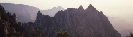 |
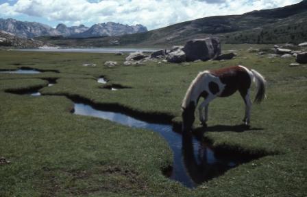
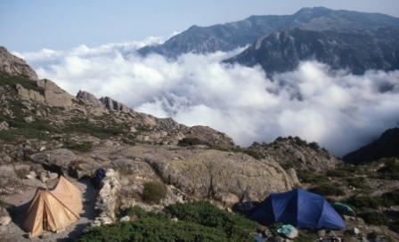
Early morning views from outside the Refuge de Paliri, GR20, Corsica |
Introduction
Corsica is a mountainous Mediterranean island to the west of Italy and north of Sardinia. It is incredibly rugged, and is home to peaks rising to 2700m. Through the heart of this incredible island runs the GR20, a classic 16 day hike that works its way from near Calvi in the northwest to near Porto-Vecchio in the southeast. I would describe this trek as easily the best European trek that I have done.
The trek starts at the village of Calenzana and ends at the village of Conca. The intervening 16 days of walking takes in magnificent scenery. I did this trek in July-August 2002 with Kendy and Rob Hynes, at the height of the Mediterranean summer. There were many other people, mainly French, doing the trek at this time. This time of year is when the weather is at its warmest and most stable, and consequently we enjoyed fine albeit hazy weather for most of the trek.
During the trek it is possible to visit some small Corsican villages, of which one of the prettiest and most memorable is Zicavo. Indeed, our visit to Zicavo was a welcome break after many days on the trail, and provided an excellent opportunity to stock up on food and enjoy hot showers, fresh food, the charming Corsican village atmosphere, and a bottle of the local wine.
The trek is split into 15 stages and at the end of each stage is a camp site or some form of trekker accommodation. We chose camping in preference to staying in huts or cabins en route. In fact, there is an abundance of camp sites throughout Corsica, and we camped every night that we were on the island. Most of the 15 stages of the trek can be completed in around half a day of walking, so this left plenty of time for side trips to climb some of the many peaks along the way and to explore the surrounding countryside.
It is possible to stock up on food at a few places en route, although we found that it is a good idea to start the trek with as much food as one can sensibly carry. On average we were able to purchase food on about every 4th day. There was not always a great variety of food to choose from at these opportunities, as the stores en route are often very small. Fresh bread and cheese was usually available, although bread may only be available just after delivery time. A limited supply of camping food such as rice, cereals and tinned fish could be purchased at a few places en route. There are small farms or bergeries en route, and from these we found it possible to buy fresh goats cheese or sheeps cheese. As previously mentioned, one of the best places for stocking up on route was the town of Zicavo, but this town is only 3 days from the end of the trek.
Almost all the route is covered by four 1:25 000 topographic maps in the French 'Top 25' series, produced by the Institut Geographique National. These four maps are:
| 4149 OT Calvi Cirque de Bonifatu |
| 4250 OT Corte Monte Cinto |
| 4251 OT Monte D'Oro Monte Rotondo |
| 4253 ET Aiguilles de Bavella Solenzara |
A small section of the route around Monte Renoso is not included on the above four maps. You can either obtain the additional map 4352 OT in the 'Top 25' series, or alternatively you can use the 'Top 100' series of 1:100 000 topographic maps. Just two sheets (No's 73 and 74) in the 'Top 100' series are required to cover the entire island of Corsica and these are good enough by themselves for navigating the GR20 in conjunction with a guide book, and they are also very useful for other travel within Corsica.
The route is well marked and easy to follow with red and white spashes of paint on rocks along the trail. For a a guide book we used the Cicerone Guide GR 20 Corsica The High Level Route by Paddy Dillon. We made good use of this book for trip planning and preparation, and on the trek itself we used it to plan our route and decide an itinerary for the days ahead. However we found that it greatly exaggerated the difficulty of the trek and the detailed trip notes were not really needed in such detail, since the high quality maps and the well marked trail were enough by themselves.
After this trek I returned to Chamonix to join another group for a climb of Mont Blanc.
Below are some photos from this classic walk. I hope you enjoy them.
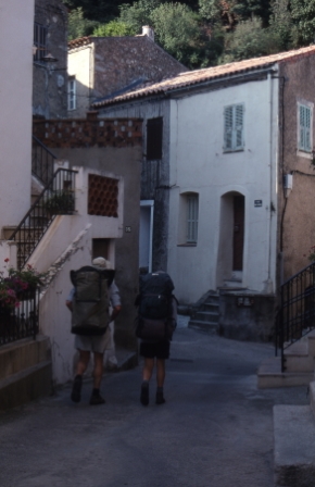 |
Day 1, 21 Jul 2002. Walking through the streets of Calenzana where the GR20 starts. This beautiful village is a few kilometres out of Calvi and can be reached by taxi. Here we are setting off with our full packs through the narrow streets, looking for the start of the GR20. In this photo: Rob and Kendy. |
|
 |
Day 1, 21 Jul 2002. As the GR20 climbs steadily into the mountains we look back down to the village of Calenzana from whence we had come. It was very hot as we climbed along this section. |
|
 |
Day 1, 21 Jul 2002. Climbing above Calenzana towards our fist camp site on the trek, at Refuge d'Ortu di u Piobbu. |
|
 |
Day 1, 21 Jul 2002. We arrived at the camp site at the Refuge d'Ortu di u Piobbu by around 4pm, and this left us time for a side trip to the summit of the nearby Monte Corona (2144m). From the summit, these great views were had. |
|
 |
Day 1, 21 Jul 2002. Evening views from the summit of Monte Corona (2144m). The Mediterranean can be seen in the distance reflecting the sun. |
|
 |
Day 1, 21 Jul 2002. Views from Monte Corona (2144m). |
|
 |
Day 1, 21 Jul 2002. Our camp site at Refuge d'Ortu di u Piobbu. |
|
 |
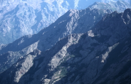
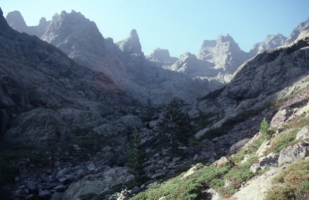
Day 2, 22 Jul 2002. The route on Day 2 climbs to a pass where this incredible scene is beheld. |
|
 |
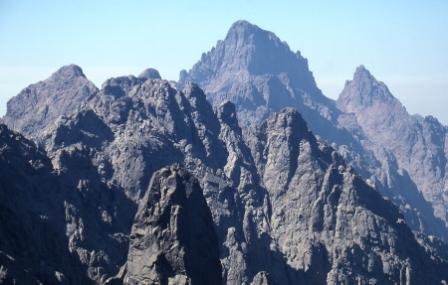
Day 2, 22 Jul 2002. Incresible scenery on the high traverse near Capu Ladroncella. In the far distance is Monte Cinto, Corsica's highest peak, and to the right is Paglia Orba, the third highest. |
|
 |
Day 2, 22 Jul 2002. Incredible scenery on Day 2. The camp site on Day 2 is at the Refuge de Carrozzu, and here we purchased a bottle of wine to accompany our dinner at our tents. |
|
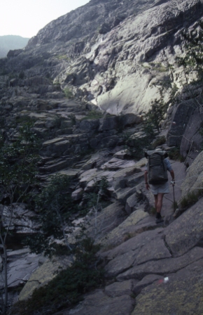 |
Day 3, 23 Jul 2002. The route on Day 3 climbs this valley along these smooth granite rock slabs. |
|
 |
Day 3, 23 Jul 2002. Here is Kendy after our climb up the layers of granite in the gorge behind. |
|
 |
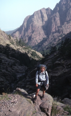
Day 3, 23 Jul 2002. Further climbing on Day 3. Today we climbed the peak of La Muvrella before heading down to the camp site at Haut Asco. At Haut Asco there is a hotel with a small shop from which we were able to top up our food supplies. |
|
 |
Day 4, 24 Jul 2002. We camped at Haut Asco for 2 nights, on the 23rd and 24th July. This gave us a full day on Day 4 for an ascent of Monte Cinto, Corsica's highest mountain (2706m). The ascent of Monte Cinto began by climbing into this high valley. |
|
 |
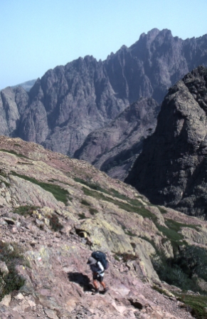
Day 4, 24 Jul 2002. The route up Monte Cinto led up this rocky mountain side high above the valley. |
|
 |
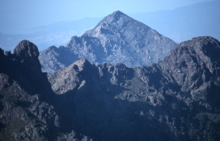
Day 4, 24 Jul 2002. Finally, after several hours of climbing and many ups and downs along a broad ridge, we reached the summit of Monte Cinto in time for lunch. We enjoyed these great views from the summit. Patches of snow left over from the winter can be seen on the left. The peak in the centre of the photo is Paglia Orba. |
|
 |
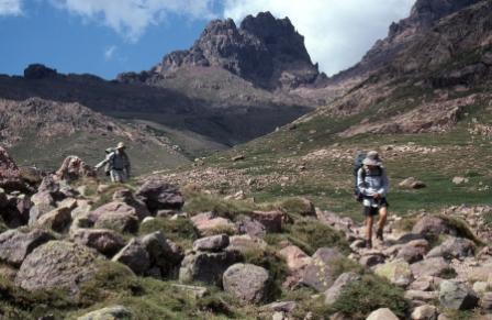
Day 5, 25 Jul 2002. We climb from Haute Asco up a valley towards the rocky gap of Bocca Tumasginesca. |
|
 |
Day 5, 25 Jul 2002. Views of Paglia Orba from the Bocca Tumasginesca. The incredible rocky spires in the foreground form the spectacular Cirque de la Solitude which is crossed by means of some steep walking. On this section the path includes some chains and a short ladder up the steep bits. Today we camped at the Bergeries de Ballone. |
|
 |
Day 6, 26 Jul 2002. Today we climbed Paglia Orba, Corsica's third highest mountain. We did this as an afternoon side trip from the Refuge de Ciottulu di I Mori. Here you can see the eye of Paglia Orba, which presumably is what gives it its name. This photo is taken from near the summit of Paglia Orba itself, from which the best views of the eye are had. We also spent some time climbing into the eye itself. It is a huge overhang, creating a large hole in the rock face. |
|
 |
Day 6, 26 Jul 2002. After the ascent of Paglia Orba it was a long descent along this ridge into the valley of the Golo and then on to the Hotel Castel di Vergio where we would camp. |
|
 |
Day 6, 26 Jul 2002. Heading towards the Hotel Castel di Vergio after our climb of Paglia Orba. We camped at the Hotel Castel di Vergio where there was a very basic shop here where we bought a few food supplies. |
|
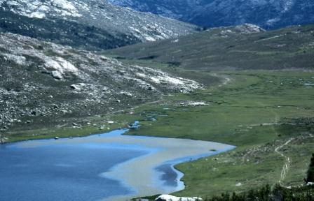 |
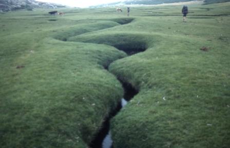
Day 7, 27 Jul 2002. Approaching the beautiful Lac de Nino, where we had a pleasant lunch. |
|
 |
Day 7, 27 Jul 2002. Lac de Nino. |
|
 |
Day 7, 27 Jul 2002. Downstream from Lac de Nino. Tonight we camped at the Refuge de Manganu. |
|
 |
Day 8, 28 Jul 2002. Today was a spectacular day of walking in which we climbed up to the Breche de Capitello. This photo was taken as we climbed up towards the pass. |
|
 |
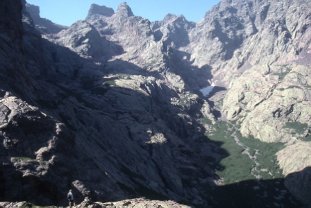
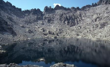
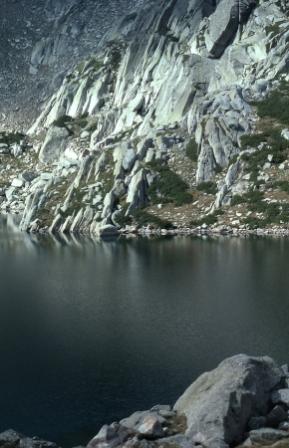
Day 8, 28 Jul 2002. In the centre of this photo is the Lac de Capitello, a deep blue glacial lake perched in a crater like formation half way up the mountainside. Tonight's camp site is at the Refuge de Petra Piana, which we reached by mid afternoon, which allowed Rob and I time for an ascent of Monte Rotondo, Corsica's second highest mountain. |
|
 |
Day 8, 28 Jul 2002. On the ascent of Monte Rotondo we passed by thie beautiful lake, Lac Bellebone. On the way back from the summit we had a quick dip in this lake. |
|
 |
Day 8, 28 Jul 2002. Views from the summit of Monte Rotondo (2622m). |
|
 |
Day 8, 28 Jul 2002. Views from the summit of Monte Rotondo (2622m). |
|
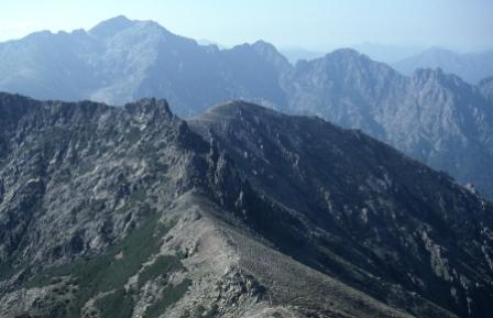 |
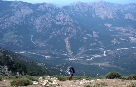
Day 9, 29 Jul 2002. Today we followed these ridge tops in the direction of Monte D'Oro. This route is considered a variation on the GR20, the main route follows a river valley. We chose the high alternate route, along this ridge, which was spectacular. |
|
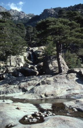 |
Day 9, 29 Jul 2002. We followed these beautiful cool and inviting streams on the GR20 leading towards Vizzavona. |
|
 |
Day 10, 30 Jul 2002. After Vizzavona we climbed over the Bocca Palmente and some thunderstorms broke creating these misty views. Tonight we camped at the Refuge de Capannelle, which was not a great place, being marred by ski piste. |
|
 |
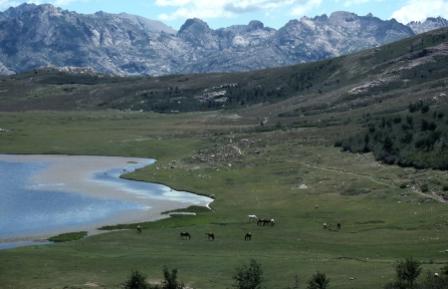
Day 11, 31 Jul 2002. This is the beautiful Lac de Bastani, a lake that we reached during our ascent of Monte Renoso. Here we had departed from the GR20, to walk the high route via Monte Renoso and I Possi. |
|
 |
Day 11, 31 Jul 2002. Mighty mountain scenery from the summit of Monte Renoso (2353m). |
|
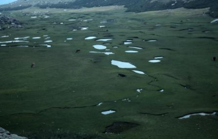 |
Day 11, 31 Jul 2002. After Monte Renoso we descended to this high grassy valley dotted with lakes. This place is called I Pozzi. |
|
 |
Day 11, 31 Jul 2002. I Pozzi. |
|
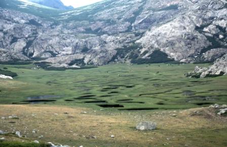 |
Day 11, 31 Jul 2002. I Pozzi. Tonight's camp was at a camp site near the Col de Verde. |
|
 |
Day 12, 1 Aug 2002. Continuing south along the GR20 we pass this rocky turret called Rocher de Penta. The GR20 keeps to a ridge line along this section. |
|
 |
Day 12, 1 Aug 2002. Our camp site at the end of Day 12, near the Refuge d'Usciolu, a picturesque camp site with clouds in the valley left behind by a passing storm. |
|
 |
Day 12, 1 Aug 2002. Evening views from our camp site near the Refuge d'Usciolu. |
|
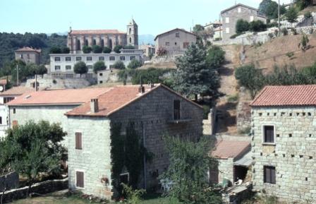 |
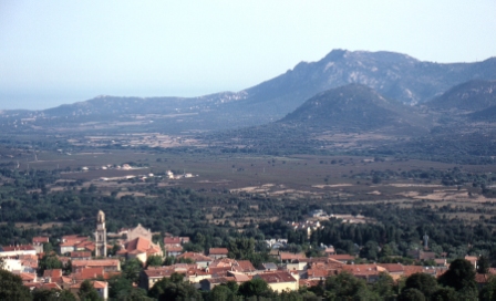
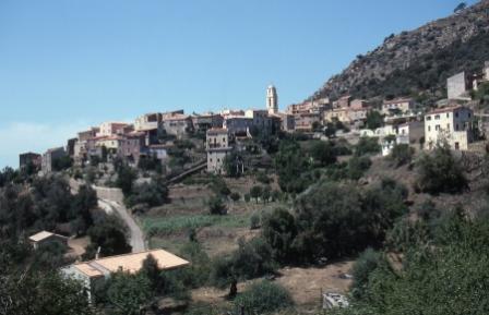
Day 13, 2 Aug 2002. The village of Zicavo. This village lies to the west of the GR20 and we descended to this beautiful village on Day 13 to enjoy the village atmosphere and stock up on supplies for the rest of the trek. |
|
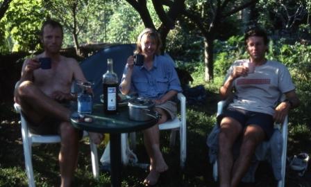 |
Day 13, 2 Aug 2002. At Zicavo we camped in the idyllic garden setting of a local gîte d'etape and in the afternoon relaxed with a bottle of local wine.
We left Zicavo on the morning of Day 14, but due to hazy conditions, no photos were taken on Day 14. We camped at the Refuge d'Asinau after climbing Monte Incudine. |
|
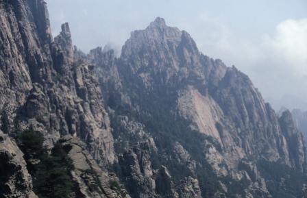 |
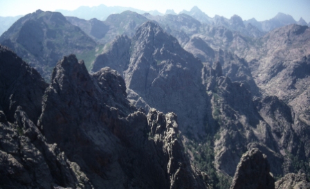
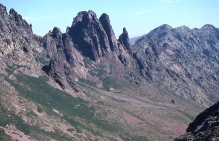
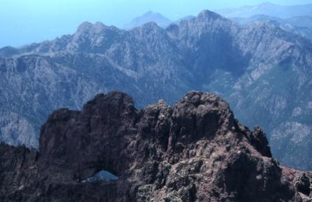
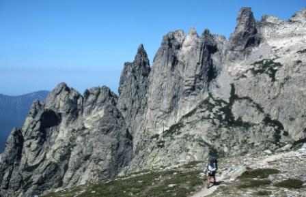
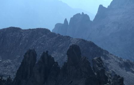
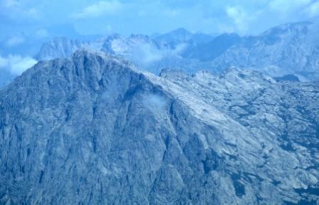
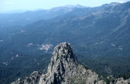
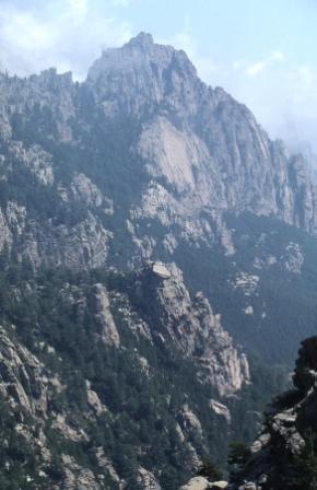
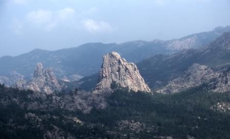
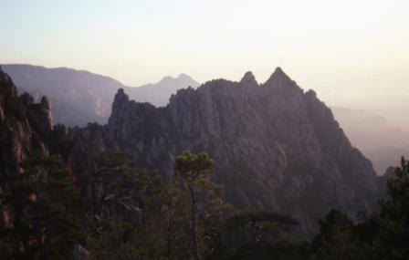
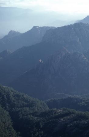
Day 15, 4 Aug 2002. On Day 15 we reached the Aiguilles de Bavella. This is a stunning knot of intensely rugged granite country, a truly spectacular area. This area is popular among rock climbers and tourists and the hike up to this area is a tourist attraction, easily accessible from the Col de Bavella. |
|
 |
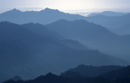
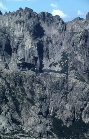
Day 15, 4 Aug 2002. Hazy views from the Aiguilles de Bavella. |
|
 |
Day 15, 4 Aug 2002. The Aiguilles de Bavella. |
|
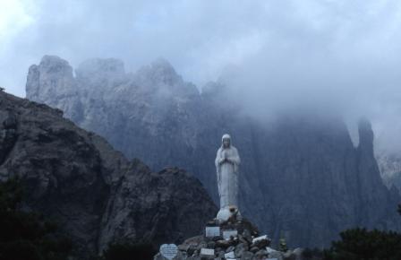 |
Day 15, 4 Aug 2002. At the Col de Bavella there is this statue, which against the backdrop of the Aiguilles de Bavella makes for a striking scene. |
|
 |
Day 15, 4 Aug 2002. We continued on from the Col de Bavella to the Refuge de Paliri, and this is some of the scenery on the way. |
|
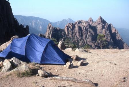 |
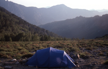
Day 15, 4 Aug 2002. Here is our tent site near the Refuge de Paliri. This was one of the best camp sites on the entire trek. |
|
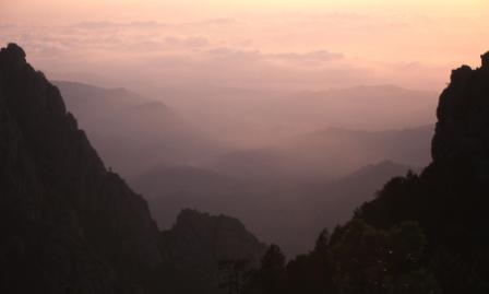 |
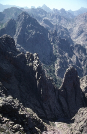
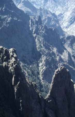
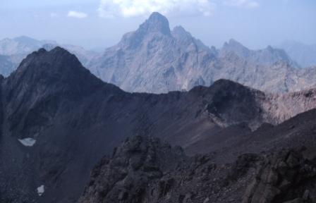
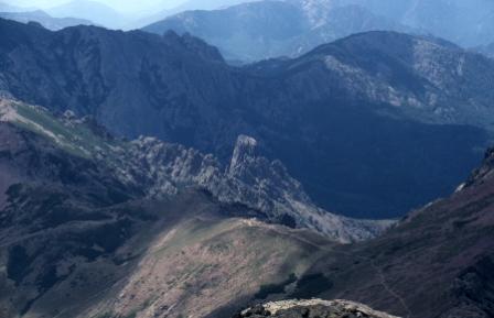
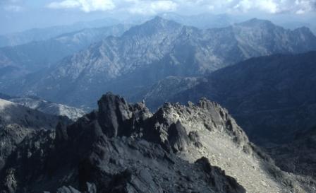
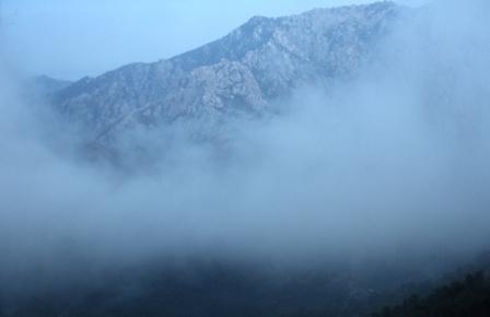
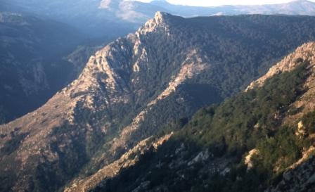
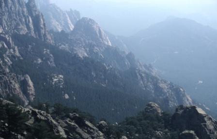
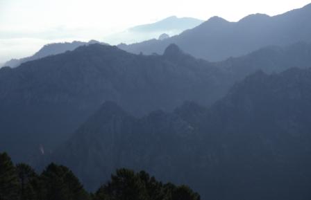
Day 16, 5 Aug 2002. Morning views from our camp site near the Refuge de Paliri. |
|
 |
Day 16, 5 Aug 2002. Morning views from our camp site near the Refuge de Paliri. |
|
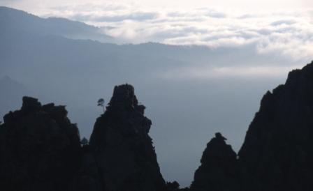 |
Day 16, 5 Aug 2002. Morning views from our camp site near the Refuge de Paliri. |
|
 |
Day 16, 5 Aug 2002. The final stage of the trek between the Refuge de Paliri and the village of Conca. |
|
 |
Day 16, 5 Aug 2002. The final stage of the trek between the Refuge de Paliri and the village of Conca. |
|
 |
Day 16, 5 Aug 2002. This is the village of Conca where the trek ends. From this village we caught a shuttle bus to the main road that follows the east coast of the island and from there we caught a bus and thence the delightful Corsican railway back to Calvi. |
Web page created 17 Dec 2007, last updated 17 Dec 2007. All content copyright © Ashley Burke 2007. Not to be copied, duplicated or used for any purpose without permission. |