Rodopi Cycling Tour, Bulgaria
Jun 2013
All content copyright © Ashley Burke 2013. Not to be copied, duplicated or used for any purpose without permission.
Rodopi Cycling Tour, Bulgaria Jun 2013
All content copyright © Ashley Burke 2013. Not to be copied, duplicated or used for any purpose without permission. |
Contents
The highest and most famous mountains in Bulgaria are those known as the Rila and the Pirin, both of which are located in the soutwest of the country. Then there are the Balkan mountains which run east-west through the middle of Bulgaria. Lesser known are the Rodopi in the south, near the border with Greece. Not true mountains in the sense of the high peaks of the Rila and Pirin, rather the Rodopi comprise ranges of forested hills interspersed with deep valleys, gentle farmland, historic villages and quiet narrow winding roads. The most striking feature of the landscape is the steep limestone gorges which is home to some extensive limestone caves. There are some amazingly deep and rugged valleys with tiny roads hewn into them, roads which connect tiny remote mountain villages with the outside world. The Rodopi mountains therefore, are perfect for cycle touring and up to a week may be spent exploring this interesting area by bike.
Another interesting aspect of this area is the unspoiled character of many of the villages, towns and rural areas. Here you can journey back in time and experience Europe as it was in the past, where farm people travel by horse and cart, wear traditional clothing and still till their fields by means of hard work and without the mechanisation of the modern world. Your only reminder of the 21st century is when you see a local farmer in their horse drawn cart rummage around in their traditional garb and pull out a mobile phone that is beeping with the same familiar ringtone as the mobile phone in the office back at home. And in many of these little villages the accommodation has all the modern amenities that you come to expect from a modern European travel experience.
In June 2013 we spent a week or so exploring this lovely area by bike.
Click on the thumbnail below to open a larger map in a new browser window.

Here is what happened day by day. The links will take you to the relevant photos.
| Date | Comments | Accommodation |
| 15 Jun 2013 | Transfer from Sofia to a road junction just north of Sestrimo. Bike failure at very start. Driver went back to Sofia to get the necessary spare part. Long uphill ride on tiny little roads through dense forest, past a hydro station and eventually arriving at a high dam above 1900m. From here it was a long downhill run through beautiful forest and remote and beautiful farmland down to the town of Velingrad. At Velingrad we had a lot of trouble finding our accommodation but eventually made it. | Guesthouse in Velingrad. |
| 16 Jun 2013 | Ordinary riding at first and then climbing steadily through forest to Batak Dam at 1000m. Then more serious climbing through dense forest to eventually reach high pasture at 1600m. Then gentle downhill through pleasant countryside passing lakes and forests, dams and farms before finally a huge downhill run to the town of Dospat, perched above a large valley lake. A nice day's riding in good weather. | Hotel in Dospat. |
| 17 Jun 2013 | A hot sunny day with cave tours to break up the riding. Lovely rural countryside and traditional farm people. Long steep descent into deep limestone valley and a spectacular ride up a side valley to Jagodina Cave. The spectacular ride on this little road was more interesting than the cave tour itself. Cycled back down the valley and then continued east for a short while and then climbed steeply up another side valley through more limestone country. Tunnels and narrow steep roads eventually led to a huge limestone formation called Devils Throat. Continued uphill to the tiny village of Trigrad where we again had trouble finding our accommodation but were eventually comfortably settled in a farmhouse. | Farmhouse in Trigrad. |
| 18 Jun 2013 | Another fine day. Descended back down the very steep road that we had come up the day before. Continued east to the historic village of Shiroka-Laka where there were heritage houses in a traditional Bulgarian style. There followed a long climb to an altitude of 1700m until finally there was a long descent to Smolyan. Our hotel was on the uphill side of town at 1116m, the town centre was still lower at about 900m. | Hotel in Smolyan. |
| 19 Jun 2013 | Hot day. Back uphill again, taking the route to Pamporono, a ski centre at 1650m. There followed forested riding, another high pass at 1700m before finally a huge 20km downhill run into Laki at about 800m. We took a minor side road that climbed very steeply in switchbacks to the tiny village of Borovo perched on a high terrace at 1100m. A seemingly oversized hotel was our accommodation in this tiny village. | Hotal in Borovo. |
Here are a few photos of the Rodopi cycle tour.
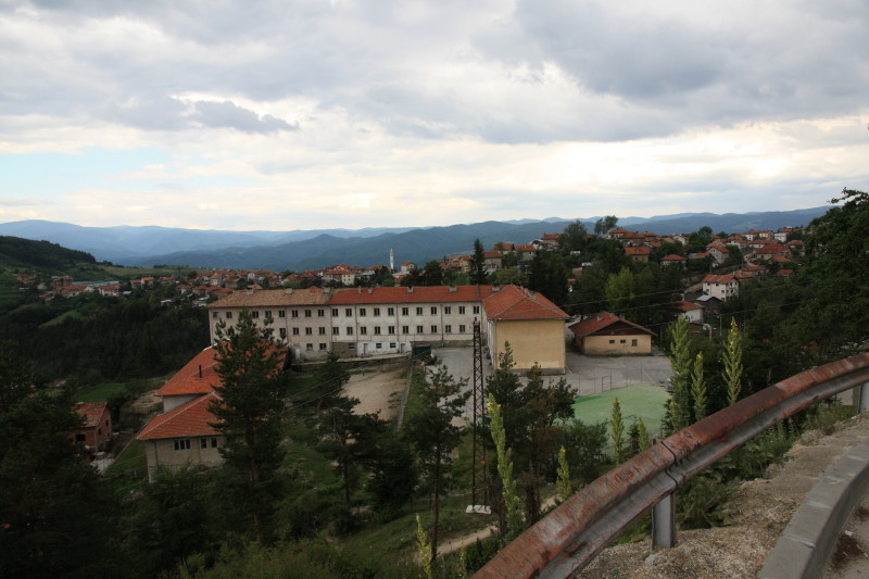 |
The village of Sveta Petka, about 10km west of Velingrad. From here is was a fast downhill run all the way into Velingrad. Culturally this area is Moslem and you can see the minaret of a mosque in the centre of this photo. |
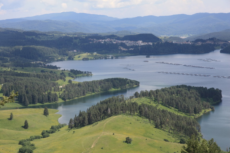 |
The town of Dospat can be seen above the lake of the same name. This was our view towards the end of our second day of riding as finally we had a long downhill run. |
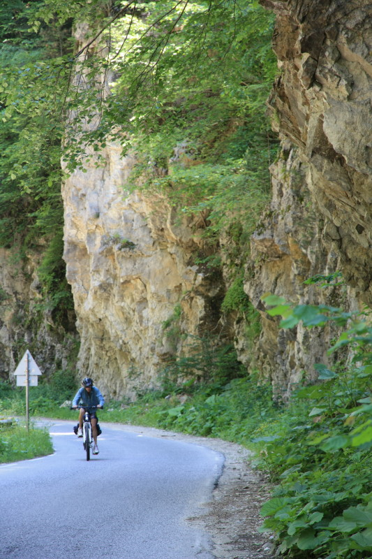 |
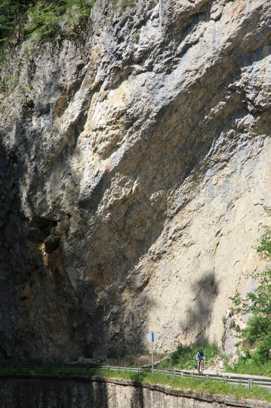
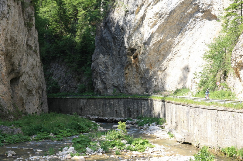
Taking a narrow side road up a steep gorge leading to Jagodina Cave. |
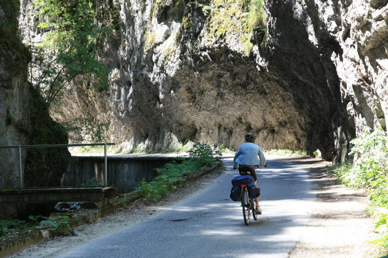 |
Taking a narrow side road up a steep gorge leading to Jagodina Cave. |
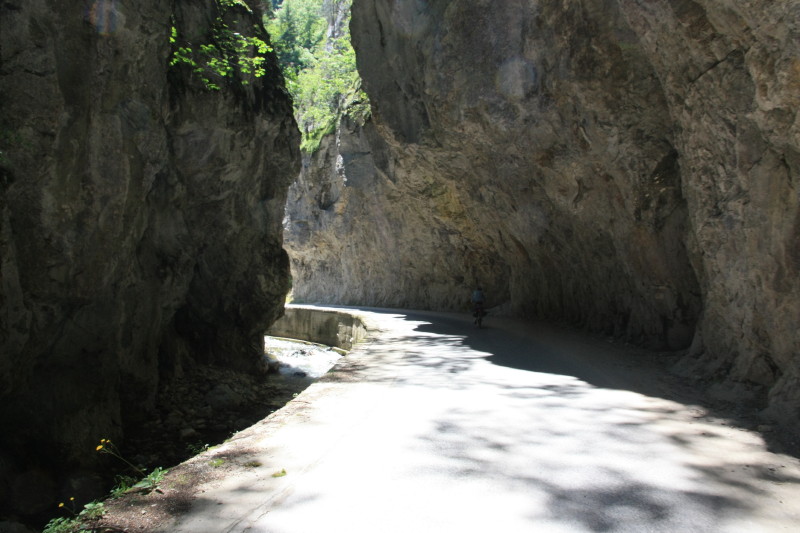 |
The road is hewn into the side of a narrow limestone canyon. |
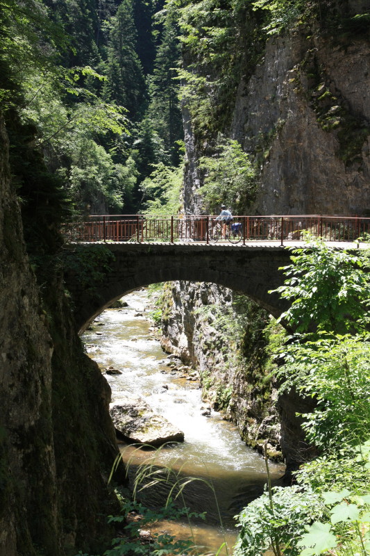 |
An old bridge en route to Jagodina Cave. |
 |
|
 |
|
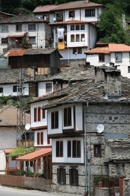 |
The historic village of Shiroka Laka. |
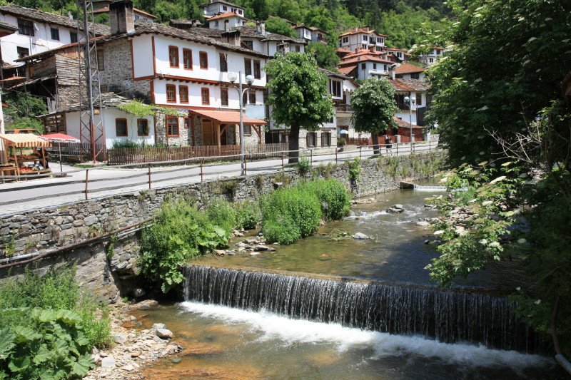 |
The historic village of Shiroka Laka. |
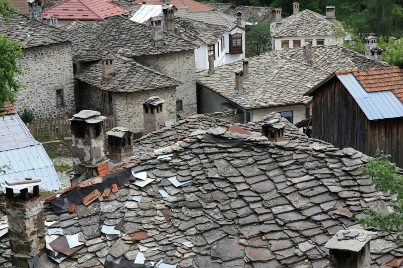 |
Rooftops, Shiroka Laka. |
 |
The village of Borovo where we spent our last night. |
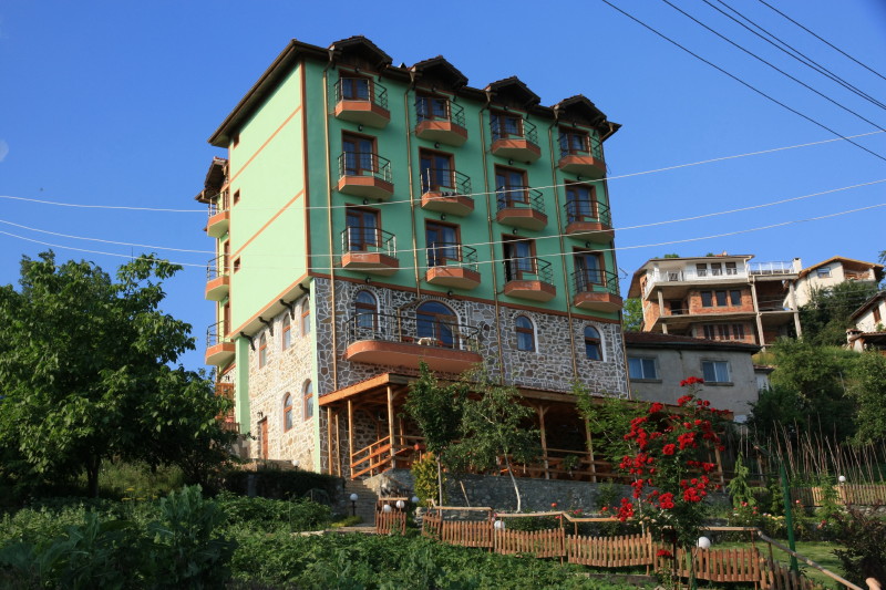 |
This hotel in Borovo, seemingly disproportionately sized compared to the size of the village itself. |
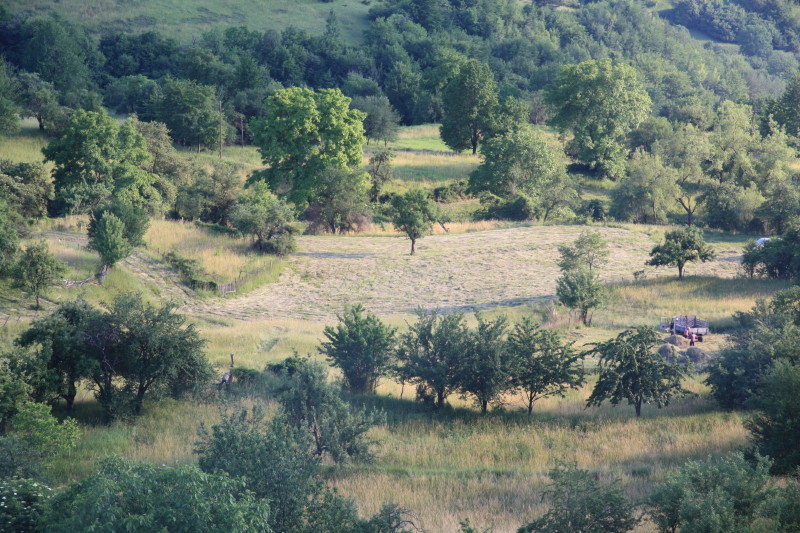 |
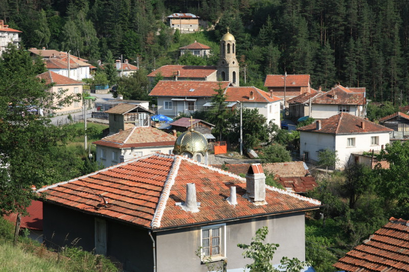
Fields and farms around the village of Borovo. |
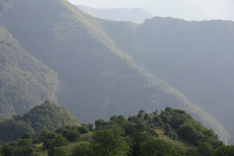 |
Views across the valley from Borovo. |
All content copyright © Ashley Burke 2013. Not to be copied, duplicated or used for any purpose without permission. Page created 18 Oct 2013, last updated 18 Oct 2013. |