Western European Cycling Tour
April - September 1996
All content copyright © Ashley Burke 2009. Not to be copied, duplicated or used for any purpose without permission.
Western European Cycling Tour April - September 1996
All content copyright © Ashley Burke 2009. Not to be copied, duplicated or used for any purpose without permission. |
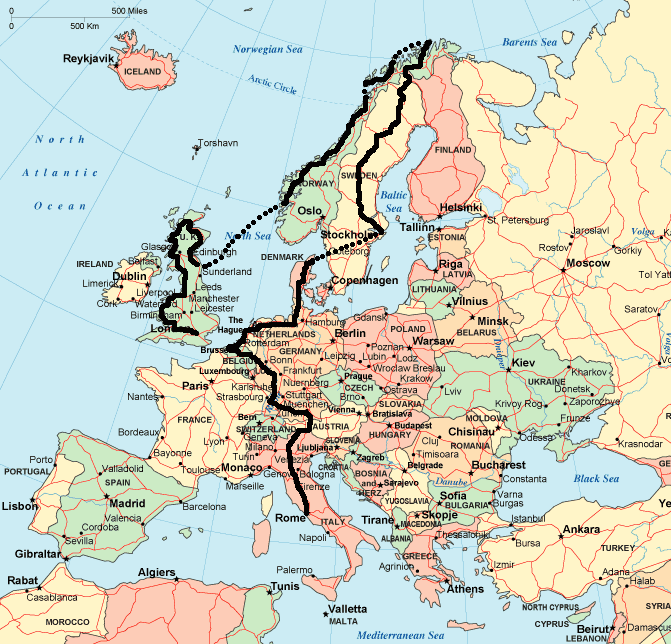
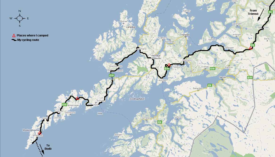
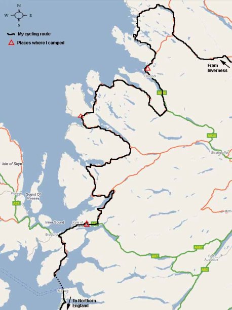
Map showing my route from Rome to Nordkapp and back to London
Introduction
On a sunny morning in April 1996 I arrived at Rome airport after a long flight from Sydney and unpacked my bike and panniers, assembled the bike from the parts packed in my baggage and then wheeled the bike through the airport concourse and out into the hustle and bustle of Rome. Five months later I would be back here with the same bike, checking in for the flight back to Sydney after the adventure of a lifetime.
The intervening 5 months were an unforgettable solo cycling adventure in which I rode nearly 13 000 kilometres through Europe, Scandinavia and the British Isles.
Now, some 12 years after this adventure I am thinking about how I might describe this trip on my web page. In one word it was an epic. I don't think anyone would want to read a detailed trip report of the entire 5 month 13000km adventure and I don't think I could write such a volume anyway, so this web page summarizes some of the highlights and most memorable experiences, and I hope it might be of some interest to other intending ultra long distance cycle tourers who might be considering a similar undertaking.
The Route
When I started I had no set plans for where I would ride apart from the first stage from Rome to Florence. After Florence I rode wherever the map and the road took me. After some time I became consumed with the idea of riding as far north as possible, and once I had done that I sought to return via a different route but ended up in the British Isles and concluded the trip in London. The route I took is shown on the above map of Europe or may be written as follows:
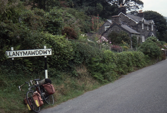
Rome -> Assisi -> Sienna -> Florence -> Italian Dolomites -> Lienz -> Grossglocker Pass -> Salzburg -> Munich -> west from Munich across Bavaria -> Danube River -> followed Danube upstream into Schwarzwald (Black Forest) -> North through Schwarzwald -> Heidelburg and northwards to east of Rhine River -> Rhine Valley northwards to Koblenz -> Mosel Valley then westwards into Belgium -> west across Belgium to Bruge -> north into Holland -> Dutch coast to Amsterdam -> east from Amsterdam into northern Germany -> continue east until near Bremen -> swing north through Schleswig-Holstein -> North into Denmark and up the Danish peninsula to Frederiksavn -> ferry to Gothenburg -> train to Stockholm -> cycle north from Stockholm until Finnish border -> continue northwest into arctic Norway -> northwest along Norwegian coast to Nordkapp, the northernmost point in Europe-> ferry to Tromso -> Lofoten Peninsula and Lofoten islands out to Moskenes -> ferry to Bodö -> southwards through Norway to Bergen -> ferry to Newcastle -> Hadrians Wall -> Edinburgh -> Cairngorm Mountains -> Inverness -> Lochinver -> Ullapool -> Gairloch -> Isle of Skye -> southwards through western Scotland -> Dumfries -> Carlisle -> Lakes District -> Yorkshire Dales -> Buxton -> Wales -> Snowdonia -> Hay-on-Wye -> Hereford -> Cotswolds -> Oxford -> London.
Apart from the use of ferries where needed to cross waterways and one train trip from Gothenburg to Stockholm, I pedalled the entire route. The entire trip was done solo apart from a few days where I met up with other cyclists and rode with them, and the very beginning of the trip where I met my family and a friend in Rome and Florence. The route passed through a total of 10 countries.
|
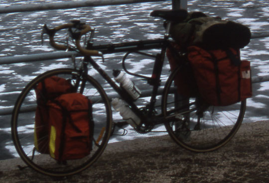
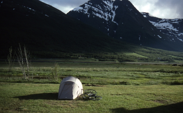
This bike was part of my body for the five month trip and still is. It is a Trek 520 touring bike and is fitted with front and rear panniers. It was purchased in 1995. Some bikers love to talk endlessly about the technical specifications of their bike but I will spare you the boredom of this and just say that it has a chromoly frame and Shimano LX group set with bar end shifters. The bike is perfectly suited to ultra long distance transcontinental road touring. Its suitability for off road or dirt road cycling is limited because that is not what it is designed for. For travelling long distances on dirt roads a mountain bike may be better, but for my western European cycling tour this bike was perfect. It is comfortable to ride, extremely stable and supple and forgiving, just what you need when you are in the saddle all day every day. As you can see, I had the bike heavily loaded up with panniers front and rear plus an additional backpack strapped to the back. I found that I could not have made do with less load on this extended tour when you consider all that I needed to carry. My load included:
I found that after such a long distance cycling with this weight, chain stretch became a problem and by the end of the trip stretch of the bike's Shimano chain had ruined the sprokets both front and rear. I would recommend replacing the Shimano chain that the bike is sold with with a much better quality Sachs/Sedis chain that does not stretch. I also found that the rims, particularly that of the rear wheel fatigued after about 7250km. This fatigue of the rim was probably accelerated by the additional weight of the luggage over the back wheel. It is essential that the wheels are kept perfectly true throughout the ride otherwise fatigue of the rim is inevitable. Even with true wheels, I found that at the 7250km mark the metal of the rim had fatigued to the point where the metal was tearing around the spokes and at the edge of the rim. The bike was virtually unridable at this point and this happened to be when I was cycling in the far northern Norwegian arctic, miles from anywhere. By a stroke of good fortune I found a Trek bike shop in Tromsö where I was able to have the rear rim replaced - at great expense due to the high cost of parts and labour in Scandanavia. Another important component of the bike were the tyres and I found that when carrying this weight, tyres of the maximum thickness possible are needed. This bike will take 40mm tyres but unfortunately is is sold with tyres that are much thinner. I had problems of punctures on such thin tyres when carrying this amount of weight. Since this trip I have used tyres with the maximum thickness of 40mm and doing so has eliminated the problems I experienced on this tour of incorrect tyre width. Apart from these abovementioned problems this bike is a superb machine that carried me from Rome to Nordkapp and back and I love it.
|
The Diary
When cycling alone for months, usually in countries where English is not the native language, I found plenty of time to write. So I kept a detailed diary of each day's achievements, frustrations, setbacks, highs and lows. Now I'm not going to bore you with it, but for the record I have summarized the contents of the diary in a trip log showing where I cycled each day and how far. So in case you're interested, here it is:
The Highlights
It is hard to describe in a few short lines what the highlights were in what was a continuous adventure of several months duration. There are many stories to tell and many vivid memories, some of which I will mention here. But if I had to describe the highlights I would say that these were the following:
The Grossglockner High Route, Austria
Reaching Nordkapp, northernmost point in Europe
The Lofoten Islands, arctic Norway
The Norwegian mountains north of Bergen
Here are a few photos and brief notes from each of these highlights.
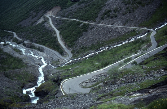
The Grossglockner High Route, Austria
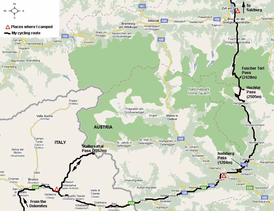
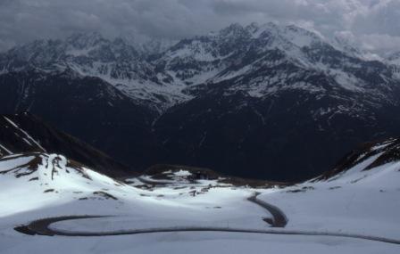
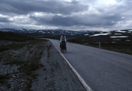
My route north through Italy took me into the Dolomites, a rugged and spectacular mountain range south of the Austrian and Swiss border. After a huge amount of climbing and descending through these mountains, often in rain which lasted for days, I began to give some thought to the route by which I would cross the border into Austria. Being only mid-May, many of these passes were officially closed even if they were no longer blocked by snow. The Grossglockner on the other hand, happens to be the highest and steepest pass, yet is kept open throughout the year.
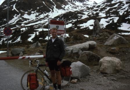 |
Initially I tried the 2000m Stallersattel Pass (see map) which was officially closed but clear of snow. I mistakenly thought that being a lone cyclist, the fact that the pass was officially closed wouldn't matter and I would be able simply to slip through. However, I hadn't counted on the officiousness and regulatory strictness of Austrian culture. After toiling for hours up the very steep and narrow road to the pass an Austrian border official flatly refused to allow me to cross the pass. The Italian officials on the other hand couldn't care less and were content to amuse themselves by throwing snowballs at each other higher up the slope. After arguing with the officious Austrian for a while in my broken German I was forced to give up and cycle all the way back down the beautiful Stallersattel valley. Here is a photo of me at the top of the Stallersattel Pass - you can see the boom gate closed. The Austrian official was nearby and wouldn't let me wheel my bike around and continue my journey. The Italians were playing in the snow beyond. |
This setback left me only one remaining option for crossing the Alps into Austria and that was the Grossglockner High Route.
|
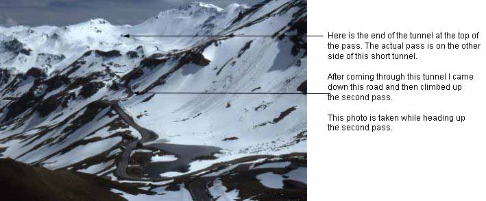
The Hochtor Pass on the Grossglockner High Route at 2505m is the highest crossing from Italy into Austria. To get to it I would have to climb more than 2000m in one day of cycling due to the hilly nature of the approach to the pass itself and the fact that there isn't just one pass but two, and a third lower one that I had to get over first on the road from Lienz. Switchback after switchback took me steadily higher. I couldn't believe how much I had to eat - I stopped for a banana sandwich every 45 minutes! And that didn't include lunch! Finally I reached the snow line and the last few kilometres of climbing was along a road that had been cleared by a snow plough and the snow was piled more than a metre deep either side of the road. The riding here was absolutely spectacular. At the summit of the main pass was a short tunnel (see photo) and then after the the tunnel the road descended through the snowy mountainscape to a lake and then climbed up yet again to the second pass. |
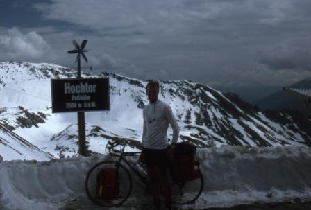 |
Here I am at the top of the pass just before going through the short tunnel. |
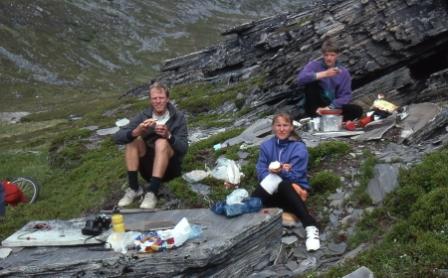
After all the arduous riding through the Dolomites followed by the huge climb over the Grossglockner I was in need of a rest. It was only a day or two's ride from the Grossglockner Pass to this beautiful city and while I was there I had perfect weather and I made the most of it. I loved wandering the streets of Salzburg enjoying the culture and the celebration of music. During the day I visited museums and castles and during the night I payed visit to some of the beer halls where the Austrian culture was in full swing. I stayed at a very lively youth hostel and met some people there.
|
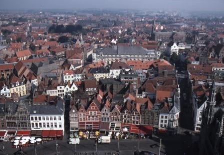
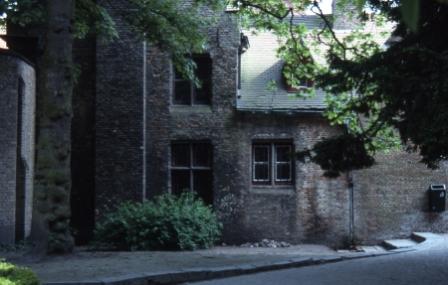
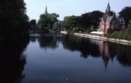
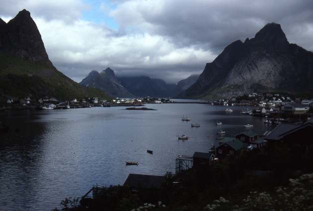
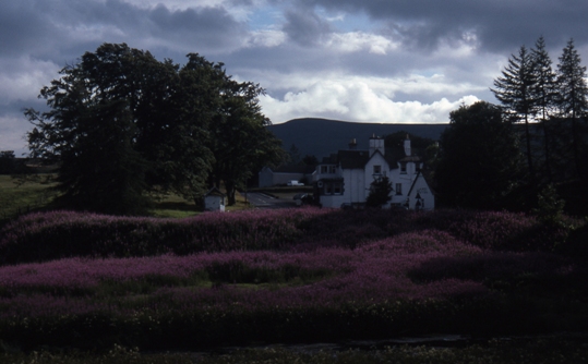
After leaving Salzburg I headed west into Munich and then continued westwards following the Danube, then worked my way north through the Schwarzwald and then along the Rhine to Koblenz. Then I followed the Mozel upstream for a while and finally crossed the border into Belgium on 3 Jun. I had heard that Bruge was a beautiful city, preserved virtually unchanged since the 15th century. So my route after Salzburg was largely driven by a desire to visit this city and that's why I kept prevailing in a westerly and northerly direction after crossing the Alps. Finally, on 5 Jun after riding through heavily traffic and some horrid industrial landscapes and sprawling suburbia I at last arrived in beautiful Bruge. It was worth the long detour. As the photos show, Bruge is a beautiful city, almost unspoilt by modern development. It is like a 15th century city in the 20th. There were 20th century cars, tourists, cafés and shops but the buildings were all of a different era. There were serene canals and gardens. The weather was perfect and there was a great view from the bell tower in the centre of town. I stayed at a hostel located close to the centre of town and met some nice people there and we went out to dinner together that evening. Actually, I had to have 2 dinners because by now all the cycling had given me the most enormous and insatiable appetite. So after enjoying dinner out at a Bruge restaurant with my hostel mates, I returned to the hostel and ordered a second dinner at the hostel kitchen and devoured that before heading to bed. Next day it was time to begin my quest to reach Nordkapp, Europe's northernmost point, and this took me into Holland and Amsterdam. |
Reaching Nordkapp, Northernmost point in Europe
During my arduous riding in appalling weather through the Dolomites in northern Italy I met an Austrian man who asked me if I was going to ride to Nordkapp. "Nordkapp?" I asked. I had never heard of it. He explained to me, and I barely understood his heavily accented German, that Nordkapp is Europe's North Cape, the northernmost tip of Norway, some 500km north of the arctic circle. In my many lonely days of cycling following this discussion I pondered the idea of going there, and once Bruge was behind me that was where I set my sights. It took 5 weeks of riding to reach Nordkapp after leaving Bruge.
|
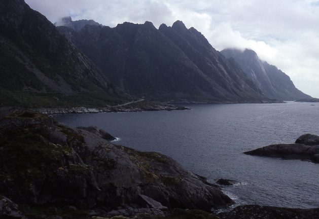
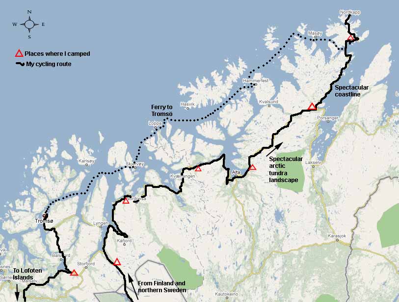
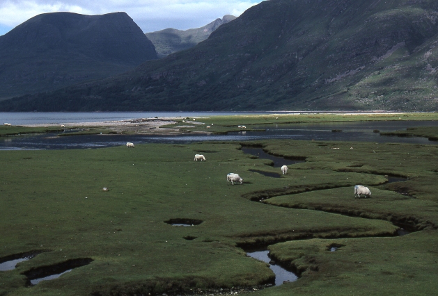
The journey from Bruge to Nordkapp was long, dull and wet for the most part, through mostly flat and uninteresting country punctuated only rarely by memorable highlights. Amsterdam was certainly not one of these highlights, I took a great dislike to this city except for the Van Gough museum which was well worth the visit. Northern Germany was flat and dull. Denmark was more scenic but still flat. Gothenburg and Stockholm were definite highlights, two wonderful cities which punctated the otherwise dull cycling, and I met up with some old family friends in Stockholm. Then came the dreadful cycle northwards through central Sweden. Endless miles of forest, lakes and mosquitoes. Yes, mosquitoes, not in their thousands or millions but their uncountable trillions. For nearly 2 weeks I pushed northwards through unchanging countryside, soaked through by rain that never let up for more than a few hours, leaden grey skies and the ever present immeasurable swarms of mosquitoes. The air was thick with them. The only way to avoid them was to ride faster than they could fly, which fortunately wasn't too fast. Whenever I stopped to camp it was a battle against insurmountable odds against the mosquitoes. Only when inside my tent was I protected from them, and in time the netting of the tent became clogged with the dead ones, ones who met their end trying to get in or out. So why am I describing all this in the highlights chapter? Because the ordeal and the monotony ended. It ended in spectacular fashion when I reached the arctic Norwegian coastline and when, on 10 July 1996, the weather finally cleared, revealing the spectacular coastal scenery depicted in these first two photos, left. It was stunning riding through this country where in midsummer there was still snow only a few hundred metres above the coast, and where deep blue fjords and lakes made deep incisions into the coastline, and where mountains rose steep out of the sea. |
|
Then it was time to head away from the coast and cross arctic tundra to Olderfjorden from where it was only a day or two's ride to Nordkapp. On this leg of the ride I met up with a Danish couple, a Japanese guy and a German man and we rode to Nordkapp together. It was superb riding across this arctic landscape. The road snaked its way across the tundra, there was snow all around, there was almost no traffic, and it never got dark. The weather held passable for a few days. It was truly incredible riding. The photos to the left show the ride across the tundra on the way to Olderfjorden and the sun at midnight. |
|
From Olderfjorden the route took me northwards along the coast to Honningsvåg. The scenery along here was stunning as the road wound its way around the coast, ducking in and out of short tunnels. The weather held good for most of the day. Nordkapp is actually located on an island just off the coast of mainland Norway and today I caught a ferry across to the town of Honningsvåg on this most northerly of islands. The people I was cycling with were great and we rode to Nordkapp together. |
|
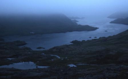
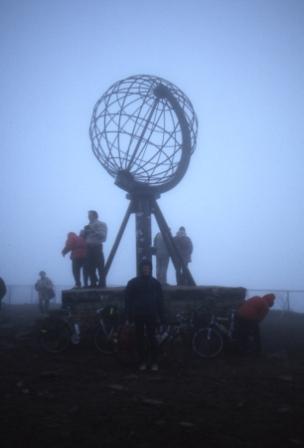
After reaching Honningsvåg a cold damp sea mist rolled in. However this did not deter us and for some reason we decided to ride the last 10-15km to Nordkapp at midnight, to take advantage of the midnight sun. The cold mist reduced the visibility but even at this time of night it was possible to ride with no need for torches. At one point the cloud lifted enough to give this view of windswept arctic fjord on the islan of Honningsvåg. Finally we reached the northernmost tip of this island and there we found tollgates where they wanted to charge 30 kroner for the privilege of riding the last 100m to Nordkapp. Well I had ridden some 6700km from Rome so I wasn't about to pay 30 kroner for the last 100m so I just rode around the boom gate and the toll collector didn't come after me - I was already cold and wet and he was cosy, warm and dry inside his toll booth so I had nothing to lose, unlike him, so he let me pass. Nordkapp itself was a bit of a disappointment, nothing much there except a heated indoor tourist complex and a cold dull monument on the northernmost rock where this photo was taken. We couldn't see much so after a while we rode back to our tents in Honningsvåg for what was left of the "night". The following day the weather worsened considerably and I remained in my tent all day - this was the first rest day in the 3 weeks since I had departed Stockholm. The quest for Europe's northernmost point was over. Where to now? This decision was made easier by the fact that the rear rim of my bike was almost completely worn out and the bike was barely rideable. Thousands of kilometres of riding with heavy panniers over the back wheel had strained the rim to the point where the metal was starting to break down in places. Major warping and cracking of the rim was occurring in places. The rear rim was in urgent need of replacement. And to make matters worse the weather had turned bad again. But as luck had it there was a ferry that ran from Honningsvåg to Tromsö, a large fishing town on the Norwegian coast. So after the rest day at the Honningsvåg camp ground I boarded the ferry for the rain lashed voyage to Tromsö. The ferry trip took 17 hours and arrived at Tromsö in the dead of night but of course in the land of the midnight sun there was still light to see by. Miraculously within metres of the ferry terminal and clearly visible was a bike shop, and a Trek specialist at that, and in the window were gleaming bikes, wheels, rims, even my own model was there on display. So I spent the remainder of the night trying to catch a little sleep sheltering from the rain under some garbage bins and waited patiently for the bike shop to open the following morning. |
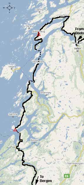
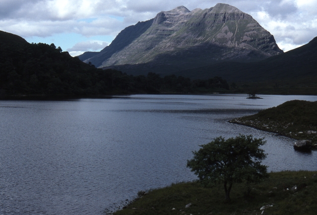
The Lofoten Islands, Arctic Norway
Map showing my cycling route through the Lofoten Islands of northern Norway
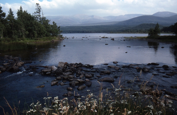
The Lofoten Islands are an archipelago of very mountainous islands jutting out into the Atlantic Ocean well within the Arctic Circle off the coast of Norway. The ride out along this archipelago was one of the most spectacular legs of the entire trip. With my rear bike rim replaced at the bike shop that I fortuitously found in Tromsö I rode south and east, reaching the start of the Lofoten area on the above map about 2 days after leaving Tromsö. The weather was true to form - utterly dismal with soaking rain.
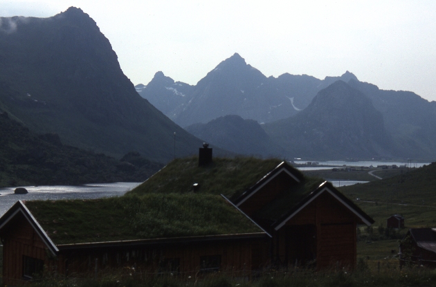
It was now less than a week out from my 30th birthday and I wanted to be somewhere interesting for that so at this point a detour out along the Lofoten peninsula seemed like a good idea. At first the weather remained poor but for a few days as I approached the outer islands the weather improved enough to place the magnificent scenery on display. After another week of depressingly dismal weather after Nordkapp, the improvement in weather on 20 July revealed a stunning landscape. Here were mountains rising sheer out of the sea, U-shaped glacial valleys with waterfalls at their head disgorging their clear waters into the sea. Patches of snow clinging to mountainsides only hundreds of metres from the sea. Tiny fishing villages clinging to shore lines hemmed in by dramatic peaks. Wooden homes with lawns growing on the roof! There was certainly enough rain to make green grass grow on top of roof tiles! The lightly trafficked roads snaked themselves around fjords, over bridges or under tunnels linking the several large islands in the chain. The Lofoten Islands are a chain of medium sized islands separated by narrow sea channels and it is possible to cycle all the way to the outermost island using bridges, tunnels or short ferry rides to hop from one island to the next.
It is hard to imagine a better landscape for cycle touring than this - except for the weather.
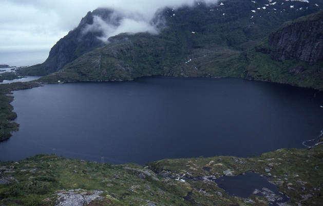
On my 30th birthday I reached the island of Moskenses, the outermost in the chain, and the outermost village accessible by road on that outermost island was a village with only one letter for a name, Å. It was from this village that I rang home on my 30th birthday and then went on a walk, following a track into the spectacular interior of the island. This was a land of thundering waterfalls, damp snow grass, boggy trails, frigid lakes and cloudy windswept peaks. The island is almost cut in two by a chain of lakes, I walked among some of these before it was time to return to my bike and the coast for the ferry trip to Bodö. Here are some photos.
|
Despite cycling with a brand new rear tyre and rim I had two punctures in the rear tube that day! |
 |
|
|
|
 |
|
|
|
 |
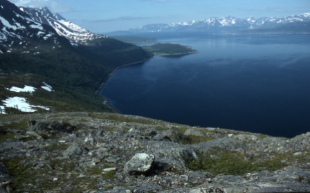
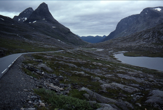
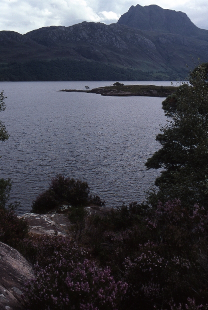
The Norwegian mountains north of Bergen
 |
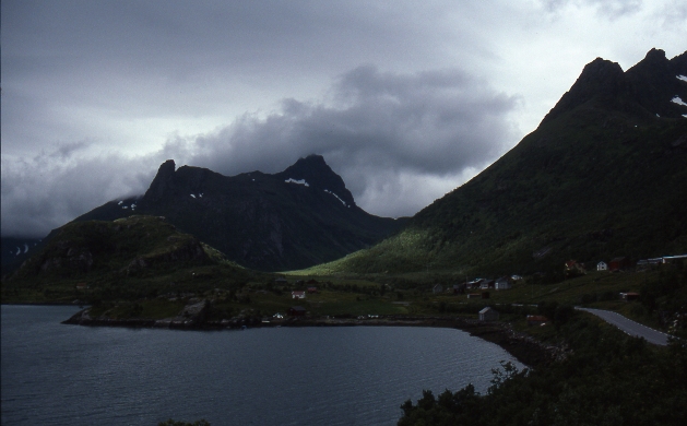
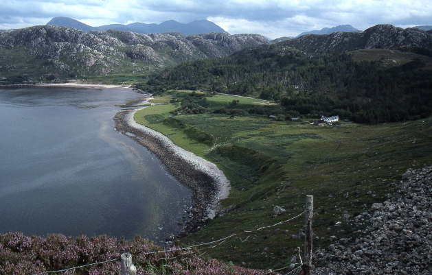
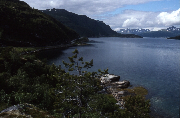
As I worked my way southwards down the Norwegian coastline the scenery became progressively more mountainous, more challenging, and more dissected by deeper and steeper fjords. Between Bodö and Trondheim I followed coastal roads fragmented by fjords. Such roads presented an opportunity to enjoy good quality bitumen road free of traffic. This is because the car ferries that linked the fragmented sections of coastal roads only operated at certain times, so this meant the road between each fjord was only used by cars at widely spaced intervals. This left the road completely free of traffic for almost the whole day and I could enjoy the coastal scenery at my leisure. For a couple of days I would find myself queuing along with cars, tourists and occasionally other cyclists, waiting for a ferry to take us all across the mouth of a deep Norwegian fjord. Then, once dropped on the other side the cars and tourists would roar off leaving me, the lone cyclist to enjoy the emptiness of the Norwegian landscape with only the occasional other cyclist and the rain for company. Solo cycling was for me now becoming a lonely undertaking as by now I had entered my fourth month of cycling alone. I had exhausted all my English reading material and had begun to hunger for English speaking people, English books and English countryside. As I made my way south down the coast of Norway I gave some thought to the idea of crossing to the British Isles, just across the North Sea, and so I made my way south to Bergen, from which sea passage to Newcastle Upon Tyne can be obtained. Below is a photo showing the nature of the scenery along this traffic free and sparsely populated section of Norwegian coastline.
|
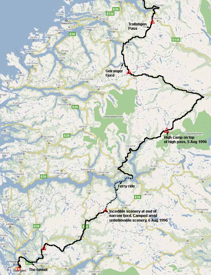 |
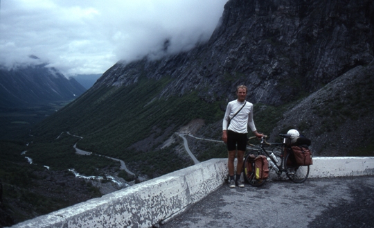
The final pitch into Bergen was perhaps the most scenically spectacular and adventurous week of the entire trip. This incredible week began on a wet and rainy afternoon at the town of Andalsnes from where I rode out, making my way towards the Trollstigen Pass. This pass, if you believe all the hype and the many stern warnings on huge road signs on both sides of the pass is a treacherous narrow switchback road fraught with danger and not to be attempted by anyone except the most experienced and properly equipped drivers. As it turned out the pass was no more than a steep switchback road carved into the mountainside, spectacular by any measure and a challenging ride, but nothing like as treacherous as the hype made it out to be and as a seasoned cycle tourer more than 3 months on the road it was just another wet pass on a just another wet day. Here is a photo of me with my bike on the Trollstigen pass, and the view down upon the switchback road, showing the way I had come.
|
|
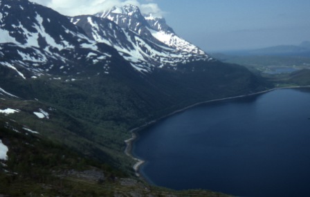
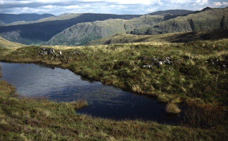
Once I reached the top of Trollstigen pass I reached a high alpine moor surrounded by peaks as depicted in the photo to the left. I pitched my sodden tent off to the side of the road near the top of the pass, utterly dejected and frustrated by the bad weather, and swore an ultimatum. This time I would not take the tent down and move on until the weather improved. Hughie the god of all weather was on notice. Next day I woke to leaden skies as usual and the prospect of more rain. My ultimatum to Hughie hadn't worked and I figured that I'd just get bored waiting here for fine weather and if I did I'd eventually die of hunger anyway. So it was off into the rain again. But then all changed. As I approached Geiranger Fjord, the clouds began to peel back and the sun broke through. Geiranger Fjord was stunning but touristy. The road plummeted steeply down into this deep incision and up the other side. By then the weather was clearing for good.
|
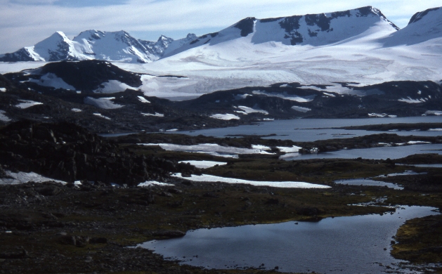
|
So next day, 5th August, I rose early and rode a massive 141km in perfect weather to finally reach a high alpine plateau. So thrilled was I to have fine weather at last I just kept riding and riding, and chose the highest point on the route as my place to camp. The photo to the left shows the view from my camp site on 5th August 1996. I took a bracing swim in one of the small lakes near the tent and as I lay in my sleeping bag I could hear the creaking and cracking of nearby glaciers. This made a marvellous change from the sound of rain on the tent! |
|
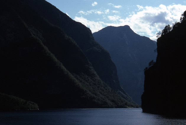
The 6th of August was another fine day with more superb nordic scenery. I descended steeply off the high plateau where I had camped the previous night and worked my way through incredibly steep country to the shores of Sognelfjord, one of the longest in Norway. From there I took a ferry to Gudvangen and what a stunning journey this was. This photo shows the scenery near Gudvangen, the ferry journey went along this incredible deep fjord. There are few routes through these mountains suitable for a cyclist because of the large number of long deep tunnels, dark and poorly ventilated, roaring with speeding motor vehicles, and no place for a cyclist. So wherever possible I sought ways to Bergen that avoided such tunnels and this ferry ride was the only way to get from where I was to where I needed to go without going through huge tunnels many kilometres long. |
 |
One such tunnel I managed to avoid by making an almost impossibly steep climb out of the valley shown in this photo. This climb was the steepest I had done so far in the entire trip and was almost impossible to pedal up, even in the lowest gear. This climb gained me this great view and managed to bypass a road tunnel but the height gain was immediately lost again when the minor side road I was on dropped steeply down to rejoin the main road. This was just the beginning of my tunnel dodging adventure. Over the next 2 days I followed whatever roads led to Bergen via the fewest long tunnels. Even so, I was confronted by roads burrowing their way into the mountainside at every turn. Many of these deep tunnels had routes around them for cyclists, but some didn't. For the ones that had no side route I took the plunge and braved the cold, dark polluted air, pedalling as hard as I could through the tunnel, dazzled by headlights and daunted by the roar of buses inches away. But there was one tunnel that I will never forget.
|
It was the tunnel with no track around it and it looked narrow and dangerous to ride through. A little way back up the road I had seen a small path winding off into the forest, so I decided to follow it to see where it took me. Wheeling my bike along this narrow path I seemed to be going in the right direction, the path was leading roughly parallel to the main road where it entered the tunnel and was skirting around rather than burrowing into the mountainside. But then the narrow path rounded a corner and plunged straight into the mountainside, into a dark, disused, unlit and narrow tunnel.
There was nothing for it but to turn on my bike lamp and wheel my bike slowly into the inky blackness of the tunnel. It was dark, damp and cold. There was nothing ahead but utter blackness. Behind me I could see the daylight from whence I had come, but then I rounded a corner and was in total blackness. I was deep inside the mountain and no one knew I was there. I was totally reliant on the single battery of my bike torch holding out, I had no other source of light whatsoever. For what seemed like forever I wheeled my bike on and on into the empty blackness ahead. The water dripping from the ceiling seemed to make too much sound, the tunnel was full of the echos of dripping water. At last, I perceived a lessening of the darkness ahead. The blackness melded into an inpenetrable greyness. Then as I rounded a corner I could see daylight ahead. Relieved I made towards the light with renewed vigour. But as I approached I realised that it wasn't the end of the tunnel at all. The light was coming not from the end of the tunnel but the side. The light was coming from no more than a rough opening in the side of the tunnel, perhaps the result of the tunnel being very close to the near vertical mountainside. Maybe part of the tunnel had collapsed and exposed part of it to the outside. Anyway, when I came to it I peered through the opening. My heart lost a beat. Outside was sheer vertical cliff above, below and on all sides. I could see below me an empty windswept fjord. And across the other side of the fjord in the far distance, forested nordic mountains, snow, not a single man made object to be seen. And ahead of me the tunnel went on, turning deep into the mountainside and plunging into the inky blackness once more. There was nothing for it but to go on. But where on Earth was I and where was this tunnel going? Again I continued deep into the tunnel, enveloped by the pitch blackness once more. My little bike torch perservered. On and on the tunnel went in complete darkness and the drip drip drip was heard loudly once more.
Then once again the darkness began to seep away and there was renewed light at the end of the tunnel. I kept going towards it, it looked more promising this time. Finally it seemed this really was the end of the tunnel. But where would it take me? Blinking in the daylight I finally emerged from the tunnel and took stock of my surroundings. I was on a steep slope and above me I could make out the main road. I needed to get up there. Lifting my bike, panniers and all over my shoulder I heaved my way up the steep slope until finally with great difficulty I made it back to the main road. I had made it! And I had bypassed the road tunnel by discovering a disused tunnel of my own! But no sooner had I pedalled off than the main road plunged once more into a new road tunnel, more than 1.5 km long! By now I'd had enough of the adventure of bypassing road tunnels so for this one I grit my teeth, faced the roaring traffic, headlights and polluted air, and rode on through.
And so it was by these means that on 8 Aug 1996 I rode into the Norwegian coastal city of Bergen, from where a ferry to England could be booked. The continenal European part of my trip was over. Ahead lay the British Isles and another 6 weeks of cycling before I'd finally reach London.
If I had thought when departing the shores of mainland Europe for the gentle hills and dales of the monther country that the steep hills and rugged mountains were behind me then I was very much mistaken. Scotland, northern England and Wales proved to be some of the most rugged, steep, spectacular and arduous country that I had cycled through on the entire trip.
 |
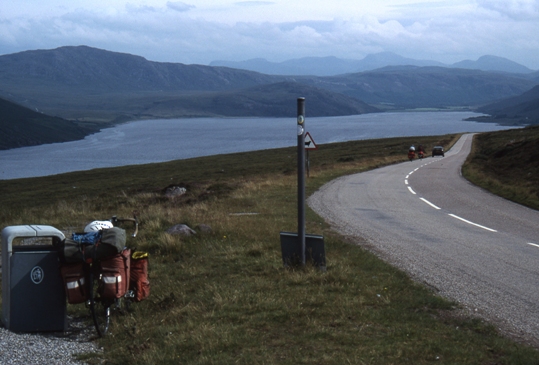
The ferry from Bergen took me to Newcastle from where I cycled to Hadrians Wall in northern England, then north into Scotland and on to Edinburgh. After spending a day of tourism in Edinburgh I rode north towards the Cairngorm mountains. Here is a photo of the rural scenery north of Edinburgh:
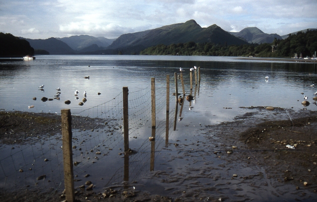
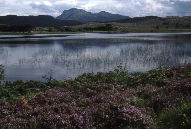
The Cairngorm mountains were lovely and the weather held. Here is a photo of Loch Morlich at the foot of the Cairngorm mountains:
|
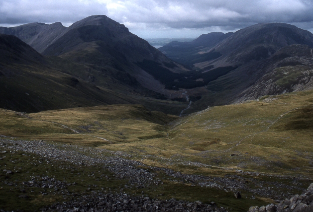
After the Cairngorm mountains I rode into Inverness. From Inverness I crossed to western Scotland and then followed the route shown on the above map. I made my way down the west coast of Scotland, hopping onto the Isle of Skye and eventually continued south back into England and the Lakes District.
Unlike my experience throughout Scandinavia where I had been beset by dismal weather for weeks on end, my journey through the British Isles was in mainly fine weather, except for some notable exceptions, usually in the form of deluges when cycling through Scotland and the Lakes District.
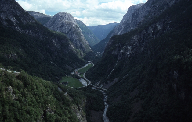
It is hard to describe the scenery of Western Scotland. Although it lacks the sheer grandeur and scale of the Norwegian coastline or the Austrian Alps, Scotland is no less spectacular. Its raw beauty is more austere and subdued, but still sweeping in scale. Like the crashing waves and ebbing tides that make the coastline seethe, the mountains heave and sigh on a symphonic scale as you cycle the narrow and winding roads.
Here are some photos of western Scotland, but they don't do justice to this landscape.
 |
|
 |
 |
 |
 |
 |
From the Isle of Skye I continued southwards into northern England and the Lakes District. I was now in the final month of my journey, making my way steadily towards London, my final destination. Like Scotland, the Lakes District is a surprisingly dramatic landscape, a knot of peaks, lakes and villages all compressed into a tiny corner of England. I spent a day or two cycling and walking in the Lakes District and then fought my way through the horrendous traffic of the midlands through to Wales. There in Wales I found more beautiful quiet corners of Britain, and climbed Mt Snowdon in perfect weather. Once more I was struck by the ruggedness of the mountains in such a small area. Some of the steepest and most arduous hills of the entire cycling tour were to be found in the Lakes District and Wales. Some hills in the Lakes District were almost impossible to climb they were so steep. And the hilly countryside nearly broke me.
Finally after cycling across the grain of the Welsh countryside I made my way east into England, through the Cotswolds and on to Oxford and finally London. Here are a few photos of this final stage of the trip.
|
|
|
|
|
|
 |
|
 |
Web page created 15 Apr 2009, last updated 15 Apr 2009. All content copyright © Ashley Burke 2009. Not to be copied, duplicated or used for any purpose without permission. |