Ecuador - Land of Volcanoes
Ascent of Gagua Pichincha, 4800m - 12 Jul 2015
All content copyright © Ashley Burke 2015. Not to be copied, duplicated or used for any purpose without permission.
Ecuador - Land of Volcanoes Ascent of Gagua Pichincha, 4800m - 12 Jul 2015
All content copyright © Ashley Burke 2015. Not to be copied, duplicated or used for any purpose without permission. |
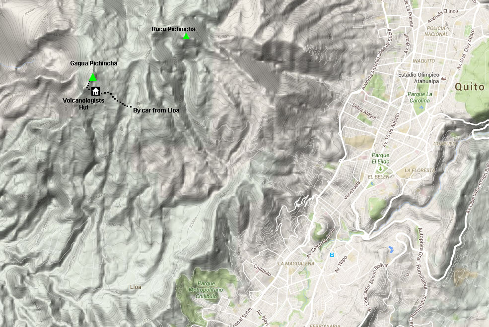
The broad mountain known as Pichincha towers above the city of Quito which lies at its feet. From almost anywhere in Quito, the slopes of Pichincha dominate the skyline to the west, though the top of the mountain is often obscured by cloud. There are two main summits on this broad peak. The most well known of these is Rucu Pichincha which at 4700m is the lower of the two and is the most easily accessed. The popular Teleférico of Quito makes access to the Rucu Pichincha summit straightforward. The higher peak of Gagua Pichincha (4800m) is located on the rim of the active caldera of the Pichincha volcano. Reaching this summit is normally achieved by travelling by car to the village of Lloa and thence along a winding road to an altitude of about 4100m where there is a small car park. You then continue along the road to a volcanologists' hut and from there you climb to the rim of the caldera. You then follow the caldera around to the summit.
Map
Trip Report
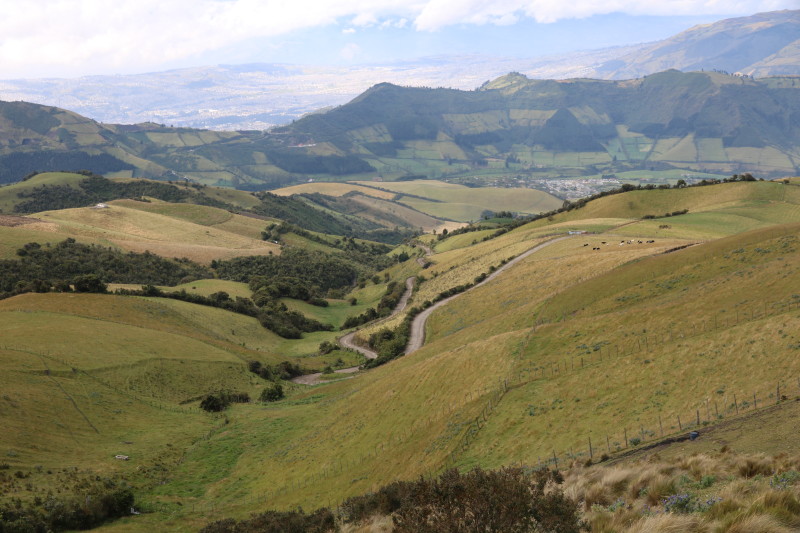
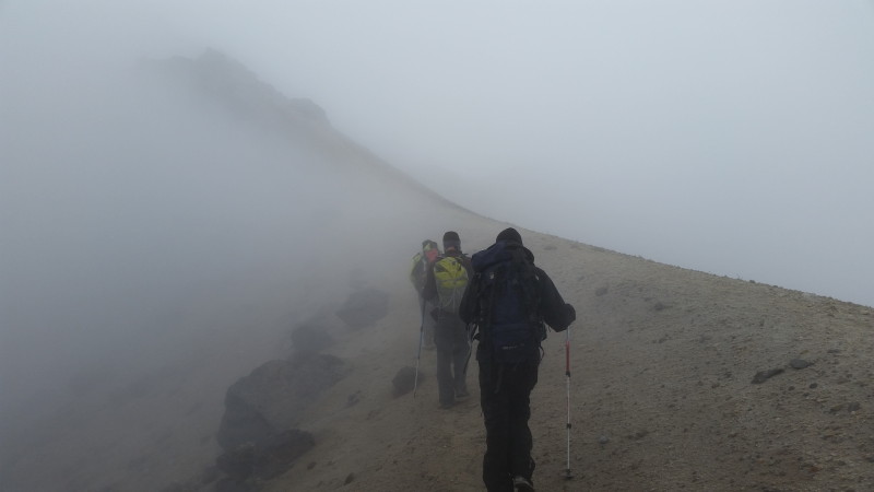
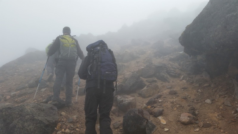
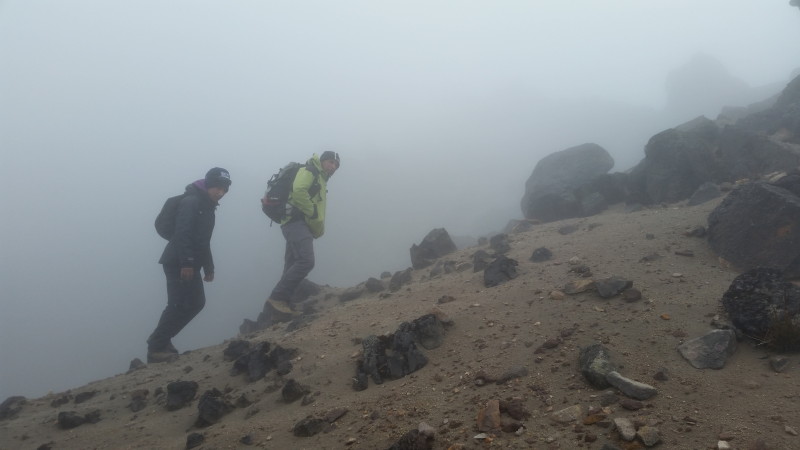
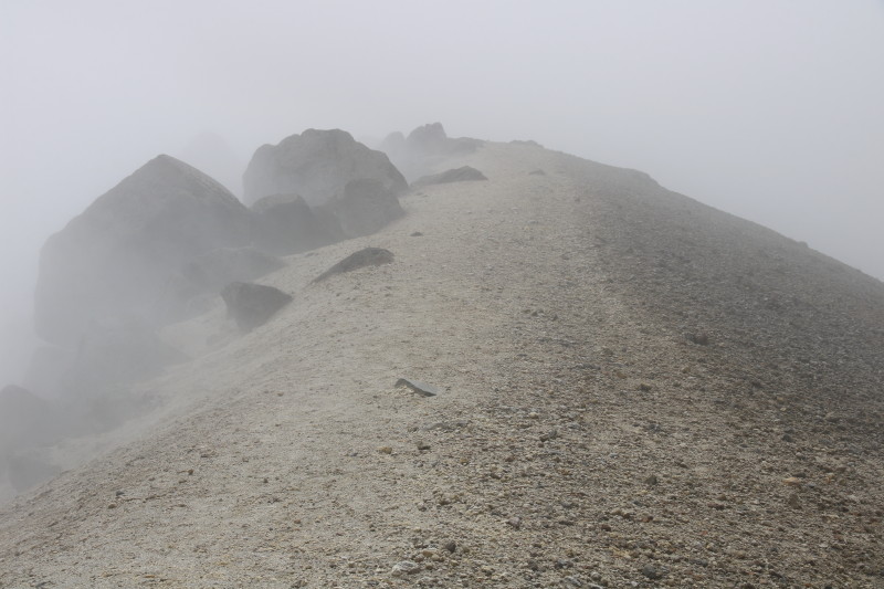
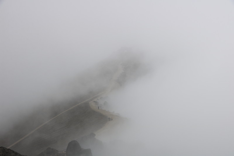
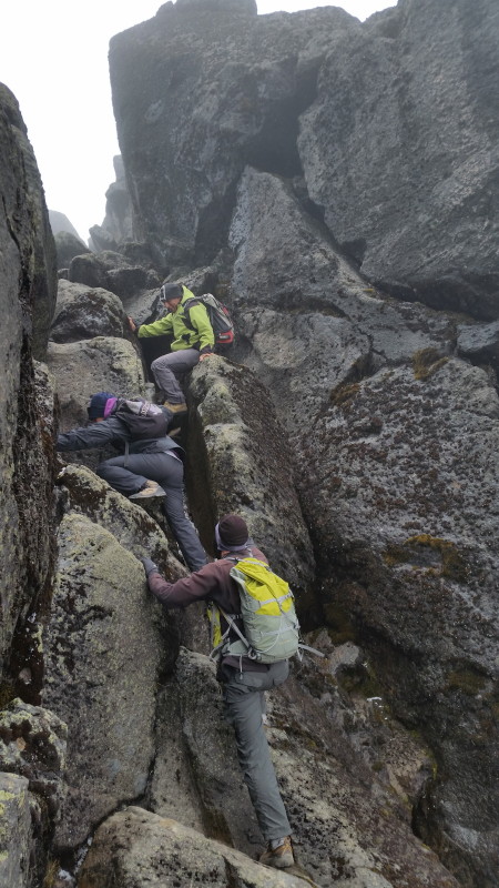
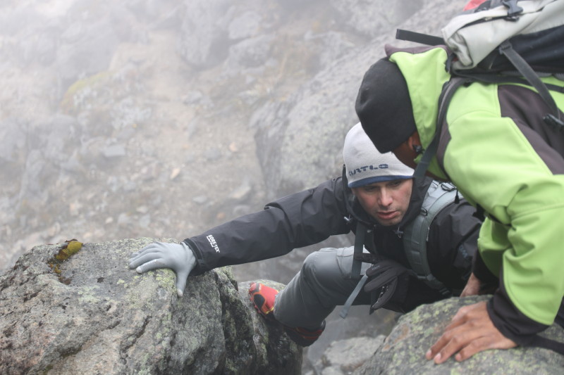
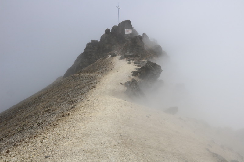
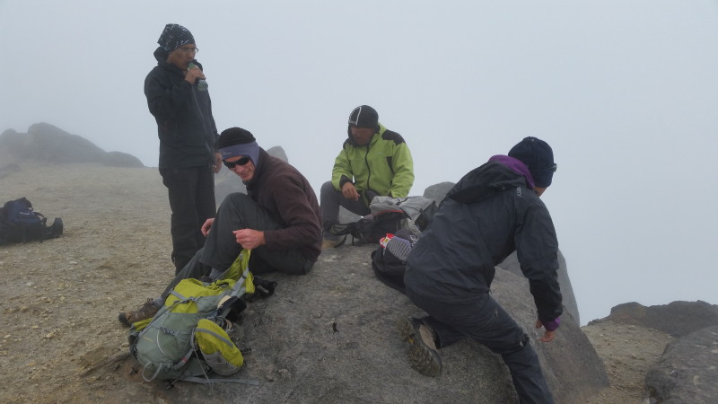
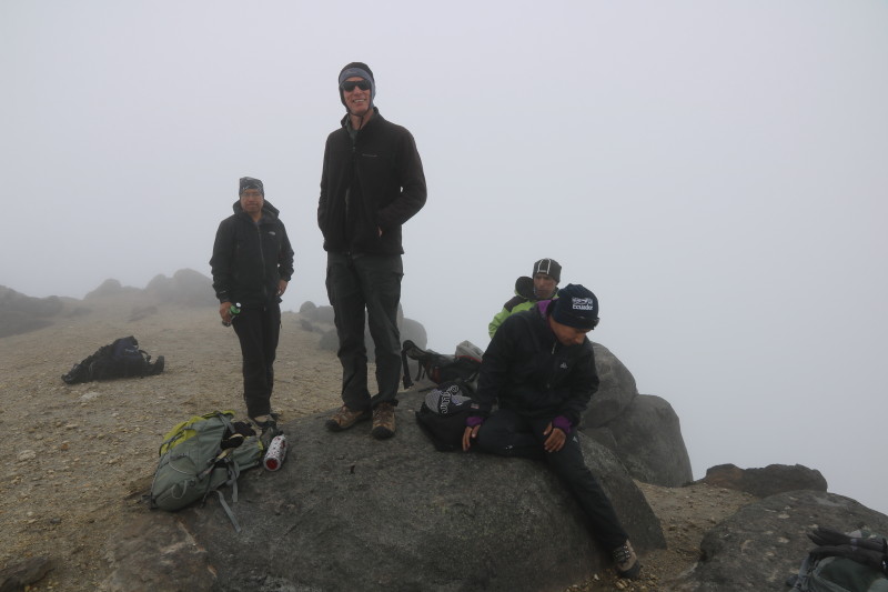
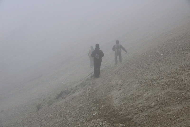
Gagua Pichincha was the second acclimatisation hike on my 9 day itinerary with High Summits, although it was my 3rd acclimatisation peak on my Ecuador 2015 trip. Our guide, Abraham, picked me up from my Quito hotel at 8am and from there we drove to the village of Lloa and onwards up a cobbled road to a saddle where there was a parking area. From there we set off on foot, continuing up the road. It was overcast with cloud all over the mountain. We stopped at the volcanologists' hut and after a rest continued on a wide track to the crater rim. It was cold and windy up there, but if you stepped to the inside of the crater just a few metres it was still, with warmth coming from the crater. We could also smell sulphurous gases. We followed the crater rim around towards the summit. It became a little rocky and steep in places with one awkward move. Funnily enough it wasn't cold or windy on the summit, though it was still completely enveloped in cloud. Our return trip was more direct, heading straight down a scree slope to the road from where it was an easy jog back to the car. We were back in Quito by about 3:30pm.
Photos
 |
|
 |
|
 |
|
 |
|
 |
|
 |
|
 |
|
 |
|
 |
|
 |
|
 |
|
 |
|
 |
|
 |
All content copyright © Ashley Burke 2015. Not to be copied, duplicated or used for any purpose without permission. Page created 5 Jan 2016, last updated 5 Jan 2016. |
|