Ecuador - Land of Volcanoes
Ascent of El Corazón, 4800m - 8 Jul 2015
All content copyright © Ashley Burke 2015. Not to be copied, duplicated or used for any purpose without permission.
Ecuador - Land of Volcanoes Ascent of El Corazón, 4800m - 8 Jul 2015
All content copyright © Ashley Burke 2015. Not to be copied, duplicated or used for any purpose without permission. |
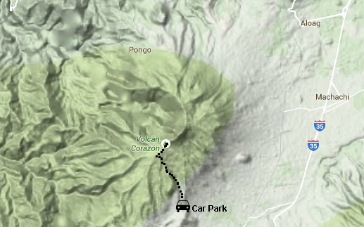
El Corazón is an extinct volcano on the "Avenue of volcanoes", an hour or two's drive southwest of Quito. It is easily visible on the western side of the Panamerican highway south of Quito.
I climbed this peak as a day trip from Quito on the day after my arrival in Ecuador.
Map
Trip Report
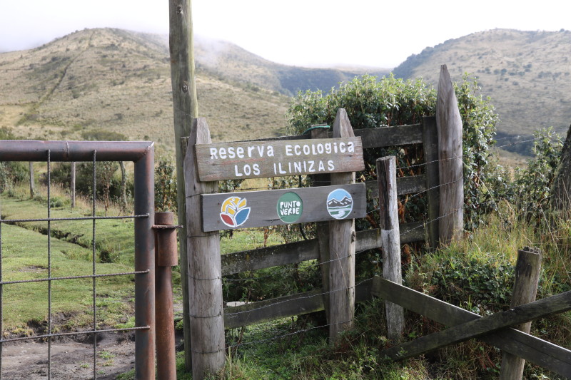
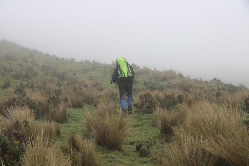
Right outside my little hostal in Quito was the office of Condor Trekk, one of many tour agencies in the Mariscal district of Quito where I was staying. At short notice the day before a guide was arranged and early on the morning of 8 July my guide was there waiting for me outside my hotel. We headed down to the Reserva Ecológica Los Illinizas, within whose borders the peak Corazon resides. As is often the case in Ecuador, the summit remained hidden in cloud throughout the day. The approach to the peal was made from the south east by 4WD on a rough narrow and muddy 4WD road. We reached an altitude of about 4000m by car which was about the altitude of the base of the clouds surrounding the peak.
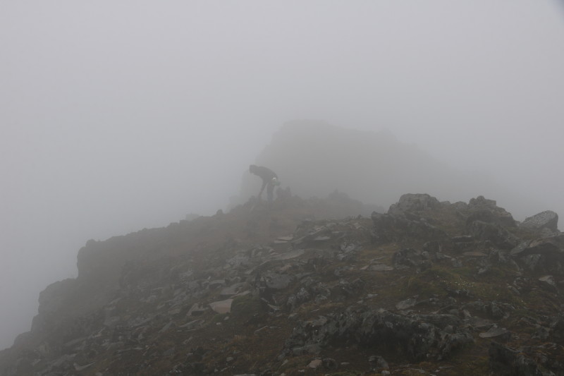
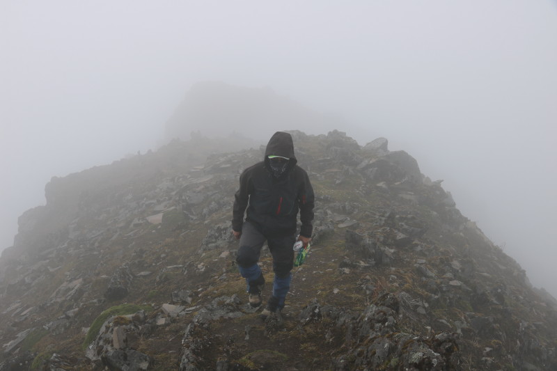
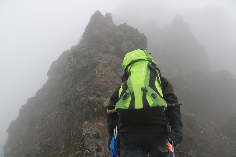
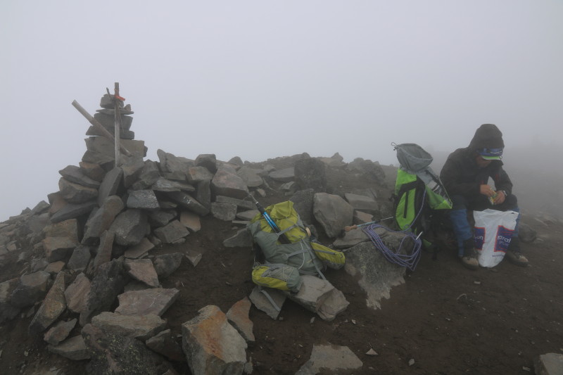
We climbed steadily among alpine grasslands to eventually reach the exposed summit ridge at about 4300m which was rocky and bare, now that we were above the vegetation line. I was breathless here as it was my first acclimatisation hike since arriving in Ecuador less than 48 hours before. From here it was a further 500m of ascending to the summit. The ridge was rocky and slippery and a few short sections were steep and exposed. My guide protected these sections with rope and I wore a harness and clipped into the rope for protection on these short, steep, slippery and exposed sections. The ridge kept climbing into the mist which was so dense we could only see the route ahead for about 50m. We reached the broad summit, spent a little while there to take our summit photos and to eat and drink a little before retracing our steps back to the waiting vehicle and driver. Then it was back to the comforts of my hostal in Quito to conclude a good day out.
Photos
 |
|
 |
|
 |
|
 |
|
 |
|
 |
All content copyright © Ashley Burke 2015. Not to be copied, duplicated or used for any purpose without permission. Page created 13 Nov 2015, last updated 13 Nov 2015. |
|