Three Peaks in 25 hours 33 minutes
17-18 Oct 2015
All content copyright © Ashley Burke 2015. Not to be used for any purpose without permission.
Three Peaks in 25 hours 33 minutes 17-18 Oct 2015
All content copyright © Ashley Burke 2015. Not to be used for any purpose without permission. |
Trip Report - Three Peaks in 25 hours 33 minutes, 17-18 Oct 2015
TRIP TIMINGS
| Checkpoint | Arrived | Departed | Elapsed Time |
| Start - Water Board Ladders | 22:40 | ||
| Coxs River | 03:10 | 03:25 | 4h 30m |
| Cloudmaker | 06:50 | 07:05 | 8h 10m |
| Kanangra Creek | 08:30 | 08:50 | 9h 50m |
| Paralyser | 10:25 | 10:50 | 11h 45m |
| Whalania Creek | 12:02 | 12:30 | 13h 22m |
| Guouogang | 14:45 | 15:15 | 16h 5m |
| Finish - Water Board Ladders | 00:13 |
25h 33m |
PARTY
Susan Keith
Ashley Burke
TRIP REPORT
The driving force for this, my 16th Three Peaks trip was my trail running friend Susan Keith. For a year or more Susan had been interested in venturing out to the mysterious Three Peaks and had been asking me when I was going to take her out into the wild mountains that lie south of Katoomba beyond the familiar trail running routes.
Having recently placed first female in the gruelling Great North Walk 100 miler, one of Australia’s toughest ultramarathons, if there was any trail runner that could give the Three Peaks a good run for its money, Susan was that person. This was especially the case given that one of her many strengths was her ability to go fast on steep technical single track trail runs. With the Three Peaks being a hard steep off track bushwalk that makes a steep single track trail run look like a walk down a city pavement, the Three Peaks beckoned as a new challenge to add to Susan’s rapidly growing repertoire.
And of course it fell to me to be the one to take her on this trip. With three years having passed since my last Three Peaks trip with Iza, my arm did not need to be twisted too hard to head out there one more time.
With this Three Peaks trip being done in trail running style we decided we would attempt the entire trip in one mad dash, with no sleep and carrying the barest minimum of food and gear. There would be no bushwalking backpacks, no sleeping bags, no cooking, and no cups of tea. There would just be our lightweight running rigs packed with electrolytes, gels, energy bars and the odd banana and piece of fruitcake. We’d stay on our legs as long as it took to get out there and back again.
After borrowing an EPIRB from Katoomba police station we parked the car in suburban Katoomba and jogged down to the Three Peaks starting point – the little car park near the Water Board ladders. There we clocked on at 10:40pm and began our long march.
It was a warm clear night as we jogged out along the Narrow Neck, walking the uphills and jogging the level and downhill bits. A sliver of moon soon set, it would be a long dark night. As we approached the fire tower it would have been close to midnight, and so we were very surprised to see two other trail runners coming in the opposite direction, their torches startling us to a halt. They told us that not far ahead of us were two blokes also doing the Three Peaks and that we’d soon catch up to them. But it wasn’t until we were well past Medlow Gap on the track towards Mobbs Soak that we did finally catch up to them. They were indeed attempting the Three Peaks, and were walking very fast. Their packs were larger than our tiny running vessels, they were intending to make one camp, on Guouogang, and were aiming for an overall Three Peaks time of around 40 hours.
We gradually pulled ahead of them and reached Mobbs Swamp just under 3 hours after the start. There was a large goanna asleep on the trail there, we gave it a wide berth. We indulged in a very brief stop at Mobbs Swamp to eat something and then we were off again. Our next milestone was Mt Yellow Dog, reached in just under 4 hours from the start, and from there we were able to jog or shuffle most of the way down Yellow Pup Ridge to reach the Coxs River at 03:10. Little yellow frogs hopped around as we took shoes off to wade the river. I allowed myself a much needed short rest here to get the weight off my feet and eat something.
It was still the dead of night and utterly dark as we began the long climb up Strongleg Buttress, and we hadn’t climbed very far when we heard a shout from across the valley. The two young lads we had seen near Mobbs Soak were on their way down Yellow Pup Ridge and they had seen our torchlights bobbing slowly up Strongleg Buttress. We gave a shout back but this was the last we saw of them.
We climbed steadily without the slightest sign of any morning light on the horizon even after reaching Mt Strongleg itself. Night bugs of every description were attracted to Susan’s powerful headlamp and Susan climbed with a cloud of insects around her. Eventually she had to take her headlamp off and carry it so the bugs wouldn’t fly into her eyes and mouth.
After Mt Strongleg the track became faint in places and I was rather hoping by then that there would be some light to see by. But the blackness of night still hung heavily. On we went at a brisk walk, and the first glow of sunrise on the horizon was seen from the high vantage point near Mt Moorilla Maloo. It was then onto Dex Creek where I lost the track among the dead stick and cutting grass. But there was just enough light to make out the lie of the land, the tell-tale humps of Cloudmaker and Mt Bolworra, as well as the little V that Dex Creek makes between them. So I led the way out of the swampy ground and a moment later we descended the little slope to Dex Creek where a tent stood quietly, its occupants probably none too pleased to be woken by 2 ultra-runners marching past at the crack of dawn.
Dex Creek had a small pool of crystal clear cool mountain water and we stopped here to replenish our supplies of water and electrolyte. I even permitted myself a helping of breakfast cereal. As we rested briefly it grew fully light at last and the sun rose, bathing the tops of the trees in gold. Torches at last were put away. We would need them again, as a full day and half a night of walking still lay ahead of us.
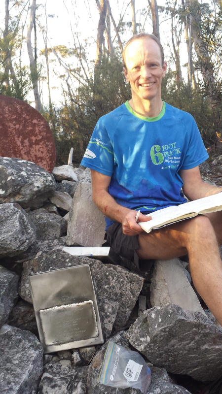
From Dex Creek it was a relatively short walk up to Mt Cloudmaker, the first of the Three Peaks, which we reached at 6:50am. It was certainly a big relief to get here and out came the mobile phone cameras for the obligatory summit pics. Also obligatory was to sign the logbook, which we did, and we were off again heading for Paralyser at 7:05am.
And so began what I called the business end of the Three Peaks. This was the bit that can’t be called a trail run because there’s no trail. And you can’t run it. We left the track just after Rumble Knoll and headed down Marooba Karoo Ridge and down to Kanangra Creek. It was steep and slow in a few places, but above all long, and hard on the knees and feet. At the bottom Susan asked if the other descents would be as bad as that. “Worse,” I was obliged to inform her. But on the positive side, Kanangra Creek was a beautiful creek bubbling with crystal clear cool mountain water. We arrived here at 8:30am, before the sun had even reached the valley floor.
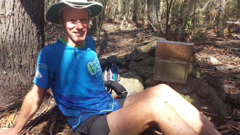
After filling up with what we thought would be enough water we began the long hot climb up Paralyser. This was the hottest climb of the trip with the full sun on us, and it was dry and tiring climbing. Susan was feeling the heat but that didn’t seem to slow her down at all. She would often ask if the next rise was the top, which it invariably wasn’t. The top is only the place where nowhere else is up and when we got there it was with relief that we collapsed trembling beside the Paralyser cairn and logbook. We drank deeply from our rapidly dwindling water supplies to regain the energy to get the logbook out of the tin, sign it, and take our selfies.
We left the summit of Paralyser at 10:50, mindful of the fact that the technically hardest section of the Three Peaks was between here and the summit of Guouogang. At first the going was relatively straightforward along the ridge, although it was hot and we were getting very thirsty. Then inevitably we had to plunge off the side of the ridge, tackling the very steep loose slope that we had to descend to reach the foot of Nooroo Ridge by the most direct route possible. This steep slope had to be taken slowly, and was very difficult, with steps needing to be taken with great care, on rough loose ground with little to hang on to and the gradient being on the verge of just too steep. This sort of off track scrambling was a new world for Susan who bravely tackled the ridge and slipped several times, doing some of the descent on her backside. There were rocks that looked stable but shifted when you put weight on them, and there were trees that looked sturdy but collapsed when you leant on them.
So it was with difficulty that we finally reached the glorious clear waters of Whalania Creek and this was a very welcome sight for our parched mouths and hot feet. We washed our hands, feet and faces, all grimy and blacked from the charcoal of burnt trees that we had clung onto or crashed into during our descent. It seemed like just moments of welcome relief by the creek but half an hour had passed before we wearily left for the long grinding climb up Guouogang, the highest of the Three Peaks.
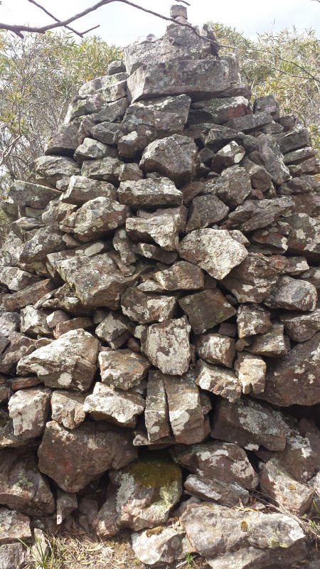
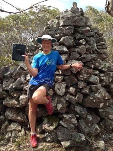
Scenically, Nooroo Ridge is the highlight of the Three Peaks with its many rock platforms offering commanding views back into the gaping expanse of Whalania Deep and the broad hump of Paralyser beyond. We ground our way up slowly and wearily up this long ridge which became rocky and exposed in places. In spots with prominent views we took short breaks, enjoying the views and the cooling breeze. But Guouogang loomed high and daunting and it was a seemingly endless climb until at last we finally broke through the last patches of scrub to reach level ground and the summit cairn beyond. It was 14:45 when we arrived at the summit, weak, hot thirsty and shaking. It was time for a much needed snack and drink before we mustered the energy to write our logbook entries and take our mandatory summit photos.
We had now been walking hard for 16 hours continuously and were deprived of a full night’s sleep and although we had now broken the back of the Three Peaks it seemed like an eternity of walking still lay before us. The journey back to Katoomba from here was still a journey to the horizon. So at 15:15 we were off again, retracing our steps for a short distance before finding a route through the scrub to the ridge leading down to Mt Bullagowar. It was steep and slow going down the heavily wooded eastern slopes of Guouogang and then a slow haul over Mt Bullagowar itself. From here it seemed like an eternity of downhill to finally reach the Coxs River. It took perhaps 2 hours to reach the Coxs River which was placid and quiet, a long pool at a bend in the river. Again we were gaspingly thirsty and our feet had been pounded to death and were tender as we took shoes off for the deep wade across the sandy river bed. I had become slow and sleepy, lingering long over the mundane task of drying feet and putting shoes back on, just soaking in the fact that I wasn’t walking. Susan was urging me on, wondering why on Earth I was taking so long. So I struggled to my feet and alas we continued.
Up the ridge we climbed, making our way towards Mt Yellow Dog, our first milestone on the interminably long march back to Katoomba. It seemed to take forever, there were so many false summits on this ridge, on and on we went until finally, just before dark we reached Mt Yellow Dog and the path leading back to Medlow Gap. Headlamps went on and we entered our second night of no sleep.
What followed was simply a matter of putting one foot in front of the other and counting off the familiar landmarks until we reached the end of the Narrow Neck. Here was one last obstacle, the Tarros Ladders. Susan baulked at climbing up the spikes, she had never gone up this way before, only down. So we skirted around the base of the cliffs in the dark until we found Duncan’s Pass which brought us out near the top of the ladders. And then at last we were on the Narrow Neck fire trail once more.
The 24 hour mark passed soon after Clear Hill, not long before the fire tower. The night was dark and the weather cooler now. A few spots of rain fell, it seemed the wind had turned to the south and become cooler. We broke into a shuffling run for the flat and downhill sections and one by one, the familiar landmarks of the Narrow Neck passed by. It had just passed midnight when we reached the locked gate and only 10 minutes from there we reached the Water Board Ladders car park and recorded our Three Peaks time as 25 hours and 33 minutes, having reached here at 00:13. From here it was about another 35 minutes’ walk back to the car.
There was nothing to do now except get home as fast as possible while we were both still awake, so we could catch some sleep at home before the night grew too old. A quick stop was made at the police station to return the EPIRB and then it was a clear run in Susan’s car down to Glenbrook where my car was waiting. And so it was then off to our respective homes for a well-earned shower and long sleep followed by a hearty breakfast.
For Susan the trip was an eye opener, her first Three Peaks and first time bushwalking off track in the wild southern Blue Mountains. To accomplish this in such a fast time was a great achievement, probably the second fastest women’s time in Three Peaks history. For me, this was my 16th Three Peaks trip and my fastest time by about 2 hours 45 minutes so I was well pleased with my achievement and I didn’t do much else apart from eat and rest for the remainder of the weekend!
Ashley Burke
PHOTOS
|
|
 |
|
|
|
 |
|
 |
|
 |
|
All content copyright © Ashley Burke 2015. Not to be used for any purpose without permission. |