Mustagh Ata Expedition, July-August 1993
All content copyright © Ashley Burke 2007. Not to be copied, duplicated or used for any purpose without permission.
Mustagh Ata Expedition, July-August 1993
All content copyright © Ashley Burke 2007. Not to be copied, duplicated or used for any purpose without permission. |
 |
 |
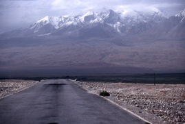
The Karakoram Highway beyond Khunjerab Pass with Mustagh Ata ahead. |
Mustagh Ata, 7546m (24 757 feet) |
Introduction
Mustagh Ata is a massive mountain in the Pamir range, located in far western China, near the borders of Pakistan, Afghanistan and Tajikistan. Its geographic location, being so close to several international borders, made the travelling I did in this region when approaching the mountain as fascinating and exciting as the ascent of the mountain itself.
The high altitude grasslands surrounding Mustagh Ata are inhabited by Kyrgyz people, and in their language, Mustagh Ata means The Father of Ice Mountains. The severity of the climate and the high altitude of the region renders it livable only in the summer months, and consequently the local inhabitants are constantly on the move and live in yurts, circular huts made of animal skins. For me at age 27, this was fascinating country to travel through.
Mustagh Ata is an attractive destination for climbers like me due to its great height and relative technical ease of the climb. It is, perhaps, the most technically easy mountain of its height in the world. Ascent is possible on skis, and rope is needed only rarely, if at all, for safety when negotiating crevasses between Camp 1 and Camp 2.
In July-August 1993 I joined an expedition run by High Country Expeditions, a New Zealand based mountain guiding company. The expedition was led by John Entwistle. Our attempt on the summit of Mustagh Ata was unsuccessful, but we did reach the altitude of just over 7000m, which to this day remains the highest altitude that I have ever attained. Even though we didn't make the summit, the expedition was a fascinating and mind blowing experience, one of life's great adventures that has had a significant influence over my life in the years since.
In order to reach this fascinating part of the world, we travelled the Karakoram Highway through northern Pakistan. Starting at Rawalpindi near Pakistan's capital Islamabad, this highway travels north through Pakistan and then over the Khunjerab pass into China. The landscape of the Karakoram is of an almost incomprehensible scale, and to travel through it is an utterly mind blowing experience. It has been described as a land "where even soaring birds are seen against a backdrop of mountains" and this is an apt description. The Karakoram is the far western end of the Himalayan mountain range and comprises a vast area of towering mountains, thrust to dizzying heights by the immense tectonic forces of colliding continents. Here is home to some of the world's highest mountains, including the perilous Nanga Parbat, and K2. At every bend in the road, a panorama of almost unbelievable scale is revealed, rocky peaks kilometres high, chewn through by thundering brown torrents.These many turbid rivers combine to form the mighty Indus River, one of the great rivers of the subcontinent. Atop the rocky peaks can be seen the relative purity of ice and snow, and then, above this, there is little room left for sky and clouds.
Once over the border in China the landscape changes dramatically. Gone are the tortured jumble of rocky peaks of northern Pakistan, here are smooth rounded mountains and vast open grasslands. The landscape loses nothing in scale, there is still the sense of immensity and vastness, written into the sweeping grasslands, rounded peaks and open skies instead of sheer rock. Dominating the scene ahead as you travel north into China is Mustagh Ata.
Base Camp, at approx 4400m (14 500 feet) is a lifeless rocky place, reached after 1 day of walking, with our equipment carried there by camels. One of the main reasons for failing to reach the summit was the poor food and hygiene at base camp. Over the coming weeks I would be progressively weakend due to recurring stomach complaints at base camp.
We established three camps on the mountain. Camp 1 at approx 5640m (18 500 ft) was reached by climbing up a rocky ridge until we reached the snow, and then by ascending the final few hundred metres to Camp 1 on skis.
Above Camp 1, we climbed on foot, negotiating a few very deep crevasses, before gaining the gentler snow slopes of the upper mountain. These slopes were climbed on skis until we reached Camp 2, at approx 6250m (20 500 ft).
The climb from Camp 2 to Camp 3 was a slow and breathless ascent on skis up the long steady slopes of the upper mountain. Camp 3 was at 7000m (23 000 ft) and at this height life was very difficult indeed.
The establishment of these three camps involved several days of effort, in which we would advance to a camp, retreat to a lower camp, advance again, retreat to Camp 1, advance ... and so on, as dictated by the weather and the logistics of portaging the required gear up the mountain. During these efforts, our group of five climbers was reduced to just three of us, as the other two decided to abandon the mountain and head down to Kashgar where the living conditions and air pressure are more agreeable.
The three of us who remained were beset by recurring bad weather, and I continued to be beset by stomach complaints througout our protracted summit attempt. The highest altitude we reached was a point about 400m beyond Camp 3, at which time the high winds and doubtful weather forced us to retreat all the way to base camp. Despite further attempts to advance back up the mountain, we never reached Camp 3 again, and to this day I expect that the tent we left there may still be there, buried by now under many seasons of snow.
Eventually we abandoned the mountain and headed down to the local city of Kashgar, which is a fascinating city on the famous silk road route linking Europe with Asia. Kashgar is influenced by a variety of cultures and a rich history, and here people from far and wide congregate in huge market bazaars where anything and everything is on sale. Sunday is market day and I spent as much time as I could wandering among the throngs of Kyrgyz, Uzbeks, Tajiks, Turkics and Chinese who were buying and selling anything from sheep's heads to silk carpets. It was a truly incredible experience.
Below are some photos from this amazing trip. I hope you enjoy them.
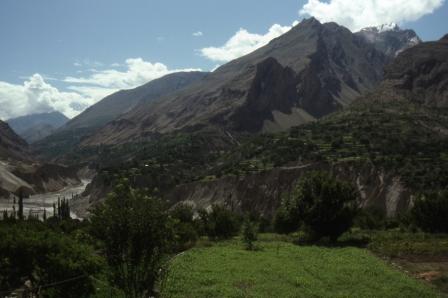 |
Travelling north from Rawalpindi on the Karakoram Highway you soon enter mountainous country. The valleys along this part of the highway are lush and intensively cultivated. | |
 |
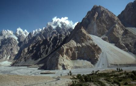
As you continue further north, the mountains become larger and higher, and the landscape starker and rockier. | |
 |
he incredible landscapes of the Karakoram. | |
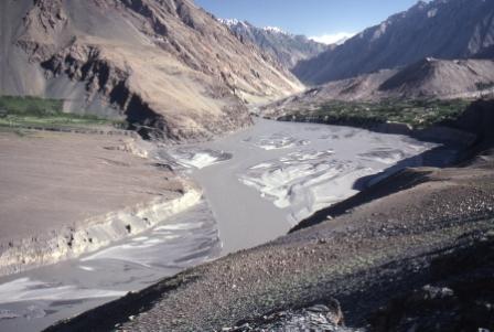 |
Amidst this incredible landscape lie small Pakistani villages, blankets of green in an otherwise bare landscape. These green cultivated areas use water that gushes down from the mountains and empties out into the main valley in a fan like delta. Upon these delta towns, villages and farms are built. | |
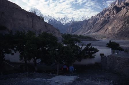 |
Our last night in Pakistan before crossing the Khunjerab Pass was spent at the village of Sust. | |
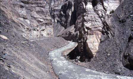 |
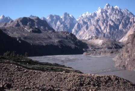
As we approach the Khunjerab Pass the scenery is collosal. Hewn rock rising kilometres into the sky, at the bottom of which is the thundering river and the Karakoram Highway, somehow snaking a way through this seemingly impossible terrain. | |
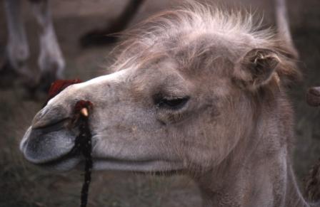 |
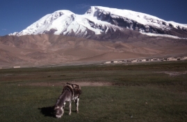
Camels, like this one, are commandeered to carry our gear up to base camp. | |
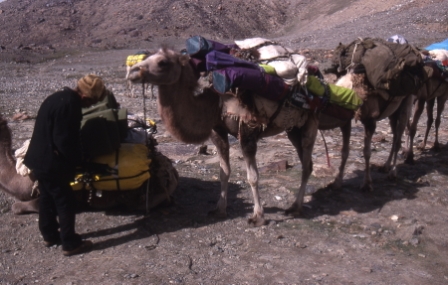 |
There can't be many places in the world where it would make sense to pack skis onto a camel, but this is one of them. | |
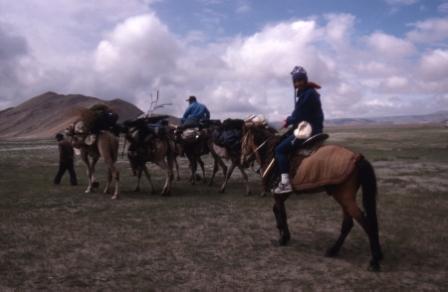 |
We spent one day walking or riding alongside our camels until we reached base camp. At base camp the camels and their drivers turned back, leaving us to the mountain. | |
 |
On the walk to base camp, the sheer immensity and scale of the lanscape is apparent. | |
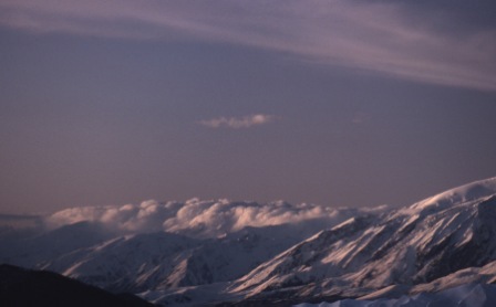 |
These are the views from base camp at 4400m (14500 feet). | |
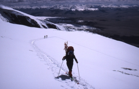 |
The ascent to Camp 1 is done on skis once the snow is reached above base camp. | |
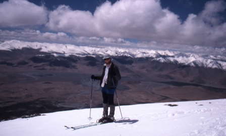 |
Myself near Camp 1 at 5640m (18 500 ft). | |
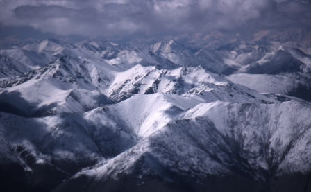 |
From Camp 1 these tremendous views into Tajikistan are seen. These mountains form part of the Pamir range. | |
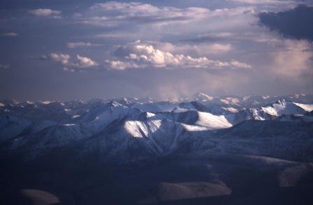 |
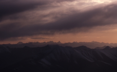
Late afternoon views from Camp 1. Altitude: 5640m (18 500 ft) |
|
 |
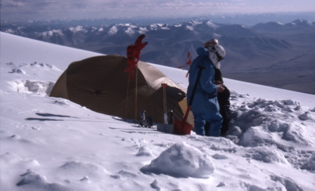
Views towards Afghanistan from Camp 2. Altitude: 6250m (20 500 ft) |
|
 |
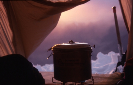
Digging in our tents at Camp 2. Altitude: 6250m (20 500 ft) |
|
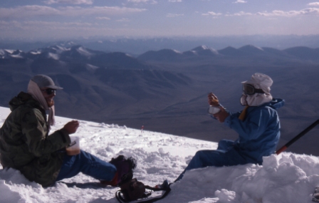 |
Dinner at Camp 2. Altitude: 6250m (20 500 ft) |
|
 |
Camp 3. Altitude: 7000m (23 000 ft).
|
|
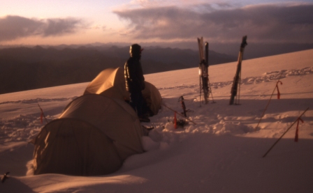 |
Back at Camp 1 on one of our later attempts on the mountain. | |
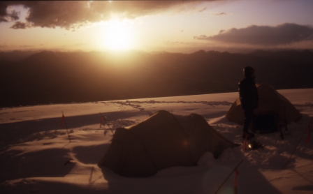 |
Sunset at Camp 1. | |
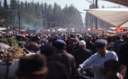 |
After leaving Mustagh Ata we visited the city of Kashgar. Sunday is market day, and throngs of people come from far and wide to trade their wares. | |
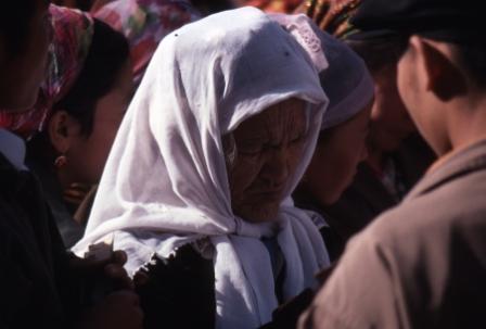 |
Among the people in the Kashgar markets. | |
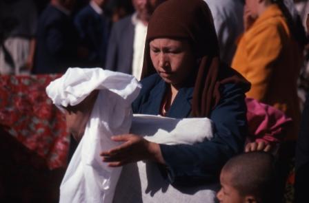 |
Among the people in the Kashgar markets. |
Web page created 8 Nov 2007, last updated 8 Nov 2007. All content copyright © Ashley Burke 2007. Not to be copied, duplicated or used for any purpose without permission. |