Leaderboard
For K2K and K2K2K
All content copyright © Ashley Burke 2019. Not to be copied, duplicated or used for any purpose without permission.
Leaderboard For K2K and K2K2K
All content copyright © Ashley Burke 2019. Not to be copied, duplicated or used for any purpose without permission. |
The purpose of this "leaderboard" isn't to make bushwalks like the K2K or K2K2K into some kind of competition or race.
Everyone who does these walks, like myself, does it for the love of it.
The sport of trail running, however, is all about speed, agility and testing the boundaries of endurance on rugged terrain, amid a backdrop of jaw dropping wilderness. Unlike bushwalkers, trail runners record the time taken to complete a route, and compare with other runners to test the boundaries of what is possible. It is never about "beating" someone. Those trail runners like myself who finish well back in the mid-field wouldn't be in the sport if it were about winning because we are never going to win a race. Being part of the spirit of adventure and enjoying pushing youself to your limit in a wilderness free of fences, traffic lights and stop signs is what draws us to the sport. It is not about winning.
Yet I have prepared a leaderboard for 3 classic walks, the Three Peaks, the K2K and the K2K2K because having a central record maintains consistency and integrity to claimed times for these events. In the past, wild and unsubstantiated claims have been made of completing trips like the Three Peaks in what would be superhuman times. To ensure the integrity of claims I have prepared the below leaderboard. Each of the claims listed below have been validated to my satisfaction. Such satisfaction might simply be because I trust the person who made these claims due to their sound reputation in the sport, or they furnished evidence in the form of logbook entries or GPS tracking.
I hope to add to this list in the future. If you have done the Three Peaks or the K2K or the K2K2K in a reasonably fast time and would like to be added to this leaderboard then please don't hesitate to get in touch. And please don't be offended that if you claim a world record, that I will ask for hard evidence to back up your claim. It is all about integrity and keeping the credibility of the sport intact.
The phrases "Official Start Point" and "Official End Point" sound, well, official, but this isn't the intention. Anyone is free to start and end any bushwalk wherever they like. But for the timings on the leaderboard, a fixed start and end point has to be nominated so the results are consistent. If you start and end at points different to those noted here, then your "official" time may be adjusted accordingly.
Three Peaks Leaderboard
For the Three Peaks Leaderboard please refer to my Three Peaks Page.
A popular route following a rough and mountainous trail from Kanangra Walls in Kanangra Boyd National Park northwards to Katoomba. Some careful navigation is required in places.
| Trip Code | K2K |
| Trip Name | Kanangra to Katoomba |
| Route | Kanangra Walls - Gangerang Range - Mt Cloudmaker - Dex Creek - Mt Strongleg - Coxs River - Mt Yellow Dog - Medlow Gap - Narrow Neck - Katoomba Station |
| "Official" Start Point | The barrier at Kanangra Walls car park. |
| "Official" End Point | Top of Katoomba street, at entrance to Katoomba station. |
| "Checkpoint" 1 | You must sign the logbook on the summit of Mt Cloudmaker and your entry must include your name and the date and time of your arrival. |
| Distance | 54km |
K2K - Leaderboard
| Overall Position | Party | Date | Time Taken | Notes | Gender | Gender Position |
| 1 | Loughlinn Kennedy Tom Brazier Matthew Scholes |
15 Jul 2017 | 6h 31m | Time quoted is for Loughlinn Kennedy, the group finished at their own pace after crossing the Coxs. | M | 1 |
| 2 | Lou Clifton | 31 Aug 2019 | 9h 18m | Fastest known women's time. Done solo on a rainy late winter's day. | F | 1 |
K2K2K - Katoomba to Kanangra Return
This is the K2K in reverse (Katoomba to Kanangra) and upon reaching the locked gate at the Kanangra Walls car park you about turn and head all the way back to Katoomba. Avoids having to organise transport to Kanangra.
| Trip Code | K2K2K or (K2)² |
| Trip Name | Katoomba to Kanangra Return |
| Route | Climbers' Car Park on Glenraphael Drive, Katoomba - Narrow Neck - Medlow Gap - Mt Yellow Dog - Coxs River - Mt Strongleg - Dex Creek - Mt Cloudmaker - Gangerang Range - Kanangra Walls ... then ... About turn and reverse the above route. |
| "Official" Start Point | Climbers' Car Park on Glenraphael Drive, Katoomba. GPS ref -33.729961, +150.287942. |
| "Official" End Point | Same as start point |
| "Checkpoint" 1 | You must sign the logbook on the summit of Mt Cloudmaker and your entry must include your name and the date and time of your arrival. |
| "Checkpoint" 2 | You need to touch the barrier at the Kanangra Walls car park. Turning around earlier than here is not valid. |
| "Checkpoint" 3 | Upon reaching the summit of Mt Cloudmaker on your return trip, please update your logbook entry with the date and time of your arrival there on the way back. |
| Distance | 104km |
K2K2K - Leaderboard
| Overall Position | Party | Date | Time Taken | Notes | Gender | Gender Position |
| 1 | Stephen Redfern Ewan Horsburgh |
9 Feb 2019 | 18h 54m | M | 1 |
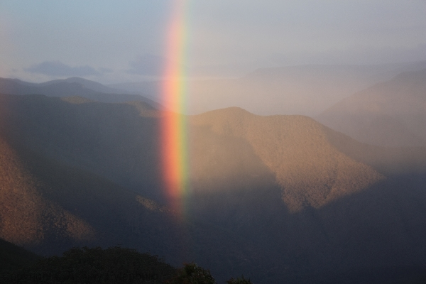
View towards Kanangra Walls from Splendour Rock
Web page created 23 Jun 2019, last updated 22 Sep 2019. All content copyright © Ashley Burke 2019. Not to be copied, duplicated or used for any purpose without permission. |
